High bidding rates for decontamination, etc., with many one-party bidders, the Board of Audit pointed out
An investigation by the Board of Audit has revealed that about half of the decontamination and other bidding projects being conducted by the Ministry of the Environment in the wake of the accident at TEPCO’s Fukushima Daiichi Nuclear Power Station had only one bidder participating, and that the success rate tended to be high. The Board of Audit announced the findings on February 3, 2023.

A decontamination site in Naraha Machi, Fukushima Prefecture, which was opened to the press by the Ministry of the Environment in March 2013. In the foreground is a contaminated water treatment facility, and in the background is a temporary storage area for contaminated soil and other materials packed in sandbags
February 14, 2023
The Ministry of the Environment is in charge of nuclear power plant accident countermeasure projects, such as decontamination, treatment of contaminated waste, and construction of interim storage facilities for soil collected during decontamination, as part of the restoration and reconstruction projects following the Great East Japan Earthquake that occurred in March 2011. The total amount of the government budget for these projects amounted to 5.16 trillion yen through FY 2009.
Article 44 of the Special Measures Law stipulates that TEPCO will ultimately bear the costs of nuclear accident countermeasure projects as compensation, with some exceptions. According to the Ministry of the Environment, TEPCO has already compensated 3.1699 trillion yen, about 80% of the 4.209 trillion yen claimed as of the end of December 2010. Although government funds are not the final source of funds, they are subject to inspection by the Board of Inquiry.
At the request of the upper house of the Diet, the inspection office investigated the bids and contract amounts at the time of the order, mainly for nuclear power plant accident countermeasure projects with initial contract amounts totaling 1.854 trillion yen that were ordered by the Ministry of the Environment between April 2004 and September 2009. The decontamination projects, which are divided into those directly under the Ministry of the Environment and those ordered by local governments, mainly covered the former.
The bidding rate for the first project increased by more than 10 percentage points.
Among the projects covered by the survey, the National Audit Office examined the participation and success rates for 735 general competitive bids for construction and operations by the Ministry of the Environment’s Fukushima Regional Environment Office.
In terms of bidding participation, 49.3% of the bids were “one-party bids,” with only one participant; the percentage of one-party bids was particularly high for bids for construction consultant services, at 62.1%. The percentage was relatively low at 29.5% for construction bids involving decontamination work.
The Ministry of the Environment (MOE) was urged to ensure competition in order to reduce the bidding ratio, given the difference of more than 10 percentage points between single and multiple bids: 94.6% for single bids and 81.3% for multiple bids.
The difference in the winning bid rate was relatively small for construction work, at 97.5% for single bidders versus 91.9% for multiple bidders. On the other hand, for construction consultant services, the winning bid rate jumped from 78% for multiple bidders to 94.4% for one bidder.
https://xtech.nikkei.com/atcl/nxt/column/18/00142/01530/?fbclid=IwAR0V0aKWHNbiy3HX7SwPaGtq1L1hkh8WnwDqou7TiUsenmV2NetsDSykQ-I
Lack of competition in biddings for Fukushima decontamination,auditors say
Feb. 3, 2023
Japan’s Board of Audit has found that nearly half of the tenders related to reconstruction work related to the Fukushima Daiichi nuclear accident had only one bidder.
The auditors on Friday submitted their report on government projects such as decontamination and waste disposal in the aftermath of the 2011 accident.
The Environment Ministry’s Fukushima office held 735 public tenders in the five and a half years until September 2021. Of these, 49.3 percent had one bidder.
The percentage is about 15 points higher than the average for public tenders held by the government.
The auditors also found that, on average, the prices offered by successful bidders were 94.6 percent of the prices set by the government.
This is more than 13 points higher than the average for tenders with two or more bidders.
The Board of Audit is calling on the government to ensure fair competition in public biddings.
Sophia University Professor Kusunoki Shigeki says the findings raise suspicion of a structural problem that allows only one bidder to take part.
He says that when a bidder is confident of winning, it usually sets a high price.
Decontamination work to start in more parts of Fukushima in FY 2023
Dec. 16, 2022
The Japanese government says decontamination work will start next fiscal year in more parts of Fukushima Prefecture that remain off limits following the March 2011 nuclear accident.
Authorities designated the areas as “difficult-to-return zones”, and evacuation orders remain in effect.
On Friday, Reconstruction Minister Akiba Kenya said the decontamination work includes parts of Okuma and Futaba towns.
A detailed schedule remains undecided, but the work will begin in the fiscal year starting next April.
The government plans to fund the work with 6 billion yen, or nearly 44 million dollars, from the state budget.
Some parts of the “difficult-to-return zones” have already been cleaned up so that people can return.
The ruling coalition has been urging the government to decontaminate more areas.
Japan says repayment of TEPCO Fukushima cleanup delayed
The Japanese government says repayment of the more than 10 trillion yen ($68 billion) government funding for cleanup and compensation for the Fukushima Daiichi nuclear plant disaster has been delayed

Men in hazmat suits work inside a facility with equipment to remove radioactive materials from contaminated water at the Fukushima Daiichi nuclear power plant, run by Tokyo Electric Power Company Holdings (TEPCO), in Okuma town, northeastern Japan, Thursday, March 3, 2022
By MARI YAMAGUCHI Associated Press
November 8, 2022
TOKYO — Repayment of the more than 10 trillion yen ($68 billion) government funding for cleanup and compensation for the Fukushima Daiichi nuclear plant disaster has been delayed, the Japanese government says.
The Board of Audit said in a report released Monday that the delay stems from technical difficulties and Tokyo Electric Power Co. Holdings’ worsening financial state. It said the entire process may take more than 40 years.
The nuclear plant suffered triple meltdowns following the 2011 earthquake and tsunami, spewing radiation that contaminated areas nearby and forcing tens of thousands of people to evacuate.
Funding for the first 11 years of the disaster has already amounted to nearly half of TEPCO’s total estimate of a cost of 22 trillion yen ($150 billion) for the decades-long project.
The Board of Audit said that by April, the government had provided 10.2 trillion yen ($70 billion) in no-interest loans to TEPCO for the plant cleanup, decontamination of its surroundings and compensation to people affected by the disaster.
The government has shouldered initial costs of the compensation with money borrowed from financial institutions. TEPCO is repaying those debts out of its revenues including electricity bills.
According to the Board of Audit, the government raised its funding limit to 13.5 trillion yen ($92 billion) from an earlier 9 trillion yen ($61 billion) in anticipation of higher costs. Costs of the cleanup are funded by government bonds, so increases or delays add to the public debt.
TEPCO’s mandated repayments were cut to 40 billion yen ($270 million) a year from an initial 70 billion yen ($470 million) a year. In a worst case scenario, it could take up to 42 years for TEPCO to fully pay back the costs, the Board of Audit said, citing its own estimate.
Assessing the damage and details of melted debris inside of the reactors is technically daunting and dozens of lawsuits could raise the amount of compensation required.
TEPCO is facing other troubles on top of its burden of decommissioning the wrecked plants and paying compensation.
The expected startups of two of seven reactors at its Kashiwazaki-Kariwa nuclear plant in northern Japan were delayed by technical and safety problems, so TEPCO restarted coal-fired plants to meet demands. Rising costs for fuel are an added burden.
The Fukushima Area Has Seen Better Days as Nobuhiko Ito Shows

October 30, 2022
“The level of the contamination is too high to be inhabitable,” says photographer Nobuhiko Ito about the ever-present danger around the vicinity of the former Fukushima nuclear plant. A decade-old event that Japan is still recovering from, the impact of the accident there and resulting economic fallout was felt around the world for quite some time. As with all nuclear plant incidents, questions remain over whether life will ever return to normal in the surrounding areas.
Dominating the news for many weeks that year, the Fukushima Daiichi Accident, as it’s officially known, occurred at the city’s nuclear plant following a tsunami caused by a major earthquake in March, 2011. Almost 14-meter-high waves lashed the plant, flooding and severe damaging its reactors. It was classified as the most severe nuclear accident since Chernobyl, and over 150,000 people were evacuated from the city. Radiation-contaminated water seep into the Pacific Ocean for many days after the incident, even as late as 2013. It was estimated then that decontamination efforts could last up to 40 years. Almost a decade from later, Japanese photographer Nobuhiko Ito has begun a project to safely photograph the areas surrounding Fukushima. Large parts of it are still off-limits to the public.
The Phoblographer: Hi Nobuhiko. Please tell us about yourself and how you got into photography.
Nobuhiko Ito: I was born in 1970 in Kanagawa prefecture, Japan. I started taking pictures when I was 15 years old and have been involved in photography ever since. In 1998, I studied under photographer Hiromi Tsuchida. I became an independent photographer in 2003, and since then, I have been an active freelancer. Although I was not aware of it when I was young, the fact that seeing things through a camera is an objective and critical act is the most important reason why I continue to express myself through photography.
Photography is basically a solo activity, and I think I have been able to continue to do it because I am suited to this kind of work.

The Phoblographer: Where were you when the Fukushima Daiichi Accident occured? What was the general feeling for the next few days in your vicinity?
Nobuhiko Ito: The earthquake occurred at 14:46 on March 11, 2011, and approximately one hour later, the nuclear reactor meltdown caused by the loss of power due to tsunami damage was a direct cause of the Fukushima Daiichi nuclear accident. This was followed by three hydrogen explosions on March 12, 14, and 15, resulting in a serious situation in which a wide area of more than 30 km radius was contaminated by radioactive materials. I was in Tokyo when the earthquake hit, and I was scheduled to have a work meeting with a client at 3:00 p.m. I felt kind of silly because I was still meeting at the client’s office as scheduled, even with the numerous aftershocks that hit afterward. I drove myself home to my house in Yokohama, about 30 kilometers away, at around 5:00 p.m. All public transportation was stopped, the roads were jammed badly, and the sidewalks were full of people walking home, which was an unusual situation. It took me about 8 hours to get home, where it usually takes me about 45 minutes. It took me twice as long as it would have taken me to walk home.
I was in a car stuck in traffic, checking with relatives on my cell phone to make sure they were safe and listening to the news bulletins that came in one after another, but I was already worried about the meltdown at the Fukushima Daiichi Nuclear Power Plant at that point. I spent the next week or so at home. I heard that some people were buying up water, food, and stockpiles, but I did not act rashly and stayed put.

The Phoblographer: How long have you been working on your book, A Decade of Fukushima? Typically how many images do you photograph of the surrounding areas of the nuclear plant site each year?
Nobuhiko Ito: I started taking pictures in April 2020, so as of now it has only been 2 years and 6 months. When I started filming, it had been 9 years since the Great East Japan Earthquake and the Fukushima Daiichi Nuclear Power Plant accident and the people of this country were beginning to have fading memories of it. I may be one of them, but one thing that sets me apart from the rest of the survivors is that I have been visiting companies based around the hard-to-return zone in Fukushima Prefecture several times a year for commercial photography assignments since 2009, before the accident.

During those nine years, I watched the transition of the area from a moving car window. Buildings destroyed by the tsunami and left abandoned, cars washed away and rusting in the middle of fields, natural scenery where the topsoil is being gouged away by the large-scale decontamination work started by the government sometime after the accident… As a person involved in photography, I felt frustrated that I could do nothing in the face of this serious problem.

What prompted me to start taking photos of the hard-to-return zones in Fukushima was the fact that the 2020 Olympics would be held in Tokyo, the capital of this country. The government had billed it as a “reconstruction Olympics,” but this was not accompanied by any substance. The Olympics were postponed for a year due to the coronavirus, but I decided to document the hard-to-return areas of Fukushima, which have been neglected as time passed. The number of photos I take in a year is between 1,000 and 2,000, but in my case, I combine three shots into one, so the actual number would be one-third of that number. As you can see, the number of locations I photograph from a fixed point has been increasing, and the more times I go to Fukushima to take photographs, the more I move from searching for shooting locations to aiming for locations where I have already taken photographs one after another.

The Phoblographer: With so much happening in the world, people tend to forget the recent past. Is this like a documentation project so that the memory of the Fukushima Daiichi Accident doesn’t fade too soon?
Nobuhiko Ito: Yes, it is.

The Phoblographer: What were some of the challenges you faced in order to gain access to the surrounding areas? What safety measures did you take while doing this project?
Nobuhiko Ito: In my case, I do not go into areas that are forbidden to enter, and most of the time, I stay within their boundaries. However, the difficult-to-return zone does not mean that the entire area is sealed off. The roads that pass through the zone have gradually been open to anyone without permission since about the third year after the accident, and the area continues to expand. However, perhaps due to concerns about radiation exposure, in many cases, passage by car is permitted, but passage by foot or motorcycle is prohibited. Therefore, it is common to be questioned by police officers when you get out of your car and take pictures, as I did.

The Phoblographer: When visiting an area like this, which has been fenced off so much, how do you get images that are visually distinct from each other?
Nobuhiko Ito: Fences essentially restrict vehicular access, so it is easily possible to enter on foot. Some of the fences are such that the meaning of their installation is not clear. It may have been necessary to draw a line somewhere due to high or low radiation levels. However, considering what happened before the accident, we must be well aware of what this unusual view that is now spreading before our eyes means.

The Phoblographer: You’ve added the radiation level (μsv/h) alongside each photograph. Were there any sites where you noticed a dangerous level of radiation after arriving there?
Nobuhiko Ito: I try to record them at the same time because, unlike photographs, radiation levels are invisible. Most of the photo sites are on paved roads, and the measurements were taken at 1 meter above the ground.

Although there are regional differences, the mountains, forests, and former farmland on either side of the road have been left undisturbed since the accident and have not been decontaminated, so if you go into the area and take measurements, the radiation levels jump. The level of contamination is too high to be inhabitable.

The Phoblographer: why was panorama format chosen for this project?
Nobuhiko Ito: It is obvious, but we felt that the usual one shot was not enough to show the left and right sides of the area. When shooting with a fence in the center, it was necessary to capture a wide area in order to grasp the landscape at that point.

The Phoblographer: How long do you think it will take for life to return to normal in these areas (if ever)?
Nobuhiko Ito: Although it may not be well known internationally, government-led efforts are underway to intensively decontaminate parts of the hard-to-return zones to improve living infrastructure and promote re-housing there, and some people have returned this year. However, that is really a very small number.

Most of the areas within the zone are mountain forests, and it is practically impossible to remove the radioactive materials that have fallen on them to a complete level, let alone to make them safe, and it is meaningless to decontaminate only the areas with villages surrounded by these forests. Although it is very unfortunate, we have to assume that it is impossible for people to be able to live a normal life in these areas.

All images by Nobuhiko Ito. Used with permission. Visit his website as well as his Instagram and Facebook pages to stay up to date on this project. Want to be featured? Click here to find out how.
S. Korean researchers find ways to decontaminate radioactive water from Japan’s Fukushima nuclear plant

August 23, 2022
Plans by Japan to release wastewater from the devastated Fukushima nuclear power plant into the Pacific Ocean are fueling renewed interest in efforts to effectively eliminate radioactive elements.
Well researchers here appear to be have made some remarkable advances to that end.
Shin Ye-eun has details.
“In a few months, we may see coasts like where I’m at right now contaminated with nuclear waste.
That’s because Japan’s Nuclear Regulation Authority has given the green light to release radioactive water from the Fukushima Daiichi nuclear power plant starting next spring.
Though the Japanese government said it would dilute the water so tritium levels fall below what’s considered dangerous, neighboring countries like South Korea and China have expressed concerns.
That’s why a group of researchers here in the country has decided to take action.
They’ve found a way to get rid of harmful, radioactive elements like iodine from the sea.
Let’s go find out how.”
The Korea Atomic Energy Research Institute took the initiative in 2019.
In just three years, they have accomplished what other researchers around the world couldn’t.
They found a way to selectively remove radioactive iodine from water.
What did the trick was coating magnetic iron nanoparticles with platinum.
Because platinum sticks well to iodine, it can suck the radioactive particles out.
Being able to selectively remove radioactive elements is set to be a game changer.
“We’ve now found a way to easily and efficiently save the earth. Unlike other adsorbents out there, ours can be used up to 1-hundred times. Because we’re able to selectively get rid of radioactive iodine, the cleaned-up water can still be of use.”
The latest development can also be used at hospitals, to clean up radioactive waste from anticancer drugs.
It can also selectively extract natural iodine, which is used to make medicine.
The team leader said more developments are on the way.
“Right now, we’re only able to decontaminate 20 liters of water at once. We hope we can expand the maximum capacity before this development gets commercialized. We’re also working on extracting other radioactive elements like caesium.”
“Once this technology is commercialized, South Korea will be one of the first countries in the world to suck out millions of tons worth of iodine from the sea.
http://www.arirang.com/News/News_View.asp?sys_lang=Eng&nseq=306120
Persistent impact of Fukushima decontamination on soil erosion and suspended sediment.
Abstract
In Fukushima, government-led decontamination reduced radiation risk and recovered 137Cs-contaminated soil, yet its long-term downstream impacts remain unclear. Here we provide the comprehensive decontamination impact assessment from 2013 to 2018 using governmental decontamination data, high-resolution satellite images and concurrent river monitoring results. We find that regional erosion potential intensified during decontamination (2013–2016) but decreased in the subsequent revegetation stage. Compared with 2013, suspended sediment at the 1-year-flood discharge increased by 237.1% in 2016. A mixing model suggests that the gradually increasing sediment from decontaminated regions caused a rapid particulate 137Cs decline, whereas no significant changes in downstream discharge-normalized 137Cs flux were observed after decontamination. Our findings demonstrate that upstream decontamination caused persistently excessive suspended sediment loads downstream, though with reduced 137Cs concentration, and that rapid vegetation recovery can shorten the duration of such unsustainable impacts. Future upstream remediation should thus consider pre-assessing local natural restoration and preparing appropriate revegetation measures in remediated regions for downstream sustainability.
Main
Radioactive material leakage from nuclear industry activities or nuclear accidents poses a major threat to the environment and the economy1,2. Historically, widespread radioactive contamination has been observed several times, such as the Kyshtym accident (Soviet Union) in the 1940s–50s3, Windscale accident (England) in 1957 (ref. 4) and Chernobyl accident (Soviet Union) in 1986 (ref. 5). Long-term radiation exposure and radiophobia have increased the health risk and psychological pressure on the people of these regions, resulting in the abandonment of large areas rich in environmental resources and consequently in constrained sustainable human development6,7. As a key means for recovering contaminated regions, mechanical decontamination has been implemented in many legacy sites, including Hanford (United States)8 and Chernobyl9. However, almost all attention has been directed to understanding in situ decontamination effects10,11 and atmospheric particle resuspension issues12 and little is known about if these perturbations would have secondary environmental impacts on their downstream catchments for the long-term.
On 11 March 2011, the most recent large-scale nuclear accident happened at the Fukushima Daiichi Nuclear Power Plant (FDNPP), Japan13. Over 2.7 PBq of fallout 137Cs (half-life T1/2 = 30.1 yr) from the FDNPP was deposited in the terrestrial environment, causing long-term radioactive contamination on large-scale neighbouring catchments13,14. To recover contaminated soil and decrease the exposure dose in Fukushima, the Japanese government evacuated the residents in 2011 and large-scale decontamination was implemented in contaminated villages15,16 in 2012. Within a few years, dramatic land-cover changes occurred in the agricultural regions where 5 cm of the surface soil and vegetation were removed and replaced with uncontaminated soil (Fig. 1), with the subsequent natural restoration promoting revegetation in these decontaminated regions11,13,16.

The effectiveness of such intensive decontamination at reducing radiation exposure in situ is apparent, with air dose rates decreasing by 20–70% after decontamination13. However, as 137Cs can firmly bind to clay minerals, it is transported along with suspended sediments (particulate 137Cs) in the river system to the Pacific Ocean17,18. Comprehensively assessing the impacts of land-use changes in decontaminated regions on the downstream ecosystem is also necessary from the perspective of environmental sustainability. Moreover, recent studies have shown notable differences in the reduction in the particulate 137Cs concentration over time across 30 rivers in Fukushima19,20, further underscoring the need to study land-use impacts on downstream particulate 137Cs discharge into the ocean.
In addition to contaminant migration, land-use changes induced by strong perturbations (for example, decontamination) also alter land–ocean sediment transfer patterns21,22, which in turn affect elemental cycles23, biodiversity24 and global climate25. Systematically assessing the perturbations’ impacts on downstream river suspended sediments (SS) has thus become a joint goal of many related disciplines and a key part of developing science-based catchment management strategies26,27,28,29. However, owing to the limited availability of reliable and concurrent river monitoring data, how downstream river SS variations and land-use changes are linked remains unclear21.
With approximately 11.9% of the watershed area subjected to government-led decontamination between 2013 and early 2017, the Niida River Basin in Fukushima (Fig. 2a)11,30 provides an excellent opportunity to examine the long-term impact on the dynamics of SS and particulate 137Cs in river systems. Previous short-term river studies19,20,31,32,33,34 have suggested an increased river SS load and decreased particulate 137Cs concentrations during decontamination. Several studies that analysed geochemical fingerprints in deposited sediments have implied a significant contribution of sediment sources from the decontaminated regions to the river35,36,37. Yet, given that threats to sustainable catchment management from anthropogenic perturbations are often long-term28,29, more comprehensive and reliable data on quantified land cover and continuous river records are required to explore the effect of decontamination on river SS and particulate 137Cs discharge.

Here we provide a comprehensive assessment of the impacts of land-use changes in decontaminated regions on river SS and particulate 137Cs dynamics, as well as the downstream discharge. We mapped the evolution of decontaminated region boundaries using governmental decontamination documents (Fig. 2b), photographed the land cover in the decontaminated regions using drones and quantified the land-use changes using the normalized difference vegetation index (NDVI) at 10 m spatial resolution. Meanwhile, we conducted a long-term field investigation (Methods and Supplementary Table 1) spanning the decontamination (2013–2016) and natural restoration (2017–2018) stages to continuously record the fluctuations in water discharge and turbidity (10 min temporal resolution) and particulate 137Cs concentrations, both upstream and downstream. Combining the above quantitative data, we systematically reveal that long-term land-use changes in upstream decontaminated regions greatly affect sediment and 137Cs discharge from downstream river systems into the Pacific Ocean.
Land-cover changes in decontaminated regions
Regional decontamination was accomplished in March 2017, spanning over 22.9% and 11.9% of the upstream (Notegami) and downstream (Haramachi) watershed areas, respectively (Fig. 2c). In 2014, agricultural land (18.02 km2) was one of the major land uses in the regions where decontamination was ordered, with a significant increase of over 720% compared with that in 2012. Conversely, the changes in the ordered grassland (1.93 km2) were minimal, with an approximately 26% increase between 2012 and 2014. Given that overall land-cover changes were more pronounced in agricultural lands than in grasslands or residential lands, large-scale agricultural land decontamination may severely alter landscape erodibility and consequently the sediment supply. Moreover, the proximity of the decontaminated agricultural land to rivers increases sediment transport from terrestrial environments.
Drone photographs (Fig. 3a and Supplementary Fig. 1) showed significant land-cover changes in the upstream decontaminated regions. For instance, the agricultural land at the Hiso site (D3, Fig. 3a) was almost bare in August 2016 when the decontamination was completed. However, natural restoration caused the recovery of vegetation during the post-decontamination stage (August 2018). Considering the decontamination sequence and seasonal dependence of the plant growth cycle38, drastic spatiotemporal land-cover changes in the decontamination regions are conceivable.


To quantitatively estimate and compare land-cover changes in the decontaminated regions, we generated NDVI maps in these regions based on the available satellite images from Sentinel 2 and the Moderate Resolution Imaging Spectroradiometer (MODIS) between 2011 and 2018. The comparison between realistic scenarios and Sentinel 2-based NDVI maps (spatial resolution: 10 m) from drone observation sites (Fig. 3a and Supplementary Fig. 1) confirmed the feasibility of NDVI images in distinguishing bare land and agricultural land with vegetation cover. To improve the temporal–spatial resolution of the NDVI dataset, we used the enhanced spatial and temporal adaptive reflectance fusion model (ESTARFM)39 to fuse Sentinel 2 and MODIS maps. Subsequently, we used interpolation to link these newly generated NDVI data (spatial resolution: 10 m) and plotted daily NDVI variations for all decontaminated regions between 2011 and 2018 (Fig. 3b).
In the daily NDVI variation curve, the peak NDVI during 2013–2014 was similar to the pre-decontamination stage (2012) but decreased by approximately 10% in 2016. After decontamination, the peak value presented an increasing trend under the influence of vegetation recovery. However, as the government lifted the evacuation zone after 2017 and allowed the residents to return, vegetation was again removed from some areas planned for agricultural activities in 2018 (Supplementary Fig. 1b). Further analyses of the NDVI variations in the decontaminated regions scheduled in 2012 (Fig. 3c), 2013 (Fig. 3d) and 2014 (Fig. 3e) showed that the NDVI peaks were decreased by approximately 12%, 11% and 15%, respectively, within 2–3 years after decontamination was ordered, thereby providing unambiguous evidence for decreasing vegetation land cover caused by decontamination.
We converted all NDVI maps derived from ESTARFM-images to C × P (cover management and support practice factors, respectively) maps using empirical models40,41. We then estimated erosion potential (that is, K × LS × C × P in the revised Universal Soil Loss Equation (RUSLE); Methods) maps using the LS (slope length and slope steepness factors, respectively) map (Supplementary Fig. 2) and K (soil erodibility) factor in the decontaminated regions. We found that the slopes of decontaminated regions were generally similar for each decontamination-ordered year (Supplementary Fig. 2), suggesting that the erosion potential was consistent with the NDVI in the decontaminated regions. Therefore, we also estimated the daily variation curve of the erosion potential using the mean CP, LS and K factors in the decontaminated regions.
Here we show the ESTARFM-based NDVI (Fig. 3f) and erosion potential (Fig. 3g) during the summer season for each year (specific periods in Supplementary Table 2). NDVI showed a decreasing trend from 2013 to 2016, while the erosion potential peaked in 2016, representing approximately 98% and 52% increases over the pre-decontamination (2011) and natural restoration (2018) stages, respectively. Combining the corresponding NDVI (Supplementary Fig. 3) and erosion potential maps (Supplementary Fig. 4), significant changes in the spatial differences between the land cover and erosion potential during decontamination were also observed.
Response of river SS to land-cover changes
The downstream river SS load (L; Fig. 4a) exhibited a strong correlation with water discharge (Q) during the monitoring periods (Supplementary Fig. 5 and Supplementary Table 3). Under the range of water discharges from 0.1 to 100 m3 s−1, river SS carrying capacity exhibited a considerable increase from 2013 to 2016 and a slight decrease after decontamination (2017 to 2018). Contrastingly, the range of water discharges was relatively narrow upstream, and a steady decrease in SS loads has been observed since 2015. Although the above result suggests an increase in SS supply during the decontamination stage, the high SS carrying capacity in 2015 is not consistent with the actual decontamination progress. Since decontaminated regions tend to be bare land, sediment loads are prone to increasing during rainstorms due to soil erosion. Governmental decontamination plans showed that over 50% of agricultural land decontamination was planned to be implemented in 2016, implying that the erosion potential of the decontaminated regions should have been higher in 2016, rather than in 2015.


The variations in downstream river SS loads over the 6 years (Supplementary Table 4) exhibited a similar trend to peak river SS load in 2015 (126.7 ± 0.3 Gg yr−1). This was an approximately 1,776%, 140% and 215% increase relative to that of 2013, 2016 and 2018, respectively. The historical rainfall records (Fig. 4b) show that the rainfall in September 2015 (551 mm) was more than two-fold greater than that during the same period in 2016 (274 mm), implying that the SS peak may be related to strong runoff. Here we estimate the SS loads at 1-year-flood discharge (Q = 95 m3 s−1) using established L–Q curves, which allow for the comparison of dynamic variations in SS loads under the same flood conditions. In Fig. 4b, a significant increasing trend during the decontamination period is shown, with a 237.1% increase in 2016 compared with 2013. After decontamination, the SS loads drastically decreased by approximately 41% from 2016 to 2017, implying changes in sediment yield and transfer patterns due to natural restoration. These results reveal that river SS loads responded closely to land-cover changes during the study period.
To better explore the response of river SS load to land-cover changes, we extracted river monitoring data during each rainfall event and quantitatively linked the river SS to the corresponding soil loss from the decontaminated regions. We found that SS loads during rainstorms were highly correlated with water discharges in both upstream and downstream areas (Supplementary Fig. 6). Comparing similar rainfall events, significantly greater SS concentrations are observed in 2015–2016 than in other years (Supplementary Figs. 7 and 8). Considering that the land-cover changes induced by decontamination were more pronounced in the summer season, the regression was performed for SS loads between May and October and soil loss during the corresponding period. A more significant correlation was observed (Fig. 4c) between estimated soil loss by RUSLE and SS load upstream (R2 = 0.55, P < 0.01, N = 34) than downstream (R2 = 0.27, P < 0.01, N = 52). Eliminating the effect of rainfall and normalizing by discharge (Fig. 4d) results in a more evident relationship between the erosion potential and SS loads downstream (R2 = 0.35, P < 0.01, N = 52). Overall, these results demonstrate the connection between river SS dynamics and land-cover changes in the decontaminated regions. The short distance between the upstream catchment and decontaminated regions makes soil erosion a critical driver for upstream river SS transport, whereas the downstream river is dependent on long-distance SS transport, making water discharge an important driver for the downstream catchment.
Long-term impact on river SS and 137Cs discharge
From August 2014 to March 2017, the particulate 137Cs concentration in Haramachi exhibited a steep decrease, contrasting remarkably with the limited 137Cs variation observed in the early decontamination stages (January 2013 to August 2014; Fig. 5a). The effective half-life of the particulate 137Cs (eliminated by the natural attenuation factor) during this decontamination period (1.87 yr) was considerably faster than that of physical decay of 137Cs (30.1 yr), the early decontamination period (16.9 yr) and the surrounding contaminated catchments (mean of 4.92 yr)20. Such a sharp decrease in the 137Cs concentration was also observed at the other three monitoring sites (Supplementary Fig. 9a). Because the 137Cs concentration in decontaminated soil was considerably lower than that in the contaminated soil37,42, these results suggest the contribution of sediment from decontaminated regions to the river system. Moreover, strong negative correlations were observed between measured 137Cs levels and decontamination progress at all monitoring sites (Fig. 5b and Supplementary Fig. 9b), which further supports our interpretation. The observed 137Cs concentration increased by approximately 150% in 2018 compared with that at the end of 2016, which may be caused by the weakened sediment supply from decontaminated regions owing to natural restoration and resulting in a relatively increased contribution of sediments from contaminated forest regions13.


Given that the variation in 137Cs concentrations reflects a change in sediment source, the deviations between the measured 137Cs and the natural decrease in 137Cs derived from surrounding contaminated catchments provide a way to quantitatively estimate the contribution of sediment from decontaminated regions (Fig. 5c). In the early decontamination period, our results showed slight variations in the 137Cs concentration (Fig. 5a), which could be attributed to the contribution of sediment from upstream regions with different degrees of contamination. During the main decontamination period, the erosion potential in the summer of 2015 was approximately 22% higher than that in 2014 and the heavy rainfall caused the largest flooding event during the study period (26-year flood). This may result in the sediment from decontaminated regions not being the dominant source for downstream. In 2016, decontamination caused an increase by approximately 59% in the erosion potential compared with 2013, with the contribution percentage steadily increasing over this period to a maximum of 75.7% ± 3.2% (value ± 95% uncertainty). After decontamination, the decreased contribution of sediment from decontaminated regions and the increased 137Cs concentrations can both be attributed to the reduction of soil loss from upstream due to natural restoration.
The 137Cs discharge from contaminated catchments around the Fukushima region into the Pacific Ocean is another ecological issue of global concern. Our data show that the export flux of particulate 137Cs from the downstream of the Niida river (that is, Haramachi) peaked in 2015 (1.24 TBq yr−1, equalling 0.65% 137Cs loss), which is an approximately 667%, 233% and 429% increase relative to that in 2013, 2016 and 2018, respectively (Fig. 5d). Although such 137Cs loss is negligible compared with the terrestrial inventory, it is approximately 105 times greater than that in the pre-Fukushima stage43,44. Accordingly, the dynamic variations in 137Cs discharge from terrestrial environments into the Pacific Ocean, and its drivers, require more attention in the future.
Here we used SS loads at one-year-flood discharge to normalize the 137Cs flux and found its peak occurred in 2015 (Fig. 5e). Additionally, the reduction of the normalized 137Cs flux from 2013 to 2016 (~32%) was similar to natural attenuation in the non-contaminated catchment (~34%) over same period, which may be due to the increased SS load during decontamination offsetting the role of declining 137Cs concentrations in reducing 137Cs emission. During the subsequent natural restoration period, the rapid NDVI increase (Fig. 3f) suggested vegetation recovery in decontaminated regions and a decrease in regional erosion potential (Fig. 3g). This resulted in an approximately 24% decrease in sediment yield from the catchment and an approximately 31% decrease in the contribution of sediment from decontaminated regions (Fig. 5c) from 2016 to 2018. Due to the mutual balance of these effects, there were no significant changes in normalized particulate 137Cs flux in 2018 compared with 2016.
Discussion
Our work highlights the great potential of interdisciplinary analyses for understanding river SS variation and quantifying the contribution of sediment from specific regions. Fukushima decontamination practices, like a controllable validation experiment, justified the reliability of using long-term 137Cs monitoring data for tracing sediment source dynamics due to specific perturbation. Combining the long-term dataset of 137Cs (or other fallout radionuclides) in SS with remote sensing images would provide additional evidence to determine if the changes in the downstream SS transport pattern are linked to the upstream perturbation.
With these interdisciplinary analyses, we systematically reveal how changes in land use in the decontaminated regions significantly influences downstream river SS and 137Cs discharge into the ocean. Indeed, the secondary environmental impacts of surface remediation are being increasingly considered in the broader field concerning remediation of regions contaminated with hazardous materials (for example, heavy metals and organic contaminants)45. The concept of environmental sustainability-centred green remediation has also been brought up in many scenarios46,47. The Fukushima decontamination practice provides evidence showing that mechanical remediation can cause persistently excessive SS load downstream, though it also reduced river 137Cs concentrations. Since persistently excessive turbidity in rivers affects not only surrounding residents’ water use but also trophic level structure in aquatic environments48, the unsustainable downstream impacts caused by upstream decontamination should be highly regarded. The vegetation recovery after land development is highly dependent on local conditions49, and the soil used for decontamination and local high rainfall amount in Fukushima promoted rapid vegetation recovery11,13, which shortened the duration of such unsustainable impacts. Therefore, future upstream contaminated lands that await mechanical remediation need to consider the pre-assessment of local natural restoration conditions or the preparation of appropriate revegetation measures in the catchments’ regulatory frameworks, which would minimize the impact of long-term decontamination on downstream sustainability.
Methods
Study region
The Niida River Basin (265 km2) is located about 40 km northwest of the damaged FDNPP. The topography of its upstream is almost mountainous and its soil types are mainly cambisols and andosols, while fluvisols are the dominant soil type in the downstream plain50. The monitoring data from the Japan Meteorological Agency show that the average rainfall in the Niida River Basin is greater than 1,300 mm, with more than 75% of the rainfall occurring between May and October. According to the third airborne monitoring survey by the Japanese government, the 137Cs inventory in the Niida River Basin was over 700 kBq m−2 (ref. 14). Because of particularly high contamination in its upstream watershed (over 1,000 kBq m−2)51, the government-led decontamination was implemented in the upstream basin from 2013 to 2016 (~1% of the area was extended to March 2017).
Land-cover observation
We constructed the vector decontamination maps based on the paper maps from the Ministry of the Environment, Japan. The boundaries of the decontaminated regions with different land-use types were first outlined by creating polygons using Google Earth. Subsequently, the projections of these polygons were imported to ArcMap v.10.3 to quantitatively evaluate their area.
During the decontamination (2016) and post-decontamination stages (2018), drone photography was utilized (Fig. 2a, triangle) to compare land-cover changes. A commercially available drone (Phantom 4, DJI product) was employed at 100 m above the ground in Matsuzuka (D1; 37.689° N, 140.720° E), Iitoi (D2; 37.663° N, 140.723° E) and Hiso (D3; 37.613° N, 140.711° E) to take photographs.
Quantification of land-cover changes in decontaminated regions
We calculated NDVI within the boundary of the decontaminated regions to quantify the land-cover changes. Through the spectral reflectance dataset in the red (R, nm) and near-infrared (NIR, nm) regions, the NDVI was calculated as52:
NDVI=NIR−RNIR+R.
(1)
The available satellite images from 2011 to 2018 from Sentinel 2 were downloaded from the United States Geological Survey53, while the concurrent MODIS images were derived from the National Aeronautics and Space Administration’s Reverb54. The wavelength bands and spatiotemporal resolutions of the satellite images used here are summarized in Supplementary Tables 5 and 6.
To confirm the reliability of the newly generated NDVI variation curve, NDVIs for the same date as the Sentinel 2 images were estimated using the interpolation and compared with the Sentinel 2-based NDVI. The linear regression analysis showed that the fitting R2 was 0.99 (N = 16, P < 0.01). We also calculated the NDVI in the decontaminated region based on available satellite images of Landsat 5/7/8 (ref. 53) and established a daily NDVI variation curve. The linear regression analysis also showed a high R2 between two daily NDVI curves (R2 = 0.97, N = 2868, P < 0.01). Therefore, these NDVIs calculated by different satellite images confirmed the reliability of the NDVI variation curve based on ESTARFM.
Estimation of erosion potential in decontaminated regions
To link the land-cover changes in decontaminated regions with the soil erosion dynamics, we defined an erosion potential (K × LS × C × P) based on the RUSLE.
The soil loss (A, t ha−1 yr−1) of a specific region can be estimated as55:
A=R×K×LS×C×P,
(2)
where R is the precipitation erosivity factor (MJ mm ha−1 h−1 yr−1), K represents the soil erodibility factor (t h MJ−1 mm−1), L and S are slope length factor (dimensionless) and slope steepness factor (dimensionless), respectively, and C and P are the cover management factor (dimensionless) and support practice factor (dimensionless), respectively. Because these parameters are often set as fixed values, it is difficult to assess the soil loss dynamics during anthropogenic disturbances. To address this problem, we used daily NDVI data to estimate C × P and then considered these dynamic factors in RUSLE.
Wakiyama et al.40 reported a correlation between vegetation cover in Fukushima and the sediment discharges from the standard USLE plot (that is, soil loss, A) that have been normalized by R, K, S and L factors40,56. Therefore, this empirical equation reflects the quantitative relationship between vegetation fractions (VF) and C × P.
To quantify daily C × P changes in decontaminated regions, we first converted the interpolated daily NDVI into the VF by a semi-empirical equation41:
VF=1−(NDVI−NDVI∞NDVIs−NDVI∞)0.6175,
(3)
where NDVIs and NDVI∞ represent the NDVI value for land cover corresponding to no plants and 100% green vegetation cover, respectively. Since these values mainly depend on plant species and soil types, we followed previous methods applied to agricultural land and set NDVIs and NDVI∞ as 0.05 and 0.88, respectively41.
Subsequently, the C × P was estimated by the empirical equation derived from uncultivated farmlands and grasslands (R2 = 0.47, N = 145)40:
C×P=0.083×e−5.666×VF.
(4)
Since the soil type used for decontamination is generally the same, the K factor was set as a constant (0.039; ref. 40). For the LS factor, we downloaded a digital elevation model from the Geospatial Information Authority of Japan (spatial resolution: 10 m) to build an LS map using55:
LS=[Qa×M22.13]y×(0.065+0.045×Sg+0.0065×S2g),
(5)
where Qa is the flow accumulation grid, Sg represents the grid slope as a percentage, M is the grid size and y is a parameter depended on slope steepness. We here used the y values recommended by a published study, ref. 55.
The calculated LS-factor map (Supplementary Fig. 2) showed a relatively consistent LS distribution in space. Based on the ESTARFM-generated satellite images, we compared C × P and erosion potential (K × LS × C × P) and found a significant correlation (R2 = 0.99, P < 0.01, N = 174). Since these results suggest that LS factors in decontaminated regions have a negligible effect on the erosion potential, the mean LS factor and interpolated NDVI based on the daily variation curve (Fig. 3b) were used to estimate the daily erosion potential.
Monitoring of river discharge and turbidity
The water-level gauges (in situ Rugged TROLL100 Data Logger) and a turbidimeter (ANALITE turbidity NEP9530, McVan Instruments) were installed in each monitoring site to continuously recording the water level and turbidity with a temporal resolution of 10 min. As ocean tides may influence the accuracy of water-level monitoring, the Sakekawa site (M4 in Fig. 2) was excluded from the river monitoring programme.
The recorded water level (H, m) was converted to the water discharge (Q, m3 h−1) based on the annual H–Q curves for each monitoring site. These curves were calibrated using a synchronous monitoring dataset of 10-min-resolution water level and discharge provided by the Fukushima prefecture’s official monitoring network57. Because of occasional damage to the water-level gauge at the Haramachi site, the available monitoring data with a temporal resolution of 10 min recorded by the Fukushima prefecture’s official monitoring network57 were used to fill the gaps. The percentages of filling data from official monitoring network were all less than 34% except for 2015 (56.6%). Although similar situations occurred in Notegami, we were unable to fill in gaps with other data due to the lack of a concurrent monitoring network.
The hourly SS concentration (Css, g m−3) at each monitoring site was calculated from the measured turbidity (T, mV) using a calibrated curve20. As the turbidimeter was susceptible to the moss and debris flowing in the river, the dataset was verified with an automated check by HEC-DSSVue (The U.S. Army Corps of Engineers’ Hydrologic Engineering Center Data Storage System) before transforming the data.
The SS load was estimated as the product of the corresponding datasets of discharge and SS concentration, after which we can obtain the annual SS load (L, ton yr−1) by taking the sum:
L=∑(Q×Css).
(6)
We estimated values for gaps including missing and abnormal data through a linear model established by 10-min-resolution monitoring data at the same site. The reliability of the gap-filling strategies used in this study has been documented by Taniguchi et al.19,20 These procedures vastly enhance the possibility of reconstructing the complete dataset. In this study, only the error in converting from water discharge to SS load was considered in the uncertainty assessment, and all estimates were within 0.5% (95% confidential interval) in this case. To reduce the uncertainty of L–Q fitting, the 10-min monitoring dataset (discharge and SS load) was transformed to a 1-hour dataset.
Considering the river SS is often transported by discharge, we used downstream L–Q curves to estimate river SS loads at 1-year-flood discharge (Q = 95 m3 s−1), which eliminates the influence caused by different annual water discharges. The 1-year-flood discharge was calculated from the daily maximum discharge data from 1 January 2013 to 30 September 2020 at the Haramachi site.
To compare river SS dynamics during rainfall events, we here defined a rainfall event as the increase in water discharge exceeding 1.4 and 1.6 times the baseflow before precipitation for the upstream and downstream catchments, respectively. As a result, a total of 64 and 72 rainfall events from the Notegami and Haramachi sites were identified.
To study the dynamic relationship between soil loss from decontaminated regions and river SS load, we estimated eroded soil amount during each rainstorm using RUSLE. Specifically, the NDVI during a specific rainfall was determined by interpolation. Subsequently, the corresponding C × P can be estimated using equations (3) and (4). With the mean values of the K and LS factors, the erosion potential can then be calculated. Finally, precipitation erosivity factor (Supplementary Table 7) for each rainfall event can be calculated as58:
R=1n∑j=1n∑k=1mj(EI30)k,
(7)
where n is the number of years used, mj is the number of precipitation events in each given year j and E and I30 represent each event’s kinetic energy (MJ) and maximum 30 min precipitation intensity (mm h−1), respectively, for each event k. The event’s erosivity, EI30, can be calculated as58:
EI30=(∑r=10ervr)I30,
(8)
where er denotes the unit rainfall energy (MJ ha−1 mm−1) and vr provides the rainfall volume during a set period (r) (mm). For this calculation, the criterion for the identification of a precipitation event is consistent with previous work, that is, the cumulative rainfall of an event is greater than 12.7 mm (ref. 58). If another rainfall event occurs within 6 h of the end of a rainfall event, they are counted as one event. Therefore, the unit rainfall energy (er) can be derived for each time interval based on rainfall intensity (ir, mm h−1)58:
er=0.29[1−0.72e(−0.05×ir)].
(9)
The calculation’s required parameters were derived from the historical precipitation record from the Japan Meteorological Agency59. For the Notegami catchment, the precipitation monitoring data were derived from Iitate. For the Haramachi catchment, the precipitation was obtained from three adjacent monitoring sites (that is, Haramachi, Iitate and Tsushima) with the specific weights of 0.143, 0.545 and 0.312, respectively. These weights were determined by the Voronoi diagram method in a Geographic Information System60.
River monitoring of particulate 137Cs
At each monitoring site, the suspended sediment sampler proposed by Phillips et al.61 was installed at 20–30 cm above the riverbed for the time‐integrated sampling of river suspended sediment. The reliability of this sampler has been widely proven in past studies19,20. After sampling, the trapped turbid water and SS samples were transferred into a clean polyethylene container and stored until laboratory analysis.
The SS samples were separated from the collected water mixture via natural precipitation and physical filtration, dried at 105 °C for 24 h and subsequently packed into a plastic container. The activities of 137Cs in the SS samples (C, Bq kg−1) were determined via the measurement system, which consists of a high-purity germanium γ-ray spectrometer (GCW2022S, Canberra−Eurisys, Meriden) coupled to an amplifier (PSC822, Canberra, Meriden) and multichannel analyser (DSA1000, Canberra, Meriden). The measurement system was calibrated with the standard soil sample from the International Atomic Energy Agency. Under the 662 keV energy channel, each measurement batch would take approximately 1–24 h to make the analytical precision of the measurements within 10% (95% confidential interval). All measured 137Cs concentrations were decay-corrected to their sampling date. Moreover, the results obtained in this study were also normalized by their initial average 137Cs inventory in the catchment (D, Bq m−2) to eliminate the effect caused by spatial differences.
As 137Cs concentration in the sediment sample depends on particle size19,20, we conducted a particle size correction for all measured data in Takase, Ukedo and Haramachi to eliminate this effect. The particle size distributions for dried SS samples were analysed using the laser diffraction particle size analyser (SALD-3100, Shimadzu Co., Ltd.). With the parameterized particle size distributions, the particle size correction coefficient (Pc) can be calculated by19:
Pc=(SsSr)v,
(10)
where Sr and Ss represent the reference and collected samples’ specific surface areas (m2 g−1). The exponent coefficient, v, is a fitting parameter associated with chemical and mineral compositions. In this study, the same parameters measured in the Abukuma River, the major river in the Fukushima area, were applied for Sr (0.202 m2 g−1) and v (0.65). The specific surface area for collected SS samples was estimated by the following equation under a spherical approximation20:
Ss=∑(6×ρ−1×d−1i×p−1i),
(11)
where ρ is the particle density and di and pi denote the ratio and diameter of the particle size fraction for particle i. Therefore, the 137Cs concentration corrected for particle size can be obtained by dividing the measured 137Cs concentration by Pc.
Considering that the decrease in particulate 137Cs concentration in a catchment was also affected by natural attenuation, there is a need to eliminate this effect from the declining trend of our observed 137Cs dataset to highlight the impacts of decontamination. The Ukedo and Takase are rivers surrounding the Niida River with similar contaminated situations. Our long-term 137Cs monitoring data from downstream of these two catchments showed that their 137Cs decline trends were relatively steady. Although there is a dam reservoir upstream of Ukedo, the 137Cs concentration observed both upstream and downstream showed a similar declining trend62. Therefore, the above evidence suggests that natural attenuation was the dominant factor controlling the 137Cs decrease in these two rivers. Here we assumed that the natural attenuation trend of 137Cs in the surrounding catchments (Ukedo and Takase) with little effect by decontamination was similar to that of the Haramachi catchment. Thus, we fitted their time change curves of 137Cs concentration (normalized by average 137Cs inventory of the corresponding catchment) using an exponential model. We then estimated the 137Cs concentration at the same sampling time as Haramachi in the two catchments by using the fitting models. Finally, we calculated the mean value of the two datasets and recalculated the effective half-life (Teff = ln(2)/λ; λ is the fitting exponential term) of the natural attenuation by the exponential model.
The 137Cs flux (LCs, Bq) for each monitoring site was estimated by the product of the SS flux and the 137Cs concentration in the suspended sediment sample. We then took the sum over that year:
LCs=∑(Q×Css×C).
(12)
According to the law of error propagation, we considered the error from SS load and 137Cs measurement in the combined uncertainty assessment for 137Cs fluxes and found their values are all within 1.1% (95% confidential interval).
Using 137Cs as a tracer in estimating SS source contribution
Although 137Cs has been widely used in tracing sediment source, the spatial variability of the 137Cs deposition inventory in the Fukushima catchment hinders the estimation of the source contribution from a specific region. However, for the decontaminated catchments, as the 137Cs concentration in decontaminated soil was much lower than that in contaminated regions (for example, forested regions and the riverbank)11,13,63, the fluctuations in the particulate 137Cs concentration can help to identify the sediment from the decontamination regions. Specifically, we assumed that the particulate 137Cs concentrations in surrounding contaminated watersheds (that is, having similar land-use composition) follow a similar decline trend driven by natural reasons, while the decontamination-induced land-cover changes cause other sediment sources to mix with the original river SS and thus result in a deviation in observed 137Cs concentrations from this natural trend. Therefore, the relative contribution (RC) of the specific sediment source can be expressed as:
RC=(Cm−Cn)(Cs−Cn),
(13)
where the Cm is the measured 137Cs concentration and Cs and Cn represent the 137Cs concentration in a specific sediment source and the naturally varied 137Cs concentration at the same time as the measured 137Cs. For data comparability, all 137Cs concentrations presented here were corrected by their particle size and 137Cs inventory. We also excluded the samples with collection weights below 0.5 g from the calculations due to their high uncertainty in Pc measurement.
In this study, the specific sediment source is the decontaminated soil in the Niida River Basin where the 137Cs concentration was approximately 53.99 ± 40.90 Bq kg−1 (refs. 37,42; mean ± standard deviation, N = 8). The natural decline of the 137Cs concentration (that is, λ) was established using temporal variation in 137Cs data originating from the Ukedo and Takase rivers, which were scarcely influenced by decontamination. The first measured 137Cs data in Haramachi were set as the starting point of its natural decline curve. The total uncertainty for the contribution percentage of SS from the decontaminated regions was calculated by the propagation of error from each part with the uncertainties originating from the measured 137Cs concentration, 137Cs concentration in a specific source and the natural 137Cs concentration. For the uncertainty in the 137Cs concentration in decontaminated soil (Cs), we set the standard deviation as its error source, while the natural 137Cs concentrations were calculated by the propagation of the 95% confidential interval of the fitting curves.
Reporting summary
Further information on research design is available in the Nature Research Reporting Summary linked to this article.
Data availability
Ordered decontamination process data are available from http://josen.env.go.jp/plaza/info/weekly/weekly_190607.html. Particulate 137Cs monitoring data in Haramachi, Takase and Ukedo during 2012–2017 are available from: https://doi.org/10.34355/Fukushima.Pref.CEC.00014, https://doi.org/10.34355/CRiED.U.Tsukuba.00020 and https://doi.org/10.34355/Fukushima.Pref.CEC.00021. The rest of data presented in this study are available from the corresponding author upon request.
References
- Anspaugh, L. R., Catlin, R. J. & Goldman, M. The global impact of the Chernobyl reactor accident. Science 242, 1513–1519 (1988).CAS Article Google Scholar
- Ten Hoeve, J. E. & Jacobson, M. Z. Worldwide health effects of the Fukushima Daiichi nuclear accident. Energy Environ. Sci. 5, 8743–8757 (2012).Article CAS Google Scholar
- Shagina, N. B. et al. Reconstruction of the contamination of the Techa River in 1949–1951 as a result of releases from the “MAYAK” Production Association. Radiat. Environ. Biophys. 51, 349–366 (2012).CAS Article Google Scholar
- Jones, S. Windscale and Kyshtym: a double anniversary. J. Environ. Radioact. 99, 1–6 (2008).CAS Article Google Scholar
- Beresford, N. A. et al. Thirty years after the Chernobyl accident: what lessons have we learnt? J. Environ. Radioact. 157, 77–89 (2016).CAS Article Google Scholar
- Steinhauser, G., Brandl, A. & Johnson, T. E. Comparison of the Chernobyl and Fukushima nuclear accidents: a review of the environmental impacts. Sci. Total Environ. 470–471, 800–817 (2014).Article CAS Google Scholar
- Fesenko, S. V. et al. An extended critical review of twenty years of countermeasures used in agriculture after the Chernobyl accident. Sci. Total Environ. 383, 1–24 (2007).CAS Article Google Scholar
- Poston, T. M., Peterson, R. E. & Cooper, A. T. Past radioactive particle contamination in the Columbia River at the Hanford site, USA. J. Radiol. Prot. 27, A45 (2007).CAS Article Google Scholar
- Voitsekhovitch, O., Nasvit, O., Los’y, I. & Berkovsky, V. Present thoughts on the aquatic countermeasures applied to regions of the Dnieper River catchment contaminated by the 1986 Chernobyl accident. Stud. Environ. Sci. 68, 75–85 (1997).Article Google Scholar
- Ramzaev, V., Barkovsky, A., Mishine, A., Andersson, K. G. & Well-being, H. Decontamination tests in the recreational areas affected by the Chernobyl accident: efficiency of decontamination and long-term stability of the effects. J. Soc. Remediat. Radioact. Contam. Environ. 1, 93–107 (2013). Google Scholar
- Evrard, O., Patrick Laceby, J. & Nakao, A. Effectiveness of landscape decontamination following the Fukushima nuclear accident: a review. Soil 5, 333–350 (2019).CAS Article Google Scholar
- Kinase, T. et al. The seasonal variations of atmospheric 134,137Cs activity and possible host particles for their resuspension in the contaminated areas of Tsushima and Yamakiya, Fukushima, Japan. Prog. Earth Planet. Sci. 5, 12 (2018).
- Onda, Y. et al. Radionuclides from the Fukushima Daiichi Nuclear Power Plant in terrestrial systems. Nat. Rev. Earth Environ. 1, 644–660 (2020).CAS Article Google Scholar
- Kato, H., Onda, Y., Gao, X., Sanada, Y. & Saito, K. Reconstruction of a Fukushima accident-derived radiocesium fallout map for environmental transfer studies. J. Environ. Radioact. 210, 105996 (2019).CAS Article Google Scholar
- Remediation of Contaminated Areas in the Aftermath of the Accident at the Fukushima Daiichi Nuclear Power Station. Overview, Analysis and Lessons Learned. Part 1. A Report on the “Decontamination Pilot Project” (Japan Atomic Energy Agency, 2015); https://jopss.jaea.go.jp/pdfdata/JAEA-Review-2014-051.pdf
- Decontamination Guidelines 2nd edn (Ministry of the Environment, 2013); http://josen.env.go.jp/en/%0Aframework/pdf/decontamination_guidelines_2nd.pdf
- Iwagami, S. et al. Temporal changes in dissolved 137Cs concentrations in groundwater and stream water in Fukushima after the Fukushima Dai-ichi Nuclear Power Plant accident. J. Environ. Radioact. 166, 458–465 (2017).CAS Article Google Scholar
- Aoyama, M., Tsumune, D., Inomata, Y. & Tateda, Y. Mass balance and latest fluxes of radiocesium derived from the Fukushima accident in the western North Pacific Ocean and coastal regions of Japan. J. Environ. Radioact. 217, 106206 (2020).CAS Article Google Scholar
- Taniguchi, K. et al. Transport and redistribution of radiocesium in Fukushima fallout through rivers. Environ. Sci. Technol. 53, 12339–12347 (2019).CAS Article Google Scholar
- Taniguchi, K. et al. Dataset on the 6-year radiocesium transport in rivers near Fukushima Daiichi Nuclear Power Plant. Sci. Data 7, 433 (2020).
- Walling, D. E. Human impact on land–ocean sediment transfer by the world’s rivers. Geomorphology 79, 192–216 (2006).Article Google Scholar
- Borrelli, P. et al. An assessment of the global impact of 21st century land use change on soil erosion. Nat. Commun. 8, 2013 (2017).
- Piao, S. et al. Changes in climate and land use have a larger direct impact than rising CO2 on global river runoff trends. Proc. Natl Acad. Sci. USA 104, 15242–15247 (2007).CAS Article Google Scholar
- Jung, M., Rowhani, P. & Scharlemann, J. P. W. Impacts of past abrupt land change on local biodiversity globally. Nat. Commun. 10, 5474 (2019).
- Borrelli, P. et al. Land use and climate change impacts on global soil erosion by water (2015–2070). Proc. Natl Acad. Sci. USA 117, 21994–22001 (2020).CAS Article Google Scholar
- Overeem, I. et al. Substantial export of suspended sediment to the global oceans from glacial erosion in Greenland. Nat. Geosci. 10, 859–863 (2017).CAS Article Google Scholar
- Giam, X., Olden, J. D. & Simberloff, D. Impact of coal mining on stream biodiversity in the US and its regulatory implications. Nat. Sustain. 1, 176–183 (2018).Article Google Scholar
- Hackney, C. R. et al. River bank instability from unsustainable sand mining in the lower Mekong River. Nat. Sustain. 3, 217–225 (2020).Article Google Scholar
- Wang, S. et al. Reduced sediment transport in the Yellow River due to anthropogenic changes. Nat. Geosci. 9, 38–41 (2016).CAS Article Google Scholar
- Environmental Remediation (Ministry of the Environment, Government of Japan, 2021); http://josen.env.go.jp/en/decontamination/
- Niizato, T. & Watanabe, T. 137Cs outflow from forest floor adjacent to a residential area: comparison of decontaminated and non-decontaminated forest floor. Glob. Environ. Res. 24, 129–136 (2021); http://www.airies.or.jp/ebook/Global_Environmental_Research_Vol.24No.2.pdf Google Scholar
- Sakuma, K. et al. Evaluation of sediment and 137Cs redistribution in the Oginosawa River catchment near the Fukushima Dai-ichi Nuclear Power Plant using integrated watershed modeling. J. Environ. Radioact. 182, 44–51 (2018).CAS Article Google Scholar
- Iwagami, S. et al. Six-year monitoring study of 137Cs discharge from headwater catchments after the Fukushima Dai-ichi Nuclear Power Plant accident. J. Environ. Radioact. 210, 106001 (2019).CAS Article Google Scholar
- Ochiai, S. et al. Effects of radiocesium inventory on 137Cs concentrations in river waters of Fukushima, Japan, under base-flow conditions. J. Environ. Radioact. 144, 86–95 (2015).CAS Article Google Scholar
- Evrard, O. et al. Impact of the 2019 typhoons on sediment source contributions and radiocesium concentrations in rivers draining the Fukushima radioactive plume, Japan. Collect. C. R. Geosci. 352, 199–211 (2020). Google Scholar
- Evrard, O. et al. Quantifying the dilution of the radiocesium contamination in Fukushima coastal river sediment (2011–2015). Sci. Rep. 6, 34828 (2016).
- Evrard, O. et al. Radionuclide contamination in flood sediment deposits in the coastal rivers draining the main radioactive pollution plume of Fukushima Prefecture, Japan (2011–2020). Earth Syst. Sci. Data 13, 2555–2560 (2021).Article Google Scholar
- Chu, H., Venevsky, S., Wu, C. & Wang, M. NDVI-based vegetation dynamics and its response to climate changes at Amur-Heilongjiang River Basin from 1982 to 2015. Sci. Total Environ. 650, 2051–2062 (2019).CAS Article Google Scholar
- Zhu, X., Chen, J., Gao, F., Chen, X. & Masek, J. G. An enhanced spatial and temporal adaptive reflectance fusion model for complex heterogeneous regions. Remote Sens. Environ. 114, 2610–2623 (2010).Article Google Scholar
- Wakiyama, Y., Onda, Y., Yoshimura, K., Igarashi, Y. & Kato, H. Land use types control solid wash-off rate and entrainment coefficient of Fukushima-derived 137Cs, and their time dependence. J. Environ. Radioact. 210, 105990 (2019).CAS Article Google Scholar
- Gao, L. et al. Remote sensing algorithms for estimation of fractional vegetation cover using pure vegetation index values: a review. ISPRS J. Photogramm. Remote Sens. 159, 364–377 (2020).Article Google Scholar
- Nemoto, T. & Matsuki, N. Soil Stratification Survey on Farmland Soil after Decontamination in Iitate Village (in Japanese) (Fukushima Agricultural Technology Centre, 2015).
- Wakiyama, Y., Onda, Y., Mizugaki, S., Asai, H. & Hiramatsu, S. Soil erosion rates on forested mountain hillslopes estimated using 137Cs and 210Pbex. Geoderma 159, 39–52 (2010).Article Google Scholar
- Fukuyama, T., Takenaka, C. & Onda, Y. 137Cs loss via soil erosion from a mountainous headwater catchment in central Japan. Sci. Total Environ. 350, 238–247 (2005).CAS Article Google Scholar
- Hou, D., Gu, Q., Ma, F. & O’Connell, S. Life cycle assessment comparison of thermal desorption and stabilization/solidification of mercury contaminated soil on agricultural land. J. Clean. Prod. 139, 949–956 (2016).CAS Article Google Scholar
- Ding, D., Song, X., Wei, C. & LaChance, J. A review on the sustainability of thermal treatment for contaminated soils. Environ. Pollut. 253, 449–463 (2019).CAS Article Google Scholar
- Hou, D. & Al-Tabbaa, A. Sustainability: a new imperative in contaminated land remediation. Environ. Sci. Policy 39, 25–34 (2014).Article Google Scholar
- Kemp, P., Sear, D., Collins, A., Naden, P. & Jones, I. The impacts of fine sediment on riverine fish. Hydrol. Process. 25, 1800–1821 (2011).Article Google Scholar
- Copeland, S. M., Munson, S. M., Bradford, J. B. & Butterfield, B. J. Influence of climate, post-treatment weather extremes, and soil factors on vegetation recovery after restoration treatments in the southwestern US. Appl. Veg. Sci. 22, 85–95 (2019).Article Google Scholar
- Lepage, H. et al. Investigating the source of radiocesium contaminated sediment in two Fukushima coastal catchments with sediment tracing techniques. Anthropocene 13, 57–68 (2016).Article Google Scholar
- Delmas, M., Garcia-Sanchez, L., Nicoulaud-Gouin, V. & Onda, Y. Improving transfer functions to describe radiocesium wash-off fluxes for the Niida River by a Bayesian approach. J. Environ. Radioact. 167, 100–109 (2017).CAS Article Google Scholar
- E. I. Jazouli, A. et al. Soil erosion modeled with USLE, GIS, and remote sensing: a case study of Ikkour watershed in Middle Atlas (Morocco). Geosci. Lett. 4, 25 (2017).
- EarthExplorer (USGS, accessed November 2021); https://earthexplorer.usgs.gov/
- EARTHDATA SEARCH (NASA, accessed November 2021); https://search.earthdata.nasa.gov/search?lat=-0.0703125
- Ganasri, B. P. & Ramesh, H. Assessment of soil erosion by RUSLE model using remote sensing and GIS—a case study of Nethravathi Basin. Geosci. Front. 7, 953–961 (2016).Article Google Scholar
- Yoshimura, K., Onda, Y. & Kato, H. Evaluation of radiocaesium wash-off by soil erosion from various land uses using USLE plots. J. Environ. Radioact. 139, 362–369 (2015).CAS Article Google Scholar
- River Monitoring Network in Fukushima Prefecture (Fukushima Prefecture, accessed November 2021); http://kaseninf.pref.fukushima.jp/gis/
- Panagos, P. et al. Rainfall erosivity in Europe. Sci. Total Environ. 511, 801–814 (2015).CAS Article Google Scholar
- Historical Meteorological Record (Japan Meteorological Agency, accessed November 2021); https://www.jma.go.jp/jma/indexe.html
- Di, Z. W. et al. Centroidal Voronoi tessellation based methods for optimal rain gauge location prediction. J. Hydrol. 584, 124651 (2020).Article Google Scholar
- Phillips, J. M., Russell, M. A. & Walling, D. E. Time-integrated sampling of fluvial suspended sediment: a simple methodology for small catchments. Hydrol. Process. 14, 2589–2602 (2000).Article Google Scholar
- Funaki, H., Sakuma, K., Nakanishi, T., Yoshimura, K. & Katengeza, E. W. Reservoir sediments as a long-term source of dissolved radiocaesium in water system; a mass balance case study of an artificial reservoir in Fukushima, Japan. Sci. Total Environ. 743, 140668 (2020).CAS Article Google Scholar
- Laceby, J. P., Huon, S., Onda, Y., Vaury, V. & Evrard, O. Do forests represent a long-term source of contaminated particulate matter in the Fukushima Prefecture? J. Environ. Manage. 183, 742–753 (2016).
Acknowledgements
We appreciate B. Matsushita for his valuable suggestions on satellite image processing and NDVI calculation, J. Chen for sharing the code for ESTARFM, J. Takahashi for sharing 137Cs in decontaminated soil data, H. Kato for his suggestions on presenting the results, S. Fujiwara for his assistance on calculating the precipitation erosivity factor, Y. Yamanaka and T. Kubo for their work on decontamination map development, field investigation and preliminary data analysis and Y. He and F. Yoshimura for their constructive suggestions on improving figure quality. We also acknowledge funding support from the commissioned study from the Ministry of Education, Culture, Sports, Science and Technology (MEXT) FY2011–2012, Nuclear Regulation Authority FY2013–2014, Japan Atomic Energy Agency-funded FY2015–2021, Grant-in-Aid for Scientific Research on Innovative Areas grant number 24110005, Grant-in-Aid for Scientific Research (A) 22H00556, Agence Nationale de la Recherche ANR-11-RSNR-0002 and the Japan Science and Technology Agency as part of the Belmont Forum.
Author information
Authors and Affiliations
- Center for Research in Isotopes and Environmental Dynamics, University of Tsukuba, Tsukuba, Japan Bin Feng, Yuichi Onda, Asahi Hashimoto & Yupan Zhang
- Institute of Environmental Radioactivity, Fukushima University, Fukushima, JapanYoshifumi Wakiyama
- National Institute of Technology, Tsuyama College, Tsuyama, JapanKeisuke Taniguchi
Contributions
B.F. and Y.O. conceived the study; B.F. performed the data evaluation and all analyses, interpreted the data, wrote the manuscript and prepared all figures and tables in close discussion with Y.O.; Y.O. provided funding support for the field monitoring and all needed resources; K.T. and Y.Z outlined the boundary of the decontamination regions and implemented the drone observations of the sites; and Y.W. and K.T. performed the field river monitoring and determined the particulate 137Cs concentration. B.F., A.H. and Y.Z. prepared all satellite images, ran the NDVI calculation and processed ESTARFM. All listed authors contributed to the editing of the manuscript and approved the final version.
The current state of my hometown…” Residents of the Tsushima area measured radiation levels by themselves as evidence in court (Fukushima Prefecture)

May 10, 2022
Residents of the Tsushima area in the hard-to-return zone in the town of Namie, Fukushima Prefecture, have begun measuring radiation levels throughout the area in connection with a lawsuit against the government and Tokyo Electric Power Company.
On the first day of the trial, at 10:00 a.m. on October 10, approximately 10 residents gathered in the Tsushima area, which is in the difficult-to-return zone, to confirm the method and location of the measurements.
Measurements will be taken by dividing the entire Tsushima area into 28 sections of 2 km square, and installing dosimeters in each section. The dosimeters will be placed mainly in areas that have not been decontaminated, and many of these areas are covered with trees and grass.
According to the plaintiffs, this is believed to be the first time such measurements have been made in a class action lawsuit involving a nuclear accident.
Hidenori Konno, leader of the plaintiffs, said, “What we are appealing to the court of appeals is to ‘give back our hometown. In order to do so, we have to come up with concrete evidence of the situation in the Tsushima area…”
Hidenori Konno, the leader of the plaintiffs’ group, said at the meeting on April 4 that he intends to submit the results of the measurements as evidence in the trial.
Although a portion of the Tsushima area has been designated as a restoration site and is being decontaminated, the outlook for more than 90% of the other areas has yet to be determined.
Mr. Konno said, “At the very least, decontamination will restore the environment to near normalcy. In fact, the radiation dose has decreased so much after 12 years. We would like to use the data to prove that we can do it, especially in areas close to our homes.”
The installation work is scheduled to continue until the 15th, and the samples will be collected and analyzed three weeks later.
Contaminated soil piles up in vast Fukushima cleanup project

March 18, 2022
More than a decade of decontamination efforts around the crippled Fukushima Daiichi Nuclear Power Plant has allowed thousands of evacuees to return home. But there are still some areas off limits due to the radiation levels. And as contaminated soil piles up, former residents are wondering when, or if, they will go back.
The cleanup work started soon after the nuclear accident in March 2011. The nuclear disaster discharged radioactive particles across Fukushima and neighboring prefectures. More than 70 percent of Fukushima’s municipalities were registering radiation levels above the national safety standard. Decontamination was key to making the region safe again and reviving local industries.
Workers have been removing radioactive topsoil, grass, trees, and building materials. The scale and expense of the project is vast. The Japanese government has already spent more than $43 billion on decontamination efforts.

Storage facility worries residents
The contaminated soil and waste was piling up in residential areas and hindering reconstruction efforts, so the government decided to build temporary storage facilities on land stretching across the towns of Futaba and Okuma which host the nuclear plant. It occupies a 1,600-hectare site—nearly five times the size of New York’s Central Park.

Since 2015, about 1,000 trucks have been arriving daily and dumping around 7,000 bags of soil. The Environment Ministry says workers have moved almost 13 million cubic meters of it so far.
The government introduced a law requiring the soil to be moved out of Fukushima Prefecture by 2045. But the people of Fukushima, especially those who used to live near the site, are worried it will become a permanent fixture.
“There is concern that this will become a final disposal site, but I understand that it’s inevitable that people will have to accept it,” says an 84-year-old man who once lived on the site. “I don’t think I will be alive in 30 years, but I want them to put my land back the way it was.”
Promising research
In a bid to reduce the overall amount of waste, crews are sorting the material at the facility to separate what can be burned. It is hoped that some of the soil can be reused.

The Environment Ministry is looking at whether it can use the soil to grow vegetables or build roads. Research on food cultivation in the area has found radiation levels below official standards.
So far, the research has been limited to one district of Fukushima. The Environment Ministry is planning to commission further studies aim to help people understand what’s possible and, most importantly, what’s safe.
A final disposal site
The biggest challenge for the national government is to find suitable land outside of Fukushima for final disposal. Officials have been running a public awareness campaign to try to find support for a location. So far, no municipality has volunteered to be the host.
Despite the lack of progress, the government is adamant it remains committed to its deadline.
“We have promised the local government we will dispose of the waste outside the prefecture by March 2045,” says Environment Ministry official Hattori Hiroshi. “Since it is required by law, we will fulfill the promise. Of course, we are fully aware of the voices of concern from local people.”
High radiation zones remain
Officials say the project to transfer contaminated soil to an interim storage site will be largely completed by the end of this month, but in parts of Fukushima—including the towns of Futaba and Okuma—the radiation levels are relatively high and full-scale decontamination work has not yet begun. And more than 30,000 people still are not able to return their homes.

Not one of the former residents of Futaba has returned to live there full-time. Local officials are hoping to allow some back in June for the first time. But an official survey found that more than 60 percent of the former residents have no intention of returning. Only about one in ten said they want to return. Almost a quarter of respondents say they haven’t made their minds up yet.
Many of the evacuees have already restarted their lives elsewhere. The central and local governments are hoping they can attract new residents to the area and are offering $17,000 to anyone who makes the move.
But for those former residents undecided about returning, safety concerns are paramount. They want to know if the decontamination work will be completed and the soil will be moved. They also want more clarity about the decommissioning work at the crippled plant. The government has promised that will be completed by 2051 at the latest, but details are scant.
Years without forestry education as Fukushima decontamination falls short
Mar 14, 2022
The March 2011 meltdown at the Fukushima No. 1 nuclear power plant caused serious damage to forests in the surrounding areas. Even now, 11 years after the accident, little has been done to decontaminate them.
In some areas, projects are underway to restore the satoyama, areas of mountain forest maintained by residents of adjacent communities, but the airborne radiation levels in those areas are still not low enough that children can safely enter, according to a local community leader.
One such area is the Yamakiya district in the town of Kawamata, Fukushima Prefecture. Walking trails in the Daini Oyako no Mori forest are covered by snow, and sunny slopes are lined with zelkova trees.
Yellow and pink vinyl wrapped around the trees indicates the year they were planted by local elementary school students. At the end of March, it will be five years since the evacuation order for the Yamakiya district was lifted. But even now, the voices of children have not returned to the mountains.
In 2016, satoyama restoration projects were launched in the prefecture to improve the forest environment. Decontamination, reforestation and radiation monitoring were carried out in an integrated manner in the mountain and forest areas that had been used by residents.
The projects have been carried out based on the comprehensive forest restoration policy for Fukushima Prefecture, which was compiled jointly by the Reconstruction Agency, the Agriculture, Forestry and Fisheries Ministry and the Environment Ministry. A total of approximately 800 hectares in 14 municipalities were selected as model areas, including forest parks and walking trails, where fallen leaves and other sediment was removed and thinned.

In the past, the forestry club of Yamakiya Elementary School was active in Daini Oyako no Mori. But since the nuclear accident, the forest had not been cared for and was in a dilapidated state — with thickets growing over the planted zelkova trees.
The town and the local residents chose Daini Oyako no Mori as a site for the project in order to revive the area as a site where children could study forestry. The project was launched in December 2016, prior to the planned lifting of the evacuation order for Yamakiya district at the end of March 2017.
The project covers an area of about 2 hectares. In fiscal years 2016 and 2017, planted cedar and zelkova trees were thinned and cleared, and trees that had fallen due to snow were removed. Logs were spread on slopes as a measure to control topsoil runoff.
Decontamination work was conducted in fiscal 2018. Leaves and branches that had fallen to the ground and other accumulated organic matter were removed in areas covering 5,595 square meters of the forest, including an open square and walking trails. The zelkova trees could die if their surfaces were stripped, so the work focused on clearing the grass and thickets.
Comparing the radiation levels in September 2018, before the decontamination work, and in November the same year, after the work, the average radiation level in the open square had been reduced by 22%, to 0.69 microsievert per hour. Based on the result, the central government concluded that “the decontamination work contributed to creating an environment ready for the resumption of forest study activities.”
However, even after the decontamination process, the airborne radiation levels were far from the central government’s long-term target of 0.23 microsieverts per hour. At some monitoring points, radiation levels exceeded 1 microsievert per hour.
“The area is not ready for children to go back,” said Toshio Hirono, 71, leader of the Yamakiya Elementary School’s forestry club.
Residents are demanding that the forest, where children once enjoyed the greenery, be restored to its original state.
The forestry club, which did its main work in Daini Oyako no Mori, was known both within and outside of the prefecture for its progressive activities that took advantage of the abundant natural resources. At the entrance of the forest, a signboard notes a commemorative tree planting by the group to mark a national commendation they received.
Children belonged to the group in the fourth through sixth grade, and their activities were diverse. They processed thinned cedar trees to create a walking path in their school’s front yard, built bridges over a river and moat in nearby mountains and made a mallet by hand for pounding rice cakes. They learned about the importance of nature by collecting mushrooms and tara buds, and eating rice cakes kneaded with burdock leaves.
These activities came to a halt after the nuclear accident at Tokyo Electric Power Company Holdings Inc.’s Fukushima No. 1 plant. Before the accident, Yamakiya Elementary School had 30 to 40 children. But the number of children decreased due to the establishment of an evacuation zone, and the school has been closed since fiscal 2019.
“If it hadn’t been for the nuclear accident, there would have been so much more I wanted to do,” said Hirono.
Hirono has been serving as the third leader of the group for about 20 years, without a chance to pass on his position to a successor due to the suspension of its activities. He feels that although Daini Oyako no Mori has been decontaminated, the level of radiation has not gone down enough.
“If there is even a slight concern, we cannot allow our children to go into the mountains,” he said with a sigh.
Even after the model project ended, Hirono continues to voluntarily clear the undergrowth along the walking trails every fall. He understands that decontaminating all the forests in the town will not be easy, but believes that unless the radiation levels in the surrounding areas of Daini Oyako no Mori are lowered, residents will not be reassured.
“It is the central government’s responsibility to decontaminate until the residents are satisfied,” he said.
https://www.japantimes.co.jp/news/2022/03/14/national/fukushima-forest-decontamination/
Japan to finish radioactive soil transfer to interim storage site
“Finished” is only government propaganda, reality differs!
With radioactive waste being kept “temporarily” at 830 locations in six municipalities in Fukushima Prefecture, stuck in limbo with no early prospect of being shipped to interim storage facilities ahead of a government-set deadline. The volume of contaminated soil and other radioactive materials awaiting shipment totals 8,460 cubic meters.

Mar 13, 2022
Fukushima – The government is set to complete by March 31 work on transferring radioactive soil collected from areas polluted by the 2011 nuclear disaster in Fukushima Prefecture to an interim storage facility as part of the decontamination effort.
The facility, straddling the Fukushima towns of Futaba and Okuma, surrounds Tokyo Electric Power Company Holdings Inc.’s Fukushima No. 1 nuclear power plant, the site of the triple meltdown that followed a massive earthquake and tsunami 11 years ago.
Under the law, such soil will be transferred to a permanent disposal site outside the prefecture by 2045. The final site has yet to be decided, however.
Since the amount of soil is massive, the Environment Ministry is planning to use some of it for public works and other projects across the country.
“We’ll reach a major juncture” by completing the transfer, a senior ministry official said. “From now on, we’d like to foster people’s understanding on the reuse (of the soil).”
The 1,600-hectare interim storage site, about the same size as Tokyo’s Shibuya Ward, is slated to hold about 14 million cubic meters of soil collected through decontamination work.
Since 2015, such soil collected from around Fukushima has been taken to the site after being stored at temporary storage facilities.
Over 1,800 local landowners, including residents of the towns, cooperated with the central government to secure land to establish the storage facility, mainly by selling their properties to the state.
Many landowners “made tough decisions to give up their properties for the sake of reconstruction,” Okuma Mayor Jun Yoshida said. “Many were my acquaintances, including friends from school, the person who arranged my marriage and workers at the town office,” Yoshida added.
The ministry plans to use only soil with relatively low levels of radioactive concentrations for public works, farmland and other purposes. It hopes that three-fourths of the total will be reused.
A demonstration project to grow flowers and vegetables on farmland using such soil has already started in the Nagadoro district in the Fukushima village of Iitate.
Meanwhile, projects to utilize the soil for road construction have been scrapped due to opposition from local residents in the cities of Nihonmatsu and Minamisoma, both in Fukushima Prefecture.
In May last year, the ministry started holding meetings to discuss the recycling of such soil with the general public to win wider understanding. Such events took place in Tokyo and the city of Nagoya.
The next session is scheduled to be held in the city of Fukuoka this month.
Futaba Mayor Shiro Izawa stressed that electricity generated by the Fukushima No. 1 plant had been consumed in the greater Tokyo area. Reuse of soil collected through decontamination work “will not proceed unless people who benefited (from the Fukushima plant) understand that fact,” he said.
“It is difficult for people living far from Fukushima to empathize” with those having to deal with tainted soil, said Hiroshi Kainuma, associate professor at the University of Tokyo’s Graduate School of Interdisciplinary Information Studies.
Kainuma said the government should proceed while checking constantly whether its communication with the public on the issue is appropriate.
Decade after Fukushima disaster, decontamination work remains incomplete in 85% of regions
Greenpeace says Japan should suspend returning residents to the afflicted region

Mar.5,2021
Decontamination work remains incomplete in 85% of regions where the Japanese government claims to have removed radioactive contaminants from the Fukushima Nuclear Power Plant disaster, an international environment group’s analysis shows.
In a report titled “Fukushima Daiichi 2011-2021,” published on Thursday ahead of the 10th anniversary of the disaster on March 11, Greenpeace urged the Japanese government to discontinue its policy of returning residents to the afflicted region without regard for science-based analysis.
Two weeks after the disaster struck in March 2011, the group sent a team of radioactivity exports to the scene in the first of 32 total visits through November 2020 to survey the radiation impacts in the Fukushima region. The recent report was based on its findings to date.
The Japanese government has announced the completion of most decontamination work for a Special Decontamination Area (SDA), which does not include a region close to the plant with particularly high levels of contamination that prevent residents from returning. Carried out through March 2019, the effort involved a commitment of 30 million person-hours and cost US$28 billion.
But an analysis of government data by Greenpeace showed that of the 840 square kilometers in the SDA, actual decontamination work had only been completed on 120 square kilometers, or 15 %.
In the case of Iitate — the largest of the seven administrative districts located entirely inside the SDA — decontamination had yet to be completed for 18,183 hectares, or 79% of its area. In the second-largest district of Namie, just 2,140 hectares, or 10%, had undergone even some decontamination.
Resident evacuation orders for the two regions were lifted in March 2017 — but according to Greenpeace, radiation levels make them still too dangerous for human habitation.
According to a Greenpeace study last November, the average amount of radiation in five out of 11 sites surrounding one home in Iitate was 0.5 microsieverts per hour (μSv/h), exceeding the government’s target of 0.23μSv/h.
The area immediately outside of one Namie school was found to be open to the general public despite 93% of measured sites showing radiation above the government’s targets.
“The fact that 85% of the contaminated surface area of the seven Fukushima districts inside the SDA has not been subject to decontamination is directly related to the radiological hazards posed by the mountainous forested areas,” the report explained.
“These remain a long-term source of contamination, including recontamination,” it warned.
Shaun Burnie, the Greenpeace senior nuclear specialist responsible for writing the report, urged the Japanese government to immediately suspend its return policy and decontamination program in order to protect residents of the Fukushima region, arguing that they ignore science-based analysis.
The same day, Greenpeace also published a technical report analyzing the decommissioning of the Fukushima Daiichi reactor. In it, Greenpeace proposed that the Japanese government adopt an alternative to its current decommissioning plan, which increases the amount of water contaminated with high-level radioactive material.
As an alternative approach, it suggested replacing water with air as a means of cooling reactor core fuel, while reducing the amount of contaminated water by installing moats to prevent seawater and underground water infiltration around the plant.
Chang Ma-ri, a climate energy campaigner for Greenpeace, said, “The ravages of radioactive contamination caused by the Fukushima disaster will pose a burden on humankind that will not be resolved for the next century or more.”
“The Japanese government needs to start by withdrawing its imminent plans for the release of contaminated water [into the ocean],” she urged.
By Kim Jeong-su, senior staff writer
http://english.hani.co.kr/arti/english_edition/e_international/985626.html
85% of Special Decontamination Area remained contaminated Fukushima Daiichi decommissioning road map unachievable – a new plan is inevitable
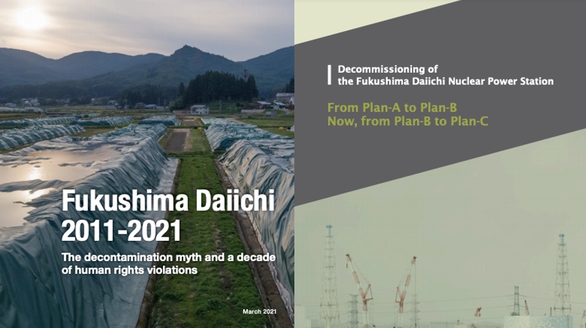
2021-03-04
Mar 4, 2021 (Greenpeace Japan) – Nearly a decade after the Fukushima Daiichi nuclear accident, Greenpeace released two reports today that highlighted the complex legacy of the 11 March 2011 earthquake and tsunami.
The first report Fukushima 2011-2020 detailed radiation levels in Iitate and Namie in Fukushima prefecture. Our original findings showed that decontamination efforts have been limited and that 85% of the Special Decontamination Area has undergone no decontamination.
The second report Decommissioning of the Fukushima Daiichi Nuclear Power Station From Plan-A to Plan-B Now, from Plan-B to Plan-C critiqued the current official decommission plan within 30-40 years of having no prospects of success and is delusional.
“Successive governments during the last ten years, and largely under prime minister Shinzo Abe, have attempted to perpetrate a myth about the nuclear disaster. They have sought to deceive the Japanese people by misrepresenting the effectiveness of the decontamination program and ignoring radiological risks,” said Shaun Burnie, Senior Nuclear Specialist at Greenpeace East Asia.
“At the same time, they continue to claim that the Fukushima Daiichi site can be returned to ‘greenfield’ status by mid-century. The decade of deception and delusion on the part of the government and TEPCO must end. A new decommissioning plan is inevitable so why waste any more time with the current fantasy?” Burnie added.
The first Greenpeace radiation expert team arrived in Fukushima prefecture on 26 March 2011, and have conducted 32 investigations into the radiological consequences of the disaster over the last decade, the most recent in November 2020. The key findings of the radiation report Fukushima 2011-2020 are:
- Greenpeace has consistently found that most of the 840 square kilometers Special Decontamination Area(SDA), where the government is responsible for decontamination, remains contaminated with radioactive cesium.
- Analysis of the government’s own data shows that in the SDA an overall average of only 15% has been decontaminated.
- No time frame for when the Japanese government’s long-term decontamination target level of 0.23 microsieverts per hour (μSv/h) will be achieved in many areas. Citizens will be subjected for decades of radiation exposure in excess of 1mSv/y recommended maximum.
- In the areas where evacuation orders were lifted in 2017, specifically, Namie and Iitate, radiation levels remain above safe limits, potentially exposing the population to increased cancer risk. Plans to continue to lift evacuation orders are unacceptable from a public health perspective.
- Up till 2018, tens of thousands of decontamination workers had been employed in decontamination in the SDA. As documented by Greenpeace[1], the workers, most of whom are poorly paid subcontractors, have been exposed to unjustified radiation risks for a limited and ineffective decontamination program.
The key findings of The Fukushima Daiichi Nuclear Power Station decommissioning report[2] are:
- There are no credible plans for retrieval of the hundreds of tons of nuclear fuel debris remaining inside and under the three Reactor Pressure vessels – it requires a fundamental review.
- Water used in reactor cooling and groundwater contamination, and therefore accumulating in tanks, will keep growing into the future unless a new approach is adopted.
- All nuclear contaminated material should remain on the site indefinitely. If the nuclear fuel debris is ever retrieved, it also should remain on site. Fukushima Daiichi is already and should remain a nuclear waste storage site for the long term.
- The current plan is unachievable in the timeframe of 30-40 years in the current road map and impossible to achieve in terms of returning the site to greenfield.
It is recommended that a fundamental rethink in approach and a new plan for the decommissioning of Fukushima Daiichi, including a delay in molten fuel removal for 50-100 years or longer is needed with the construction of secure containment buildings for the long term. The Primary Containment vessel, with reinforcement, should be used as an incomplete primary boundary and the reactor building as the secondary boundary for the medium-to-long term, while developing robotic technology that can perform tasks without high radiation risks to human workers.
Finally, to prevent the further increase of radioactive contaminated water, cooling of nuclear fuel debris should be switched from water to air cooling, and the Fukushima Daiichi site should be made into a ‘dry island’ isolated from groundwater with the construction of a deep moat.
ENDS
Links to full reports:
- Fukushima 2011-2020
- Decommissioning of the Fukushima Daiichi Nuclear Power Station From Plan-A to Plan-B Now, from Plan-B to Plan-C
- Greenpeace Briefing “Fukushima Daiichi Decommissioning Time for a new long term strategic plan”
Notes:
[2] Report commissioned by Greenpeace from a consulting nuclear engineer, formerly with General Electric including at the Fukushima Daiichi reactors, Mr. Satoshi Sato.
Fukushima residents demand stricter decontamination to enable safe return
Residents of the Yonomori district in Tomioka, Fukushima Prefecture, march with a portable shrine in April 2007.
January 22, 2021
“Will Tomioka go back to how it was before?” Looking at the results of a survey, Kazuyoshi Kamata, vice head of the Yonomori Station northern administrative district in Tomioka, Fukushima Prefecture, reflects on his hometown and its reconstruction following the Fukushima No. 1 nuclear power plant triple meltdown in 2011.
In the surveys conducted by the Reconstruction Agency last fall, Tomioka residents listed important conditions in deciding whether they would return to their hometown or not, such as the reopening and construction of new medical, welfare and elder care facilities as well as the resumption and improvement of shopping complexes.
One condition that stands out among the list, though, is a further reduction in the amount of radiation, which 1 in 3 residents raised as an important issue. The government has been decontaminating specially designated areas, where it was once thought that settlement was limited for good but which can be reopened for residents. It has set the annual radiation exposure limit to be lower than 20 millisieverts as one of the standards to lift the evacuation orders.
Now that nearly 10 years have passed since the nuclear crisis at the Fukushima No. 1 plant, Kamata stressed the need for the government to decontaminate the area under stricter standards so that residents will feel safer returning to their hometown.
“In order to maintain people’s feelings for their hometowns, I want (the government) to stick to the stance of rebuilding our Tomioka in the form that we all want, including restoring the (basic living) environment.”
Tomioka’s Yonomori district used to be bustling with an increasing population, said Kamata, adding that younger generations supported the local community by planning events utilizing a famous row of cherry blossom trees and developing agriculture centered around rice crops.
“The district was a place full of energy where everyone, regardless of generation, was involved in making the local community,” said Kamata.
At the Yonomori cherry blossom festival held in spring, for example, smiles spread among residents as children strolled around, and the event also featured a mikoshi, or Shinto palanquin, from Otoshi Shrine.
The government is also doing its part in reconstructing the specially designated area in Tomioka by establishing zones focused on revitalizing businesses and agriculture. With creating agricultural corporations and making use of tourism resources such as roadside cherry blossom trees as the two main pillars, the government is working to attract about 1,600 people to live there, which is 40% of the population before the accident.
In the meantime, residents have been raising concerns about the 20 millisieverts condition, demanding a higher standard and more decontamination. In places that have recorded higher radiation levels, it is expected there will be damage from harmful rumors about things including tourism and agriculture.
“Without people, reconstruction would not begin. Creating conditions to invite more people without concerns is of utmost importance,” said Kamata, arguing that alongside other areas, restoring the living environment, including decontamination with the aim of lowering the annual radiation exposure to 1 millisevert or less, will be needed for future generations to live in Yonomori.
“Once the evacuation order is lifted, I want the local community to regain its connections within (the district),” said Kamata, hoping to take on a role of handing down the district’s traditions and way of life, as well as traditional scenery, to younger generations once he returns. As a vice-head of the administrative district, though, Kamata also intends to communicate crucial issues to the local government while residing in the area.
The lifting of the evacuation order in the specially designated area is expected in the spring of 2023, 12 years after the order was first issued.
“Without tackling issues such as restoring the living environment and infrastructure, as well as decommissioning of the Fukushima No.1 plant in a diligent manner, people won’t come back,” said Kamata. Now he hopes the government will share his passion for the hometown’s rebuilding.
This section features topics and issues covered by the Fukushima Minpo, the prefecture’s largest newspaper. The original article was published Jan. 12.
https://www.japantimes.co.jp/news/2021/01/22/national/fukushima-decontaminating-town/
Fukushima ‘blank spaces’ in limbo, left out of decontamination plan

A September 2009 photo shows the home of Takashi Asano in Okuma, Fukushima Prefecture. The house is now a wreck with a damaged roof and is accessible to wild animals.
Oct 16, 2020
It was back in the autumn of 2011. Wind blowing from the Pacific Ocean was cutting through the golden rice fields.
Takashi Asano, 67, who had evacuated from the town of Okuma in Fukushima Prefecture following the March 2011 Great East Japan Earthquake and subsequent Fukushima nuclear disaster, had returned temporarily to his home.
When Asano was gazing at the paddy fields behind his former home from afar, it looked like the field was full of rice ready to be harvested.
“Why would that be when I haven’t planted rice,” wondered Asano, who had evacuated to Aizuwakamatsu in the prefecture after the disaster.
When he went closer, he noticed the plants had yellow tips belonging to Canadian goldenrods, an invasive foreign plant. In his absence, the plants had already begun to take over the fields.
The area where his home is located had been designated a no-go zone. It was excluded from the area designated by the government where it plans to decontaminate and either rebuild it for future use or make it a storage facility for radioactive waste such as soil by the spring of 2023.
Therefore, local residents call the area the “blank-space district,” in reference to the uncolored space on the government map for reconstruction. With no decontamination projects in the pipeline, locals can’t make any plans for the future.
At Asano’s home, rain has seeped through damaged roof, and there are signs that wild boars have found their way inside. He returns once a year to pay respects at family graves but each time it is difficult to see what remains of his home.
“I don’t want to see it. When I leave, I tell myself not to look back,” he said.
Nearly 10 years have elapsed since Asano was forced to evacuate. Nothing seems to represent the passage of time more than the deteriorating fields and homes.
Before the disaster, Asano had been growing rice and vegetables while working at a chemical factory. He had his two-story home constructed in 1986, with a garage and a shed for farming tools.
Construction fees had been paid off and retirement was just around the corner. After he retired, Asano intended to continue as a contract worker, but plans of a comfortable retirement were shattered by the disaster in 2011.
Two years ago, he considered tearing his house down. When he contacted the municipal government, they referred him to a contractor for the work, only to be turned down.
“We can’t work on projects in the blank-space district,” the contractor said.
Demolition and decontamination efforts were underway in other parts of the town the government has designated areas for reconstruction. However, in the blank-space district contractors are turning down requests for demolition since the government’s plans are still unclear.
“The house is no longer livable,” Asano said. “Buildings are being torn down in other parts of the town, so I don’t understand why I can’t have mine torn down, too.”
The central government announced it would secure about ¥1.6 trillion for a five-year recovery plan from fiscal 2021. About ¥1.1 trillion of that will be allocated for Fukushima Prefecture, separately from which ¥100 billion will be funneled into efforts targeting no-go zones located outside of the designated recovery zones. But specific details on what to do with those places have yet to be mapped out.
Entry restrictions have been loosened in parts of the recovery zones in Okuma, allowing some residents to begin rebuilding their homes.
In those areas, residents have the right to decide whether to return or live elsewhere. But Asano and others living in the surrounding area don’t yet have the freedom to choose their future.
“The government hasn’t made it clear what it plans to do over the next 20 or 30 years,” Asano said. “People who want to return and people who have given up — everybody is stuck.”
The disjointed dismantling of restrictions within and near recovery zones continues to invite frustration.
https://www.japantimes.co.jp/news/2020/10/16/national/fukushima-blank-spaces-decontamination-limbo/
1 This Month

of the week – Nuclear Information and Resource Service
July 16 – 19H BST ATOMIC TIES Webinar!!


22,000+ miles voyaging for nuclear disarmament
and a radiation-free environment https://vfpgoldenruleproject.org/
To see nuclear-related stories in greater depth and intensity – go to https://nuclearinformation.wordpress.com
-
Archives
- July 2026 (184)
- June 2026 (287)
- May 2026 (306)
- April 2026 (356)
- March 2026 (251)
- February 2026 (267)
- January 2026 (308)
- December 2025 (358)
- November 2025 (359)
- October 2025 (375)
- September 2025 (257)
- August 2025 (319)
-
Categories
- 1
- 1 NUCLEAR ISSUES
- business and costs
- climate change
- culture and arts
- ENERGY
- environment
- health
- history
- indigenous issues
- Legal
- marketing of nuclear
- media
- opposition to nuclear
- PERSONAL STORIES
- politics
- politics international
- Religion and ethics
- safety
- secrets,lies and civil liberties
- spinbuster
- technology
- Uranium
- wastes
- weapons and war
- Women
- 2 WORLD
- ACTION
- AFRICA
- Atrocities
- AUSTRALIA
- Christina's notes
- Christina's themes
- culture and arts
- Events
- Fuk 2022
- Fuk 2023
- Fukushima 2017
- Fukushima 2018
- fukushima 2019
- Fukushima 2020
- Fukushima 2021
- general
- global warming
- Humour (God we need it)
- Nuclear
- RARE EARTHS
- Reference
- resources – print
- Resources -audiovicual
- Weekly Newsletter
- World
- World Nuclear
- YouTube
-
RSS
Entries RSS
Comments RSS
