Fed up with net-zero climate goals, activists call for ‘real zero’
Fed up with net-zero climate goals, activists call for ‘real zero’
Net zero — which calls for a neutral carbon impact through the removal of the same amount of emissions from the atmosphere that an entity releases — has drawn backlash from activists and some experts.
Persistent impact of Fukushima decontamination on soil erosion and suspended sediment.
Abstract
In Fukushima, government-led decontamination reduced radiation risk and recovered 137Cs-contaminated soil, yet its long-term downstream impacts remain unclear. Here we provide the comprehensive decontamination impact assessment from 2013 to 2018 using governmental decontamination data, high-resolution satellite images and concurrent river monitoring results. We find that regional erosion potential intensified during decontamination (2013–2016) but decreased in the subsequent revegetation stage. Compared with 2013, suspended sediment at the 1-year-flood discharge increased by 237.1% in 2016. A mixing model suggests that the gradually increasing sediment from decontaminated regions caused a rapid particulate 137Cs decline, whereas no significant changes in downstream discharge-normalized 137Cs flux were observed after decontamination. Our findings demonstrate that upstream decontamination caused persistently excessive suspended sediment loads downstream, though with reduced 137Cs concentration, and that rapid vegetation recovery can shorten the duration of such unsustainable impacts. Future upstream remediation should thus consider pre-assessing local natural restoration and preparing appropriate revegetation measures in remediated regions for downstream sustainability.
Main
Radioactive material leakage from nuclear industry activities or nuclear accidents poses a major threat to the environment and the economy1,2. Historically, widespread radioactive contamination has been observed several times, such as the Kyshtym accident (Soviet Union) in the 1940s–50s3, Windscale accident (England) in 1957 (ref. 4) and Chernobyl accident (Soviet Union) in 1986 (ref. 5). Long-term radiation exposure and radiophobia have increased the health risk and psychological pressure on the people of these regions, resulting in the abandonment of large areas rich in environmental resources and consequently in constrained sustainable human development6,7. As a key means for recovering contaminated regions, mechanical decontamination has been implemented in many legacy sites, including Hanford (United States)8 and Chernobyl9. However, almost all attention has been directed to understanding in situ decontamination effects10,11 and atmospheric particle resuspension issues12 and little is known about if these perturbations would have secondary environmental impacts on their downstream catchments for the long-term.
On 11 March 2011, the most recent large-scale nuclear accident happened at the Fukushima Daiichi Nuclear Power Plant (FDNPP), Japan13. Over 2.7 PBq of fallout 137Cs (half-life T1/2 = 30.1 yr) from the FDNPP was deposited in the terrestrial environment, causing long-term radioactive contamination on large-scale neighbouring catchments13,14. To recover contaminated soil and decrease the exposure dose in Fukushima, the Japanese government evacuated the residents in 2011 and large-scale decontamination was implemented in contaminated villages15,16 in 2012. Within a few years, dramatic land-cover changes occurred in the agricultural regions where 5 cm of the surface soil and vegetation were removed and replaced with uncontaminated soil (Fig. 1), with the subsequent natural restoration promoting revegetation in these decontaminated regions11,13,16.

The effectiveness of such intensive decontamination at reducing radiation exposure in situ is apparent, with air dose rates decreasing by 20–70% after decontamination13. However, as 137Cs can firmly bind to clay minerals, it is transported along with suspended sediments (particulate 137Cs) in the river system to the Pacific Ocean17,18. Comprehensively assessing the impacts of land-use changes in decontaminated regions on the downstream ecosystem is also necessary from the perspective of environmental sustainability. Moreover, recent studies have shown notable differences in the reduction in the particulate 137Cs concentration over time across 30 rivers in Fukushima19,20, further underscoring the need to study land-use impacts on downstream particulate 137Cs discharge into the ocean.
In addition to contaminant migration, land-use changes induced by strong perturbations (for example, decontamination) also alter land–ocean sediment transfer patterns21,22, which in turn affect elemental cycles23, biodiversity24 and global climate25. Systematically assessing the perturbations’ impacts on downstream river suspended sediments (SS) has thus become a joint goal of many related disciplines and a key part of developing science-based catchment management strategies26,27,28,29. However, owing to the limited availability of reliable and concurrent river monitoring data, how downstream river SS variations and land-use changes are linked remains unclear21.
With approximately 11.9% of the watershed area subjected to government-led decontamination between 2013 and early 2017, the Niida River Basin in Fukushima (Fig. 2a)11,30 provides an excellent opportunity to examine the long-term impact on the dynamics of SS and particulate 137Cs in river systems. Previous short-term river studies19,20,31,32,33,34 have suggested an increased river SS load and decreased particulate 137Cs concentrations during decontamination. Several studies that analysed geochemical fingerprints in deposited sediments have implied a significant contribution of sediment sources from the decontaminated regions to the river35,36,37. Yet, given that threats to sustainable catchment management from anthropogenic perturbations are often long-term28,29, more comprehensive and reliable data on quantified land cover and continuous river records are required to explore the effect of decontamination on river SS and particulate 137Cs discharge.

Here we provide a comprehensive assessment of the impacts of land-use changes in decontaminated regions on river SS and particulate 137Cs dynamics, as well as the downstream discharge. We mapped the evolution of decontaminated region boundaries using governmental decontamination documents (Fig. 2b), photographed the land cover in the decontaminated regions using drones and quantified the land-use changes using the normalized difference vegetation index (NDVI) at 10 m spatial resolution. Meanwhile, we conducted a long-term field investigation (Methods and Supplementary Table 1) spanning the decontamination (2013–2016) and natural restoration (2017–2018) stages to continuously record the fluctuations in water discharge and turbidity (10 min temporal resolution) and particulate 137Cs concentrations, both upstream and downstream. Combining the above quantitative data, we systematically reveal that long-term land-use changes in upstream decontaminated regions greatly affect sediment and 137Cs discharge from downstream river systems into the Pacific Ocean.
Land-cover changes in decontaminated regions
Regional decontamination was accomplished in March 2017, spanning over 22.9% and 11.9% of the upstream (Notegami) and downstream (Haramachi) watershed areas, respectively (Fig. 2c). In 2014, agricultural land (18.02 km2) was one of the major land uses in the regions where decontamination was ordered, with a significant increase of over 720% compared with that in 2012. Conversely, the changes in the ordered grassland (1.93 km2) were minimal, with an approximately 26% increase between 2012 and 2014. Given that overall land-cover changes were more pronounced in agricultural lands than in grasslands or residential lands, large-scale agricultural land decontamination may severely alter landscape erodibility and consequently the sediment supply. Moreover, the proximity of the decontaminated agricultural land to rivers increases sediment transport from terrestrial environments.
Drone photographs (Fig. 3a and Supplementary Fig. 1) showed significant land-cover changes in the upstream decontaminated regions. For instance, the agricultural land at the Hiso site (D3, Fig. 3a) was almost bare in August 2016 when the decontamination was completed. However, natural restoration caused the recovery of vegetation during the post-decontamination stage (August 2018). Considering the decontamination sequence and seasonal dependence of the plant growth cycle38, drastic spatiotemporal land-cover changes in the decontamination regions are conceivable.


To quantitatively estimate and compare land-cover changes in the decontaminated regions, we generated NDVI maps in these regions based on the available satellite images from Sentinel 2 and the Moderate Resolution Imaging Spectroradiometer (MODIS) between 2011 and 2018. The comparison between realistic scenarios and Sentinel 2-based NDVI maps (spatial resolution: 10 m) from drone observation sites (Fig. 3a and Supplementary Fig. 1) confirmed the feasibility of NDVI images in distinguishing bare land and agricultural land with vegetation cover. To improve the temporal–spatial resolution of the NDVI dataset, we used the enhanced spatial and temporal adaptive reflectance fusion model (ESTARFM)39 to fuse Sentinel 2 and MODIS maps. Subsequently, we used interpolation to link these newly generated NDVI data (spatial resolution: 10 m) and plotted daily NDVI variations for all decontaminated regions between 2011 and 2018 (Fig. 3b).
In the daily NDVI variation curve, the peak NDVI during 2013–2014 was similar to the pre-decontamination stage (2012) but decreased by approximately 10% in 2016. After decontamination, the peak value presented an increasing trend under the influence of vegetation recovery. However, as the government lifted the evacuation zone after 2017 and allowed the residents to return, vegetation was again removed from some areas planned for agricultural activities in 2018 (Supplementary Fig. 1b). Further analyses of the NDVI variations in the decontaminated regions scheduled in 2012 (Fig. 3c), 2013 (Fig. 3d) and 2014 (Fig. 3e) showed that the NDVI peaks were decreased by approximately 12%, 11% and 15%, respectively, within 2–3 years after decontamination was ordered, thereby providing unambiguous evidence for decreasing vegetation land cover caused by decontamination.
We converted all NDVI maps derived from ESTARFM-images to C × P (cover management and support practice factors, respectively) maps using empirical models40,41. We then estimated erosion potential (that is, K × LS × C × P in the revised Universal Soil Loss Equation (RUSLE); Methods) maps using the LS (slope length and slope steepness factors, respectively) map (Supplementary Fig. 2) and K (soil erodibility) factor in the decontaminated regions. We found that the slopes of decontaminated regions were generally similar for each decontamination-ordered year (Supplementary Fig. 2), suggesting that the erosion potential was consistent with the NDVI in the decontaminated regions. Therefore, we also estimated the daily variation curve of the erosion potential using the mean CP, LS and K factors in the decontaminated regions.
Here we show the ESTARFM-based NDVI (Fig. 3f) and erosion potential (Fig. 3g) during the summer season for each year (specific periods in Supplementary Table 2). NDVI showed a decreasing trend from 2013 to 2016, while the erosion potential peaked in 2016, representing approximately 98% and 52% increases over the pre-decontamination (2011) and natural restoration (2018) stages, respectively. Combining the corresponding NDVI (Supplementary Fig. 3) and erosion potential maps (Supplementary Fig. 4), significant changes in the spatial differences between the land cover and erosion potential during decontamination were also observed.
Response of river SS to land-cover changes
The downstream river SS load (L; Fig. 4a) exhibited a strong correlation with water discharge (Q) during the monitoring periods (Supplementary Fig. 5 and Supplementary Table 3). Under the range of water discharges from 0.1 to 100 m3 s−1, river SS carrying capacity exhibited a considerable increase from 2013 to 2016 and a slight decrease after decontamination (2017 to 2018). Contrastingly, the range of water discharges was relatively narrow upstream, and a steady decrease in SS loads has been observed since 2015. Although the above result suggests an increase in SS supply during the decontamination stage, the high SS carrying capacity in 2015 is not consistent with the actual decontamination progress. Since decontaminated regions tend to be bare land, sediment loads are prone to increasing during rainstorms due to soil erosion. Governmental decontamination plans showed that over 50% of agricultural land decontamination was planned to be implemented in 2016, implying that the erosion potential of the decontaminated regions should have been higher in 2016, rather than in 2015.


The variations in downstream river SS loads over the 6 years (Supplementary Table 4) exhibited a similar trend to peak river SS load in 2015 (126.7 ± 0.3 Gg yr−1). This was an approximately 1,776%, 140% and 215% increase relative to that of 2013, 2016 and 2018, respectively. The historical rainfall records (Fig. 4b) show that the rainfall in September 2015 (551 mm) was more than two-fold greater than that during the same period in 2016 (274 mm), implying that the SS peak may be related to strong runoff. Here we estimate the SS loads at 1-year-flood discharge (Q = 95 m3 s−1) using established L–Q curves, which allow for the comparison of dynamic variations in SS loads under the same flood conditions. In Fig. 4b, a significant increasing trend during the decontamination period is shown, with a 237.1% increase in 2016 compared with 2013. After decontamination, the SS loads drastically decreased by approximately 41% from 2016 to 2017, implying changes in sediment yield and transfer patterns due to natural restoration. These results reveal that river SS loads responded closely to land-cover changes during the study period.
To better explore the response of river SS load to land-cover changes, we extracted river monitoring data during each rainfall event and quantitatively linked the river SS to the corresponding soil loss from the decontaminated regions. We found that SS loads during rainstorms were highly correlated with water discharges in both upstream and downstream areas (Supplementary Fig. 6). Comparing similar rainfall events, significantly greater SS concentrations are observed in 2015–2016 than in other years (Supplementary Figs. 7 and 8). Considering that the land-cover changes induced by decontamination were more pronounced in the summer season, the regression was performed for SS loads between May and October and soil loss during the corresponding period. A more significant correlation was observed (Fig. 4c) between estimated soil loss by RUSLE and SS load upstream (R2 = 0.55, P < 0.01, N = 34) than downstream (R2 = 0.27, P < 0.01, N = 52). Eliminating the effect of rainfall and normalizing by discharge (Fig. 4d) results in a more evident relationship between the erosion potential and SS loads downstream (R2 = 0.35, P < 0.01, N = 52). Overall, these results demonstrate the connection between river SS dynamics and land-cover changes in the decontaminated regions. The short distance between the upstream catchment and decontaminated regions makes soil erosion a critical driver for upstream river SS transport, whereas the downstream river is dependent on long-distance SS transport, making water discharge an important driver for the downstream catchment.
Long-term impact on river SS and 137Cs discharge
From August 2014 to March 2017, the particulate 137Cs concentration in Haramachi exhibited a steep decrease, contrasting remarkably with the limited 137Cs variation observed in the early decontamination stages (January 2013 to August 2014; Fig. 5a). The effective half-life of the particulate 137Cs (eliminated by the natural attenuation factor) during this decontamination period (1.87 yr) was considerably faster than that of physical decay of 137Cs (30.1 yr), the early decontamination period (16.9 yr) and the surrounding contaminated catchments (mean of 4.92 yr)20. Such a sharp decrease in the 137Cs concentration was also observed at the other three monitoring sites (Supplementary Fig. 9a). Because the 137Cs concentration in decontaminated soil was considerably lower than that in the contaminated soil37,42, these results suggest the contribution of sediment from decontaminated regions to the river system. Moreover, strong negative correlations were observed between measured 137Cs levels and decontamination progress at all monitoring sites (Fig. 5b and Supplementary Fig. 9b), which further supports our interpretation. The observed 137Cs concentration increased by approximately 150% in 2018 compared with that at the end of 2016, which may be caused by the weakened sediment supply from decontaminated regions owing to natural restoration and resulting in a relatively increased contribution of sediments from contaminated forest regions13.


Given that the variation in 137Cs concentrations reflects a change in sediment source, the deviations between the measured 137Cs and the natural decrease in 137Cs derived from surrounding contaminated catchments provide a way to quantitatively estimate the contribution of sediment from decontaminated regions (Fig. 5c). In the early decontamination period, our results showed slight variations in the 137Cs concentration (Fig. 5a), which could be attributed to the contribution of sediment from upstream regions with different degrees of contamination. During the main decontamination period, the erosion potential in the summer of 2015 was approximately 22% higher than that in 2014 and the heavy rainfall caused the largest flooding event during the study period (26-year flood). This may result in the sediment from decontaminated regions not being the dominant source for downstream. In 2016, decontamination caused an increase by approximately 59% in the erosion potential compared with 2013, with the contribution percentage steadily increasing over this period to a maximum of 75.7% ± 3.2% (value ± 95% uncertainty). After decontamination, the decreased contribution of sediment from decontaminated regions and the increased 137Cs concentrations can both be attributed to the reduction of soil loss from upstream due to natural restoration.
The 137Cs discharge from contaminated catchments around the Fukushima region into the Pacific Ocean is another ecological issue of global concern. Our data show that the export flux of particulate 137Cs from the downstream of the Niida river (that is, Haramachi) peaked in 2015 (1.24 TBq yr−1, equalling 0.65% 137Cs loss), which is an approximately 667%, 233% and 429% increase relative to that in 2013, 2016 and 2018, respectively (Fig. 5d). Although such 137Cs loss is negligible compared with the terrestrial inventory, it is approximately 105 times greater than that in the pre-Fukushima stage43,44. Accordingly, the dynamic variations in 137Cs discharge from terrestrial environments into the Pacific Ocean, and its drivers, require more attention in the future.
Here we used SS loads at one-year-flood discharge to normalize the 137Cs flux and found its peak occurred in 2015 (Fig. 5e). Additionally, the reduction of the normalized 137Cs flux from 2013 to 2016 (~32%) was similar to natural attenuation in the non-contaminated catchment (~34%) over same period, which may be due to the increased SS load during decontamination offsetting the role of declining 137Cs concentrations in reducing 137Cs emission. During the subsequent natural restoration period, the rapid NDVI increase (Fig. 3f) suggested vegetation recovery in decontaminated regions and a decrease in regional erosion potential (Fig. 3g). This resulted in an approximately 24% decrease in sediment yield from the catchment and an approximately 31% decrease in the contribution of sediment from decontaminated regions (Fig. 5c) from 2016 to 2018. Due to the mutual balance of these effects, there were no significant changes in normalized particulate 137Cs flux in 2018 compared with 2016.
Discussion
Our work highlights the great potential of interdisciplinary analyses for understanding river SS variation and quantifying the contribution of sediment from specific regions. Fukushima decontamination practices, like a controllable validation experiment, justified the reliability of using long-term 137Cs monitoring data for tracing sediment source dynamics due to specific perturbation. Combining the long-term dataset of 137Cs (or other fallout radionuclides) in SS with remote sensing images would provide additional evidence to determine if the changes in the downstream SS transport pattern are linked to the upstream perturbation.
With these interdisciplinary analyses, we systematically reveal how changes in land use in the decontaminated regions significantly influences downstream river SS and 137Cs discharge into the ocean. Indeed, the secondary environmental impacts of surface remediation are being increasingly considered in the broader field concerning remediation of regions contaminated with hazardous materials (for example, heavy metals and organic contaminants)45. The concept of environmental sustainability-centred green remediation has also been brought up in many scenarios46,47. The Fukushima decontamination practice provides evidence showing that mechanical remediation can cause persistently excessive SS load downstream, though it also reduced river 137Cs concentrations. Since persistently excessive turbidity in rivers affects not only surrounding residents’ water use but also trophic level structure in aquatic environments48, the unsustainable downstream impacts caused by upstream decontamination should be highly regarded. The vegetation recovery after land development is highly dependent on local conditions49, and the soil used for decontamination and local high rainfall amount in Fukushima promoted rapid vegetation recovery11,13, which shortened the duration of such unsustainable impacts. Therefore, future upstream contaminated lands that await mechanical remediation need to consider the pre-assessment of local natural restoration conditions or the preparation of appropriate revegetation measures in the catchments’ regulatory frameworks, which would minimize the impact of long-term decontamination on downstream sustainability.
Methods
Study region
The Niida River Basin (265 km2) is located about 40 km northwest of the damaged FDNPP. The topography of its upstream is almost mountainous and its soil types are mainly cambisols and andosols, while fluvisols are the dominant soil type in the downstream plain50. The monitoring data from the Japan Meteorological Agency show that the average rainfall in the Niida River Basin is greater than 1,300 mm, with more than 75% of the rainfall occurring between May and October. According to the third airborne monitoring survey by the Japanese government, the 137Cs inventory in the Niida River Basin was over 700 kBq m−2 (ref. 14). Because of particularly high contamination in its upstream watershed (over 1,000 kBq m−2)51, the government-led decontamination was implemented in the upstream basin from 2013 to 2016 (~1% of the area was extended to March 2017).
Land-cover observation
We constructed the vector decontamination maps based on the paper maps from the Ministry of the Environment, Japan. The boundaries of the decontaminated regions with different land-use types were first outlined by creating polygons using Google Earth. Subsequently, the projections of these polygons were imported to ArcMap v.10.3 to quantitatively evaluate their area.
During the decontamination (2016) and post-decontamination stages (2018), drone photography was utilized (Fig. 2a, triangle) to compare land-cover changes. A commercially available drone (Phantom 4, DJI product) was employed at 100 m above the ground in Matsuzuka (D1; 37.689° N, 140.720° E), Iitoi (D2; 37.663° N, 140.723° E) and Hiso (D3; 37.613° N, 140.711° E) to take photographs.
Quantification of land-cover changes in decontaminated regions
We calculated NDVI within the boundary of the decontaminated regions to quantify the land-cover changes. Through the spectral reflectance dataset in the red (R, nm) and near-infrared (NIR, nm) regions, the NDVI was calculated as52:
NDVI=NIR−RNIR+R.
(1)
The available satellite images from 2011 to 2018 from Sentinel 2 were downloaded from the United States Geological Survey53, while the concurrent MODIS images were derived from the National Aeronautics and Space Administration’s Reverb54. The wavelength bands and spatiotemporal resolutions of the satellite images used here are summarized in Supplementary Tables 5 and 6.
To confirm the reliability of the newly generated NDVI variation curve, NDVIs for the same date as the Sentinel 2 images were estimated using the interpolation and compared with the Sentinel 2-based NDVI. The linear regression analysis showed that the fitting R2 was 0.99 (N = 16, P < 0.01). We also calculated the NDVI in the decontaminated region based on available satellite images of Landsat 5/7/8 (ref. 53) and established a daily NDVI variation curve. The linear regression analysis also showed a high R2 between two daily NDVI curves (R2 = 0.97, N = 2868, P < 0.01). Therefore, these NDVIs calculated by different satellite images confirmed the reliability of the NDVI variation curve based on ESTARFM.
Estimation of erosion potential in decontaminated regions
To link the land-cover changes in decontaminated regions with the soil erosion dynamics, we defined an erosion potential (K × LS × C × P) based on the RUSLE.
The soil loss (A, t ha−1 yr−1) of a specific region can be estimated as55:
A=R×K×LS×C×P,
(2)
where R is the precipitation erosivity factor (MJ mm ha−1 h−1 yr−1), K represents the soil erodibility factor (t h MJ−1 mm−1), L and S are slope length factor (dimensionless) and slope steepness factor (dimensionless), respectively, and C and P are the cover management factor (dimensionless) and support practice factor (dimensionless), respectively. Because these parameters are often set as fixed values, it is difficult to assess the soil loss dynamics during anthropogenic disturbances. To address this problem, we used daily NDVI data to estimate C × P and then considered these dynamic factors in RUSLE.
Wakiyama et al.40 reported a correlation between vegetation cover in Fukushima and the sediment discharges from the standard USLE plot (that is, soil loss, A) that have been normalized by R, K, S and L factors40,56. Therefore, this empirical equation reflects the quantitative relationship between vegetation fractions (VF) and C × P.
To quantify daily C × P changes in decontaminated regions, we first converted the interpolated daily NDVI into the VF by a semi-empirical equation41:
VF=1−(NDVI−NDVI∞NDVIs−NDVI∞)0.6175,
(3)
where NDVIs and NDVI∞ represent the NDVI value for land cover corresponding to no plants and 100% green vegetation cover, respectively. Since these values mainly depend on plant species and soil types, we followed previous methods applied to agricultural land and set NDVIs and NDVI∞ as 0.05 and 0.88, respectively41.
Subsequently, the C × P was estimated by the empirical equation derived from uncultivated farmlands and grasslands (R2 = 0.47, N = 145)40:
C×P=0.083×e−5.666×VF.
(4)
Since the soil type used for decontamination is generally the same, the K factor was set as a constant (0.039; ref. 40). For the LS factor, we downloaded a digital elevation model from the Geospatial Information Authority of Japan (spatial resolution: 10 m) to build an LS map using55:
LS=[Qa×M22.13]y×(0.065+0.045×Sg+0.0065×S2g),
(5)
where Qa is the flow accumulation grid, Sg represents the grid slope as a percentage, M is the grid size and y is a parameter depended on slope steepness. We here used the y values recommended by a published study, ref. 55.
The calculated LS-factor map (Supplementary Fig. 2) showed a relatively consistent LS distribution in space. Based on the ESTARFM-generated satellite images, we compared C × P and erosion potential (K × LS × C × P) and found a significant correlation (R2 = 0.99, P < 0.01, N = 174). Since these results suggest that LS factors in decontaminated regions have a negligible effect on the erosion potential, the mean LS factor and interpolated NDVI based on the daily variation curve (Fig. 3b) were used to estimate the daily erosion potential.
Monitoring of river discharge and turbidity
The water-level gauges (in situ Rugged TROLL100 Data Logger) and a turbidimeter (ANALITE turbidity NEP9530, McVan Instruments) were installed in each monitoring site to continuously recording the water level and turbidity with a temporal resolution of 10 min. As ocean tides may influence the accuracy of water-level monitoring, the Sakekawa site (M4 in Fig. 2) was excluded from the river monitoring programme.
The recorded water level (H, m) was converted to the water discharge (Q, m3 h−1) based on the annual H–Q curves for each monitoring site. These curves were calibrated using a synchronous monitoring dataset of 10-min-resolution water level and discharge provided by the Fukushima prefecture’s official monitoring network57. Because of occasional damage to the water-level gauge at the Haramachi site, the available monitoring data with a temporal resolution of 10 min recorded by the Fukushima prefecture’s official monitoring network57 were used to fill the gaps. The percentages of filling data from official monitoring network were all less than 34% except for 2015 (56.6%). Although similar situations occurred in Notegami, we were unable to fill in gaps with other data due to the lack of a concurrent monitoring network.
The hourly SS concentration (Css, g m−3) at each monitoring site was calculated from the measured turbidity (T, mV) using a calibrated curve20. As the turbidimeter was susceptible to the moss and debris flowing in the river, the dataset was verified with an automated check by HEC-DSSVue (The U.S. Army Corps of Engineers’ Hydrologic Engineering Center Data Storage System) before transforming the data.
The SS load was estimated as the product of the corresponding datasets of discharge and SS concentration, after which we can obtain the annual SS load (L, ton yr−1) by taking the sum:
L=∑(Q×Css).
(6)
We estimated values for gaps including missing and abnormal data through a linear model established by 10-min-resolution monitoring data at the same site. The reliability of the gap-filling strategies used in this study has been documented by Taniguchi et al.19,20 These procedures vastly enhance the possibility of reconstructing the complete dataset. In this study, only the error in converting from water discharge to SS load was considered in the uncertainty assessment, and all estimates were within 0.5% (95% confidential interval) in this case. To reduce the uncertainty of L–Q fitting, the 10-min monitoring dataset (discharge and SS load) was transformed to a 1-hour dataset.
Considering the river SS is often transported by discharge, we used downstream L–Q curves to estimate river SS loads at 1-year-flood discharge (Q = 95 m3 s−1), which eliminates the influence caused by different annual water discharges. The 1-year-flood discharge was calculated from the daily maximum discharge data from 1 January 2013 to 30 September 2020 at the Haramachi site.
To compare river SS dynamics during rainfall events, we here defined a rainfall event as the increase in water discharge exceeding 1.4 and 1.6 times the baseflow before precipitation for the upstream and downstream catchments, respectively. As a result, a total of 64 and 72 rainfall events from the Notegami and Haramachi sites were identified.
To study the dynamic relationship between soil loss from decontaminated regions and river SS load, we estimated eroded soil amount during each rainstorm using RUSLE. Specifically, the NDVI during a specific rainfall was determined by interpolation. Subsequently, the corresponding C × P can be estimated using equations (3) and (4). With the mean values of the K and LS factors, the erosion potential can then be calculated. Finally, precipitation erosivity factor (Supplementary Table 7) for each rainfall event can be calculated as58:
R=1n∑j=1n∑k=1mj(EI30)k,
(7)
where n is the number of years used, mj is the number of precipitation events in each given year j and E and I30 represent each event’s kinetic energy (MJ) and maximum 30 min precipitation intensity (mm h−1), respectively, for each event k. The event’s erosivity, EI30, can be calculated as58:
EI30=(∑r=10ervr)I30,
(8)
where er denotes the unit rainfall energy (MJ ha−1 mm−1) and vr provides the rainfall volume during a set period (r) (mm). For this calculation, the criterion for the identification of a precipitation event is consistent with previous work, that is, the cumulative rainfall of an event is greater than 12.7 mm (ref. 58). If another rainfall event occurs within 6 h of the end of a rainfall event, they are counted as one event. Therefore, the unit rainfall energy (er) can be derived for each time interval based on rainfall intensity (ir, mm h−1)58:
er=0.29[1−0.72e(−0.05×ir)].
(9)
The calculation’s required parameters were derived from the historical precipitation record from the Japan Meteorological Agency59. For the Notegami catchment, the precipitation monitoring data were derived from Iitate. For the Haramachi catchment, the precipitation was obtained from three adjacent monitoring sites (that is, Haramachi, Iitate and Tsushima) with the specific weights of 0.143, 0.545 and 0.312, respectively. These weights were determined by the Voronoi diagram method in a Geographic Information System60.
River monitoring of particulate 137Cs
At each monitoring site, the suspended sediment sampler proposed by Phillips et al.61 was installed at 20–30 cm above the riverbed for the time‐integrated sampling of river suspended sediment. The reliability of this sampler has been widely proven in past studies19,20. After sampling, the trapped turbid water and SS samples were transferred into a clean polyethylene container and stored until laboratory analysis.
The SS samples were separated from the collected water mixture via natural precipitation and physical filtration, dried at 105 °C for 24 h and subsequently packed into a plastic container. The activities of 137Cs in the SS samples (C, Bq kg−1) were determined via the measurement system, which consists of a high-purity germanium γ-ray spectrometer (GCW2022S, Canberra−Eurisys, Meriden) coupled to an amplifier (PSC822, Canberra, Meriden) and multichannel analyser (DSA1000, Canberra, Meriden). The measurement system was calibrated with the standard soil sample from the International Atomic Energy Agency. Under the 662 keV energy channel, each measurement batch would take approximately 1–24 h to make the analytical precision of the measurements within 10% (95% confidential interval). All measured 137Cs concentrations were decay-corrected to their sampling date. Moreover, the results obtained in this study were also normalized by their initial average 137Cs inventory in the catchment (D, Bq m−2) to eliminate the effect caused by spatial differences.
As 137Cs concentration in the sediment sample depends on particle size19,20, we conducted a particle size correction for all measured data in Takase, Ukedo and Haramachi to eliminate this effect. The particle size distributions for dried SS samples were analysed using the laser diffraction particle size analyser (SALD-3100, Shimadzu Co., Ltd.). With the parameterized particle size distributions, the particle size correction coefficient (Pc) can be calculated by19:
Pc=(SsSr)v,
(10)
where Sr and Ss represent the reference and collected samples’ specific surface areas (m2 g−1). The exponent coefficient, v, is a fitting parameter associated with chemical and mineral compositions. In this study, the same parameters measured in the Abukuma River, the major river in the Fukushima area, were applied for Sr (0.202 m2 g−1) and v (0.65). The specific surface area for collected SS samples was estimated by the following equation under a spherical approximation20:
Ss=∑(6×ρ−1×d−1i×p−1i),
(11)
where ρ is the particle density and di and pi denote the ratio and diameter of the particle size fraction for particle i. Therefore, the 137Cs concentration corrected for particle size can be obtained by dividing the measured 137Cs concentration by Pc.
Considering that the decrease in particulate 137Cs concentration in a catchment was also affected by natural attenuation, there is a need to eliminate this effect from the declining trend of our observed 137Cs dataset to highlight the impacts of decontamination. The Ukedo and Takase are rivers surrounding the Niida River with similar contaminated situations. Our long-term 137Cs monitoring data from downstream of these two catchments showed that their 137Cs decline trends were relatively steady. Although there is a dam reservoir upstream of Ukedo, the 137Cs concentration observed both upstream and downstream showed a similar declining trend62. Therefore, the above evidence suggests that natural attenuation was the dominant factor controlling the 137Cs decrease in these two rivers. Here we assumed that the natural attenuation trend of 137Cs in the surrounding catchments (Ukedo and Takase) with little effect by decontamination was similar to that of the Haramachi catchment. Thus, we fitted their time change curves of 137Cs concentration (normalized by average 137Cs inventory of the corresponding catchment) using an exponential model. We then estimated the 137Cs concentration at the same sampling time as Haramachi in the two catchments by using the fitting models. Finally, we calculated the mean value of the two datasets and recalculated the effective half-life (Teff = ln(2)/λ; λ is the fitting exponential term) of the natural attenuation by the exponential model.
The 137Cs flux (LCs, Bq) for each monitoring site was estimated by the product of the SS flux and the 137Cs concentration in the suspended sediment sample. We then took the sum over that year:
LCs=∑(Q×Css×C).
(12)
According to the law of error propagation, we considered the error from SS load and 137Cs measurement in the combined uncertainty assessment for 137Cs fluxes and found their values are all within 1.1% (95% confidential interval).
Using 137Cs as a tracer in estimating SS source contribution
Although 137Cs has been widely used in tracing sediment source, the spatial variability of the 137Cs deposition inventory in the Fukushima catchment hinders the estimation of the source contribution from a specific region. However, for the decontaminated catchments, as the 137Cs concentration in decontaminated soil was much lower than that in contaminated regions (for example, forested regions and the riverbank)11,13,63, the fluctuations in the particulate 137Cs concentration can help to identify the sediment from the decontamination regions. Specifically, we assumed that the particulate 137Cs concentrations in surrounding contaminated watersheds (that is, having similar land-use composition) follow a similar decline trend driven by natural reasons, while the decontamination-induced land-cover changes cause other sediment sources to mix with the original river SS and thus result in a deviation in observed 137Cs concentrations from this natural trend. Therefore, the relative contribution (RC) of the specific sediment source can be expressed as:
RC=(Cm−Cn)(Cs−Cn),
(13)
where the Cm is the measured 137Cs concentration and Cs and Cn represent the 137Cs concentration in a specific sediment source and the naturally varied 137Cs concentration at the same time as the measured 137Cs. For data comparability, all 137Cs concentrations presented here were corrected by their particle size and 137Cs inventory. We also excluded the samples with collection weights below 0.5 g from the calculations due to their high uncertainty in Pc measurement.
In this study, the specific sediment source is the decontaminated soil in the Niida River Basin where the 137Cs concentration was approximately 53.99 ± 40.90 Bq kg−1 (refs. 37,42; mean ± standard deviation, N = 8). The natural decline of the 137Cs concentration (that is, λ) was established using temporal variation in 137Cs data originating from the Ukedo and Takase rivers, which were scarcely influenced by decontamination. The first measured 137Cs data in Haramachi were set as the starting point of its natural decline curve. The total uncertainty for the contribution percentage of SS from the decontaminated regions was calculated by the propagation of error from each part with the uncertainties originating from the measured 137Cs concentration, 137Cs concentration in a specific source and the natural 137Cs concentration. For the uncertainty in the 137Cs concentration in decontaminated soil (Cs), we set the standard deviation as its error source, while the natural 137Cs concentrations were calculated by the propagation of the 95% confidential interval of the fitting curves.
Reporting summary
Further information on research design is available in the Nature Research Reporting Summary linked to this article.
Data availability
Ordered decontamination process data are available from http://josen.env.go.jp/plaza/info/weekly/weekly_190607.html. Particulate 137Cs monitoring data in Haramachi, Takase and Ukedo during 2012–2017 are available from: https://doi.org/10.34355/Fukushima.Pref.CEC.00014, https://doi.org/10.34355/CRiED.U.Tsukuba.00020 and https://doi.org/10.34355/Fukushima.Pref.CEC.00021. The rest of data presented in this study are available from the corresponding author upon request.
References
- Anspaugh, L. R., Catlin, R. J. & Goldman, M. The global impact of the Chernobyl reactor accident. Science 242, 1513–1519 (1988).CAS Article Google Scholar
- Ten Hoeve, J. E. & Jacobson, M. Z. Worldwide health effects of the Fukushima Daiichi nuclear accident. Energy Environ. Sci. 5, 8743–8757 (2012).Article CAS Google Scholar
- Shagina, N. B. et al. Reconstruction of the contamination of the Techa River in 1949–1951 as a result of releases from the “MAYAK” Production Association. Radiat. Environ. Biophys. 51, 349–366 (2012).CAS Article Google Scholar
- Jones, S. Windscale and Kyshtym: a double anniversary. J. Environ. Radioact. 99, 1–6 (2008).CAS Article Google Scholar
- Beresford, N. A. et al. Thirty years after the Chernobyl accident: what lessons have we learnt? J. Environ. Radioact. 157, 77–89 (2016).CAS Article Google Scholar
- Steinhauser, G., Brandl, A. & Johnson, T. E. Comparison of the Chernobyl and Fukushima nuclear accidents: a review of the environmental impacts. Sci. Total Environ. 470–471, 800–817 (2014).Article CAS Google Scholar
- Fesenko, S. V. et al. An extended critical review of twenty years of countermeasures used in agriculture after the Chernobyl accident. Sci. Total Environ. 383, 1–24 (2007).CAS Article Google Scholar
- Poston, T. M., Peterson, R. E. & Cooper, A. T. Past radioactive particle contamination in the Columbia River at the Hanford site, USA. J. Radiol. Prot. 27, A45 (2007).CAS Article Google Scholar
- Voitsekhovitch, O., Nasvit, O., Los’y, I. & Berkovsky, V. Present thoughts on the aquatic countermeasures applied to regions of the Dnieper River catchment contaminated by the 1986 Chernobyl accident. Stud. Environ. Sci. 68, 75–85 (1997).Article Google Scholar
- Ramzaev, V., Barkovsky, A., Mishine, A., Andersson, K. G. & Well-being, H. Decontamination tests in the recreational areas affected by the Chernobyl accident: efficiency of decontamination and long-term stability of the effects. J. Soc. Remediat. Radioact. Contam. Environ. 1, 93–107 (2013). Google Scholar
- Evrard, O., Patrick Laceby, J. & Nakao, A. Effectiveness of landscape decontamination following the Fukushima nuclear accident: a review. Soil 5, 333–350 (2019).CAS Article Google Scholar
- Kinase, T. et al. The seasonal variations of atmospheric 134,137Cs activity and possible host particles for their resuspension in the contaminated areas of Tsushima and Yamakiya, Fukushima, Japan. Prog. Earth Planet. Sci. 5, 12 (2018).
- Onda, Y. et al. Radionuclides from the Fukushima Daiichi Nuclear Power Plant in terrestrial systems. Nat. Rev. Earth Environ. 1, 644–660 (2020).CAS Article Google Scholar
- Kato, H., Onda, Y., Gao, X., Sanada, Y. & Saito, K. Reconstruction of a Fukushima accident-derived radiocesium fallout map for environmental transfer studies. J. Environ. Radioact. 210, 105996 (2019).CAS Article Google Scholar
- Remediation of Contaminated Areas in the Aftermath of the Accident at the Fukushima Daiichi Nuclear Power Station. Overview, Analysis and Lessons Learned. Part 1. A Report on the “Decontamination Pilot Project” (Japan Atomic Energy Agency, 2015); https://jopss.jaea.go.jp/pdfdata/JAEA-Review-2014-051.pdf
- Decontamination Guidelines 2nd edn (Ministry of the Environment, 2013); http://josen.env.go.jp/en/%0Aframework/pdf/decontamination_guidelines_2nd.pdf
- Iwagami, S. et al. Temporal changes in dissolved 137Cs concentrations in groundwater and stream water in Fukushima after the Fukushima Dai-ichi Nuclear Power Plant accident. J. Environ. Radioact. 166, 458–465 (2017).CAS Article Google Scholar
- Aoyama, M., Tsumune, D., Inomata, Y. & Tateda, Y. Mass balance and latest fluxes of radiocesium derived from the Fukushima accident in the western North Pacific Ocean and coastal regions of Japan. J. Environ. Radioact. 217, 106206 (2020).CAS Article Google Scholar
- Taniguchi, K. et al. Transport and redistribution of radiocesium in Fukushima fallout through rivers. Environ. Sci. Technol. 53, 12339–12347 (2019).CAS Article Google Scholar
- Taniguchi, K. et al. Dataset on the 6-year radiocesium transport in rivers near Fukushima Daiichi Nuclear Power Plant. Sci. Data 7, 433 (2020).
- Walling, D. E. Human impact on land–ocean sediment transfer by the world’s rivers. Geomorphology 79, 192–216 (2006).Article Google Scholar
- Borrelli, P. et al. An assessment of the global impact of 21st century land use change on soil erosion. Nat. Commun. 8, 2013 (2017).
- Piao, S. et al. Changes in climate and land use have a larger direct impact than rising CO2 on global river runoff trends. Proc. Natl Acad. Sci. USA 104, 15242–15247 (2007).CAS Article Google Scholar
- Jung, M., Rowhani, P. & Scharlemann, J. P. W. Impacts of past abrupt land change on local biodiversity globally. Nat. Commun. 10, 5474 (2019).
- Borrelli, P. et al. Land use and climate change impacts on global soil erosion by water (2015–2070). Proc. Natl Acad. Sci. USA 117, 21994–22001 (2020).CAS Article Google Scholar
- Overeem, I. et al. Substantial export of suspended sediment to the global oceans from glacial erosion in Greenland. Nat. Geosci. 10, 859–863 (2017).CAS Article Google Scholar
- Giam, X., Olden, J. D. & Simberloff, D. Impact of coal mining on stream biodiversity in the US and its regulatory implications. Nat. Sustain. 1, 176–183 (2018).Article Google Scholar
- Hackney, C. R. et al. River bank instability from unsustainable sand mining in the lower Mekong River. Nat. Sustain. 3, 217–225 (2020).Article Google Scholar
- Wang, S. et al. Reduced sediment transport in the Yellow River due to anthropogenic changes. Nat. Geosci. 9, 38–41 (2016).CAS Article Google Scholar
- Environmental Remediation (Ministry of the Environment, Government of Japan, 2021); http://josen.env.go.jp/en/decontamination/
- Niizato, T. & Watanabe, T. 137Cs outflow from forest floor adjacent to a residential area: comparison of decontaminated and non-decontaminated forest floor. Glob. Environ. Res. 24, 129–136 (2021); http://www.airies.or.jp/ebook/Global_Environmental_Research_Vol.24No.2.pdf Google Scholar
- Sakuma, K. et al. Evaluation of sediment and 137Cs redistribution in the Oginosawa River catchment near the Fukushima Dai-ichi Nuclear Power Plant using integrated watershed modeling. J. Environ. Radioact. 182, 44–51 (2018).CAS Article Google Scholar
- Iwagami, S. et al. Six-year monitoring study of 137Cs discharge from headwater catchments after the Fukushima Dai-ichi Nuclear Power Plant accident. J. Environ. Radioact. 210, 106001 (2019).CAS Article Google Scholar
- Ochiai, S. et al. Effects of radiocesium inventory on 137Cs concentrations in river waters of Fukushima, Japan, under base-flow conditions. J. Environ. Radioact. 144, 86–95 (2015).CAS Article Google Scholar
- Evrard, O. et al. Impact of the 2019 typhoons on sediment source contributions and radiocesium concentrations in rivers draining the Fukushima radioactive plume, Japan. Collect. C. R. Geosci. 352, 199–211 (2020). Google Scholar
- Evrard, O. et al. Quantifying the dilution of the radiocesium contamination in Fukushima coastal river sediment (2011–2015). Sci. Rep. 6, 34828 (2016).
- Evrard, O. et al. Radionuclide contamination in flood sediment deposits in the coastal rivers draining the main radioactive pollution plume of Fukushima Prefecture, Japan (2011–2020). Earth Syst. Sci. Data 13, 2555–2560 (2021).Article Google Scholar
- Chu, H., Venevsky, S., Wu, C. & Wang, M. NDVI-based vegetation dynamics and its response to climate changes at Amur-Heilongjiang River Basin from 1982 to 2015. Sci. Total Environ. 650, 2051–2062 (2019).CAS Article Google Scholar
- Zhu, X., Chen, J., Gao, F., Chen, X. & Masek, J. G. An enhanced spatial and temporal adaptive reflectance fusion model for complex heterogeneous regions. Remote Sens. Environ. 114, 2610–2623 (2010).Article Google Scholar
- Wakiyama, Y., Onda, Y., Yoshimura, K., Igarashi, Y. & Kato, H. Land use types control solid wash-off rate and entrainment coefficient of Fukushima-derived 137Cs, and their time dependence. J. Environ. Radioact. 210, 105990 (2019).CAS Article Google Scholar
- Gao, L. et al. Remote sensing algorithms for estimation of fractional vegetation cover using pure vegetation index values: a review. ISPRS J. Photogramm. Remote Sens. 159, 364–377 (2020).Article Google Scholar
- Nemoto, T. & Matsuki, N. Soil Stratification Survey on Farmland Soil after Decontamination in Iitate Village (in Japanese) (Fukushima Agricultural Technology Centre, 2015).
- Wakiyama, Y., Onda, Y., Mizugaki, S., Asai, H. & Hiramatsu, S. Soil erosion rates on forested mountain hillslopes estimated using 137Cs and 210Pbex. Geoderma 159, 39–52 (2010).Article Google Scholar
- Fukuyama, T., Takenaka, C. & Onda, Y. 137Cs loss via soil erosion from a mountainous headwater catchment in central Japan. Sci. Total Environ. 350, 238–247 (2005).CAS Article Google Scholar
- Hou, D., Gu, Q., Ma, F. & O’Connell, S. Life cycle assessment comparison of thermal desorption and stabilization/solidification of mercury contaminated soil on agricultural land. J. Clean. Prod. 139, 949–956 (2016).CAS Article Google Scholar
- Ding, D., Song, X., Wei, C. & LaChance, J. A review on the sustainability of thermal treatment for contaminated soils. Environ. Pollut. 253, 449–463 (2019).CAS Article Google Scholar
- Hou, D. & Al-Tabbaa, A. Sustainability: a new imperative in contaminated land remediation. Environ. Sci. Policy 39, 25–34 (2014).Article Google Scholar
- Kemp, P., Sear, D., Collins, A., Naden, P. & Jones, I. The impacts of fine sediment on riverine fish. Hydrol. Process. 25, 1800–1821 (2011).Article Google Scholar
- Copeland, S. M., Munson, S. M., Bradford, J. B. & Butterfield, B. J. Influence of climate, post-treatment weather extremes, and soil factors on vegetation recovery after restoration treatments in the southwestern US. Appl. Veg. Sci. 22, 85–95 (2019).Article Google Scholar
- Lepage, H. et al. Investigating the source of radiocesium contaminated sediment in two Fukushima coastal catchments with sediment tracing techniques. Anthropocene 13, 57–68 (2016).Article Google Scholar
- Delmas, M., Garcia-Sanchez, L., Nicoulaud-Gouin, V. & Onda, Y. Improving transfer functions to describe radiocesium wash-off fluxes for the Niida River by a Bayesian approach. J. Environ. Radioact. 167, 100–109 (2017).CAS Article Google Scholar
- E. I. Jazouli, A. et al. Soil erosion modeled with USLE, GIS, and remote sensing: a case study of Ikkour watershed in Middle Atlas (Morocco). Geosci. Lett. 4, 25 (2017).
- EarthExplorer (USGS, accessed November 2021); https://earthexplorer.usgs.gov/
- EARTHDATA SEARCH (NASA, accessed November 2021); https://search.earthdata.nasa.gov/search?lat=-0.0703125
- Ganasri, B. P. & Ramesh, H. Assessment of soil erosion by RUSLE model using remote sensing and GIS—a case study of Nethravathi Basin. Geosci. Front. 7, 953–961 (2016).Article Google Scholar
- Yoshimura, K., Onda, Y. & Kato, H. Evaluation of radiocaesium wash-off by soil erosion from various land uses using USLE plots. J. Environ. Radioact. 139, 362–369 (2015).CAS Article Google Scholar
- River Monitoring Network in Fukushima Prefecture (Fukushima Prefecture, accessed November 2021); http://kaseninf.pref.fukushima.jp/gis/
- Panagos, P. et al. Rainfall erosivity in Europe. Sci. Total Environ. 511, 801–814 (2015).CAS Article Google Scholar
- Historical Meteorological Record (Japan Meteorological Agency, accessed November 2021); https://www.jma.go.jp/jma/indexe.html
- Di, Z. W. et al. Centroidal Voronoi tessellation based methods for optimal rain gauge location prediction. J. Hydrol. 584, 124651 (2020).Article Google Scholar
- Phillips, J. M., Russell, M. A. & Walling, D. E. Time-integrated sampling of fluvial suspended sediment: a simple methodology for small catchments. Hydrol. Process. 14, 2589–2602 (2000).Article Google Scholar
- Funaki, H., Sakuma, K., Nakanishi, T., Yoshimura, K. & Katengeza, E. W. Reservoir sediments as a long-term source of dissolved radiocaesium in water system; a mass balance case study of an artificial reservoir in Fukushima, Japan. Sci. Total Environ. 743, 140668 (2020).CAS Article Google Scholar
- Laceby, J. P., Huon, S., Onda, Y., Vaury, V. & Evrard, O. Do forests represent a long-term source of contaminated particulate matter in the Fukushima Prefecture? J. Environ. Manage. 183, 742–753 (2016).
Acknowledgements
We appreciate B. Matsushita for his valuable suggestions on satellite image processing and NDVI calculation, J. Chen for sharing the code for ESTARFM, J. Takahashi for sharing 137Cs in decontaminated soil data, H. Kato for his suggestions on presenting the results, S. Fujiwara for his assistance on calculating the precipitation erosivity factor, Y. Yamanaka and T. Kubo for their work on decontamination map development, field investigation and preliminary data analysis and Y. He and F. Yoshimura for their constructive suggestions on improving figure quality. We also acknowledge funding support from the commissioned study from the Ministry of Education, Culture, Sports, Science and Technology (MEXT) FY2011–2012, Nuclear Regulation Authority FY2013–2014, Japan Atomic Energy Agency-funded FY2015–2021, Grant-in-Aid for Scientific Research on Innovative Areas grant number 24110005, Grant-in-Aid for Scientific Research (A) 22H00556, Agence Nationale de la Recherche ANR-11-RSNR-0002 and the Japan Science and Technology Agency as part of the Belmont Forum.
Author information
Authors and Affiliations
- Center for Research in Isotopes and Environmental Dynamics, University of Tsukuba, Tsukuba, Japan Bin Feng, Yuichi Onda, Asahi Hashimoto & Yupan Zhang
- Institute of Environmental Radioactivity, Fukushima University, Fukushima, JapanYoshifumi Wakiyama
- National Institute of Technology, Tsuyama College, Tsuyama, JapanKeisuke Taniguchi
Contributions
B.F. and Y.O. conceived the study; B.F. performed the data evaluation and all analyses, interpreted the data, wrote the manuscript and prepared all figures and tables in close discussion with Y.O.; Y.O. provided funding support for the field monitoring and all needed resources; K.T. and Y.Z outlined the boundary of the decontamination regions and implemented the drone observations of the sites; and Y.W. and K.T. performed the field river monitoring and determined the particulate 137Cs concentration. B.F., A.H. and Y.Z. prepared all satellite images, ran the NDVI calculation and processed ESTARFM. All listed authors contributed to the editing of the manuscript and approved the final version.
4 former executives blamed for Fukushima nuclear disaster and ordered to pay $97 billion to shareholders

July 14, 2022
Four former heads of Japanese utility Tokyo Electric Power Co. have been ordered to pay 13.32 trillion yen ($97 billion) for the damages caused by the Mar. 11, 2011, Fukushima nuclear power plant meltdown, as the country continues to struggle to deal with the aftermath of the disaster.
In the first case to lead to a verdict against TEPCO executives, presiding judge Yoshihide Asakura found that the leaders of the company at the time had failed to properly prepare for a tsunami-related accident.
The civil lawsuit, brought on by 48 TEPCO shareholders, claimed the three reactor meltdowns could have been avoided if measures had been taken to prevent flooding in the plant’s main buildings and critical equipment rooms.
The eye-popping $97 billion verdict is the largest ever awarded by a court for a civil lawsuit, according to the Japan Times.
11 years on
The aftermath of the nuclear disaster can still be felt in Japan and the rest of the world more than 11 years later. Scientists continue working to decommission and decontaminate the plant, which still has more than 1.24 million tonnes of water contaminated with radioactivity on-site. TEPCO has recently been campaigning to dump the water into the surrounding ocean—a plan met with pushback from environmentalists and the local fishing industry.
Many residents are also still not able to return to their homes near the site. Of the 154,000 people who were evacuated after the nuclear meltdown, 37,000 were still unable to return home due to the risk of radiation as of 2021.
A spokesperson for TEPCO told Fortune, “We deeply apologize for the immense burden and deep concern the accident at the Fukushima Daiichi Nuclear Power Station of TEPCO Holdings, Inc. is causing local residents and society at large.”
The spokesperson declined to comment on the litigation against TEPCO.
The lawsuit
The civil lawsuit was initially filed against five former TEPCO officials—including former chair Tsunehisa Katsumata and former president Masataka Shimizu—and centered on whether senior TEPCO management could have predicted a serious nuclear accident hitting the facility after a powerful tsunami. The court found one of the five executives not responsible in the civil suit: Akio Komori, a former managing executive officer and director of the Fukushima plant.
The plaintiffs charged the TEPCO executives with ignoring recommendations to take stronger tsunami protection measures and initially sought 22 trillion yen ($158 billion) in compensation to completely neutralize the site. The plaintiffs sought 8 trillion yen to decommission the plant completely, another 6 trillion to decontaminate the site and build interim nuclear waste storage, and 8 trillion for victim compensation.
In the case, the executives argued that the data presented to them in a long-term government assessment of possible tsunami damage published in 2002 was unreliable, and they could not have foreseen the massive tsunami that triggered the disaster.
The Tōhoku earthquake and tsunami ended up being the most powerful earthquake ever recorded in Japan and the fourth most powerful in the world, and would eventually claim 19,747 deaths, with 2,556 people still missing as of 2021.
Even if it was possible to predict the damage, the defendants argued, they didn’t have the time to take the needed countermeasures.
In the end, the judge ruled in favor of the prosecution, saying the company’s countermeasures against the tsunami “fundamentally lacked safety awareness and a sense of responsibility.” According to Kyodo News Agency, the defendants will be expected to pay as much as their assets allow.
Criminal complaint
This is not the first lawsuit brought against the TEPCO executives. The same prosecutors filed a criminal lawsuit against three of the five defendants—Katsumata, former vice president Ichiro Takekuro, and vice president Sakae Muto—in the Tokyo District Court of criminal responsibility. The prosecutors at the time sought a five-year prison term for each executive.
The three executives were found not guilty of professional negligence, as they could not have foreseen the huge tsunami, and cleared by the court in the 2019 ruling. Prosecutors have since appealed the decision; a ruling is expected in early 2023.
TODAY. The social media is the massage

Social media is making sweeping and dangerous changes to public information and politics. It’s not as if the effect of new media is a new phenomenon in Western culture.
For centuries, the Catholic church held grip on information – everything was in Latin, in hand-writing, and accessible only to a few – almost all monks and religious officials.
In the16th Century, the arrival of the printing press brought about drastic changes – the Bible in national languages, more widely accessible, and the spread of literacy – the rise of Protestant religions and of nationalism,
In the 1930s, the Nazis had a great time with new technology – radio.

Under Goebbels’s direction the cheap Volksempfänger, or “people’s receiver,” was developed . The Nazis took control of all radio organizations and programming. While many Germans did not read newspapers, radio was quickly taken up by the majority of households, and was also transmitted by loudspeakers in town squares. The nation was effectively blanketed by Nazi radio propaganda 11 hours a day, was to a certain extent brainwashed into acquiescence.
So – now we have the joys of Facebook. Twitter, Youtube and others, effectively controlled to a large degree by algorithms devised for such information authorities as the CIA, National Security Agency (NSA), and The Atlantic Council.
As we head towards World War 3, with the West against Russia-China, and the nuclear industry and weapons corporations salivating over the current and future profits, we are allowed (as Caitlin Johnstone has pointed out) – to freely express our dissent. It’s just that other people won’t actually get to read it or hear it.
Fukushima nuclear disaster: ex-bosses of owner Tepco ordered to pay ¥13tn
Firm’s president at time of disaster among four defendants found liable for $95 billion in damage by Tokyo court

A court in Japan has ordered former executives of Tokyo Electric Power (Tepco) to pay ¥13tn (£80bn) in damages for failing to prevent a triple meltdown at the Fukushima Daiichi nuclear power plant in 2011.
The ruling by Tokyo district court centred on whether senior Tepco management could have predicted a serious nuclear accident striking the facility after a powerful tsunami.
Four defendants, including Tepco’s president at the time of the disaster, Masataka Shimizu, were ordered to pay the sum, while a fifth was not found liable for damages, according to the Kyodo news agency.
The plant in Fukushima, 150 miles north of Tokyo, experienced meltdowns in three of its six reactors after it was struck by a tsunami on 11 March 2011, flooding the backup generators.
The tsunami, which was triggered by a magnitude-9 earthquake, killed more than 18,000 people along Japan’s north-east coast.
The meltdowns at Fukushima, the world’s worst nuclear disaster since Chornobyl 25 years earlier, caused massive radiation leaks and forced the evacuation of more than 150,000 people living nearby – some of who have only recently been given permission to return to their homes.
The lawsuit, which was filed in 2012 by 48 Tepco shareholders, is the first to find company executives liable for damages connected to the Fukushima disaster, which shook Japan’s faith in nuclear energy and resulted in widespread closures of atomic power plants.
The plaintiffs had sought a record ¥22tn in damages. The executives found liable are unlikely to have the capacity to pay the full amount, according to media reports, but will be expected to pay as much as their assets allow.
Tepco did not comment on the ruling, saying it would not respond to individual lawsuits, according to Kyodo.
The court said the company’s countermeasures against tsunami “fundamentally lacked safety awareness and a sense of responsibility”.
Tepco has argued it was powerless to take precautions against a tsunami of the size that struck in March 2011, and that it had done everything possible to protect the plant. But an internal company document revealed in 2015 that it had been aware of the need to improve the facility’s defences against tsunami more than two years before the disaster, but had failed to take action.
Plaintiffs also cited a government report that showed Tepco had predicted in June 2008 that the Fukushima plant could be hit by tsunami waves of up to 15.7 metres in height after a major offshore earthquake.
The court said the government’s assessment had been reliable enough to oblige Tepco to take preventive measures.
Former Tepco executives ordered to pay $95 billion in damages over Fukushima nuclear disaster
The ruling, in a civil case brought by Tepco shareholders, marks the first time a court has found former executives responsible for the nuclear disaster, local media reports said.

The Tokyo district court on Wednesday ordered four former executives of Tokyo Electric Power Company (Tepco) to pay 13 trillion yen ($95 billion) in damages to the operator of the wrecked Fukushima Dai-ichi nuclear power plant, national broadcaster NHK reported.
The ruling, in a civil case brought by Tepco shareholders, marks the first time a court has found former executives responsible for the nuclear disaster, local media reports said.
The court judged that the executives could have prevented the disaster if they had exercised due care, the reports said.
A Tepco spokesperson declined to comment on the ruling.
“We understand that a ruling on the matter was handed down today, but we will refrain from answering questions on individual court cases,” the spokesperson said.
The ruling marks a departure from a criminal trial ruling in 2019, where the Tokyo district court found three Tepco executives not guilty of professional negligence, judging that they could not have foreseen the huge tsunami that struck the nuclear power plant.
The criminal case has been appealed and the Tokyo high court is expected to rule on the case next year.
The Fukushima Dai-ichi nuclear power disaster, triggered by a tsunami that hit the east coast of Japan in March 2011, was one of the world’s worst and generated massive clean-up, compensation and decommissioning costs for Tepco.
The civil lawsuit, brought by Tepco shareholders in 2012, demanded that five former Tepco executives pay the beleaguered company 22 trillion yen in compensation for ignoring warnings of a possible tsunami.
Ex-TEPCO execs found liable for damages over Fukushima nuclear crisis

July 13, 2022
A Tokyo court on Wednesday ordered former executives of Tokyo Electric Power Company Holdings Inc. to pay the utility some 13 trillion yen ($95 billion) in total damages for failing to prevent the 2011 crisis at the Fukushima Daiichi nuclear plant.
The ruling in favor of shareholders who filed the lawsuit in 2012 is the first to find former TEPCO executives liable for compensation after the nuclear plant in northeastern Japan caused one of the worst nuclear disasters in history triggered by a massive earthquake and tsunami in March 2011.
The Tokyo District Court’s Presiding Judge Yoshihide Asakura said the utility’s countermeasures for the tsunami “fundamentally lacked safety awareness and a sense of responsibility,” ruling that the executives failed to perform their duties.
If tsunami resilience work had been conducted to prevent flooding of main structures, TEPCO could have prevented the disaster, in which power was lost and reactor cooling functions were crippled, causing reactor meltdowns, according to the ruling.
Among five defendants — former Chairman Tsunehisa Katsumata, former vice presidents Sakae Muto and Ichiro Takekuro, former President Masataka Shimizu and former Managing Director Akio Komori — the court found all but Komori liable to pay the damages.
“It’s a historic verdict that deserves lasting praise,” Hiroyuki Kawai, a lawyer representing the shareholders, said in a press conference. “It showed company executives have such a heavy responsibility and could even be held liable for damages if an accident occurs.”
The damages of over 13 trillion yen are likely be the largest ever in a civil lawsuit in Japan, though it would be realistically difficult for the company to collect them from the former executives.
Nearly 50 shareholders had sought a total of around 22 trillion yen ($160 billion) in damages.
TEPCO declined to comment on the ruling, saying it will refrain from responding to matters related to individual lawsuits.
Chief Cabinet Secretary Hirokazu Matsuno reiterated the government’s policy to continue to use nuclear energy despite the disaster, saying, “We will make safety our top priority and make utmost efforts to resolve the Japanese people’s concerns.”
The focal point of the trial was whether the management’s decisions on tsunami countermeasures were appropriate after a TEPCO unit estimated in 2008 that a tsunami of up to 15.7 meters could hit the plant based on the government’s long-term earthquake assessment made public in 2002.
The shareholders said the government’s evaluation was the “best scientific assessment,” but the management postponed taking preventive steps, such as installing a seawall.
The former executives’ lawyers said the assessment lacked reliability and the accident occurred when the management was asking a civil engineering association to study whether the utility should incorporate the evaluation into its countermeasures.
The court judged that the government’s assessment was reliable enough to oblige the company to take measures against tsunami. “It is extremely irrational and unforgivable” to put off a decision to act on the government study, the ruling said.
In a criminal trial in 2019, defendants were acquitted on the grounds they could not foresee a giant tsunami triggering a nuclear disaster.
Yukie Yoshida, 46, who was forced to evacuate her home near the Fukushima Daiichi power plant, said, “My life won’t change even if the damages are paid to TEPCO,” adding, “I just want to go back to my home as soon as possible.”
More than 15,000 people lost their lives after the magnitude-9.0 earthquake and ensuing tsunami caused widespread damage in the country’s northeast and triggered meltdowns at the Fukushima nuclear complex.
Some 38,000 people still remain displaced as of March due mainly to the aftermath of the world’s worst nuclear accident since the 1986 Chernobyl disaster.
There is still a no-go zone near the Fukushima plant where decommissioning work is scheduled to continue until sometime between 2041 and 2051.
Court orders former TEPCO managers to pay damages for Fukushima plant losses

July 13, 2022
A Tokyo court has ruled that former managers of Tokyo Electric Power Company must pay damages to the utility, as demanded by its shareholders.
The shareholders claimed the company incurred massive losses from the 2011 accident at the Fukushima Daiichi nuclear plant.
They include costs for decommissioning the plant’s crippled reactors and compensation for local residents who had to evacuate.
The shareholders demanded 22 trillion yen, or more than 160 billion dollars, from five individuals who held managerial posts.
On Wednesday, the Tokyo District Court ordered four of them to pay a total of 13.3 trillion yen, or about 97 billion dollars.
The trial focused on the reliability of a long-term assessment of possible seismic activities issued by a government panel in 2002, nine years prior to the accident.
The shareholders claimed the assessment was reliable, and that the managers should have done more to safeguard the plant against a huge tsunami that they knew would come.
The former managers, on the other hand, claimed the assessment had low credibility, so they could not foresee damage from a massive tsunami.
They argued that even if they did, they would not have had time to take necessary preventive measures.
The shareholders filed their lawsuit in 2012. In October last year, the presiding judge inspected the plant compound for the first time.
Why was the tsunami countermeasure postponed? TEPCO resisted the NISA’s request for 40 minutes.
July 12, 2022
<The “warning” that was not utilized
On July 13, the Tokyo District Court will issue a ruling on a shareholder lawsuit seeking to hold five former TEPCO executives responsible for the accident at the Fukushima Daiichi Nuclear Power Plant. The possibility of a giant tsunami off the coast of Fukushima Prefecture surfaced nearly 10 years before the accident occurred. Why were tsunami countermeasures continually postponed? Ahead of the verdict, we take a look back at the evidence presented in court. (Keiichi Ozawa)
TEPCO Shareholders’ Suit 48 shareholders are demanding that former TEPCO chairman Tsunehisa Katsumata and five others pay approximately 22 trillion yen in compensation to TEPCO for damages, decommissioning costs, and other losses caused by the former management’s failure to take tsunami countermeasures following the Fukushima Daiichi Nuclear Power Plant accident. The other defendants are former president Masataka Shimizu, former vice president Ichiro Takekuro, former vice president Sakae Muto, and former managing director Akio Komori. Katsumata, Takekuro, and Muto were indicted on charges of manslaughter in connection with the nuclear accident, but the Tokyo District Court ruled in 2007 that they were not guilty. In June, the Supreme Court ruled against the government’s responsibility in a lawsuit against nuclear power plant evacuees and confirmed that TEPCO must pay a total of approximately 1.4 billion yen in compensation to plaintiffs in four lawsuits in Fukushima, Gunma, Chiba, and Ehime.
In July 2002, the government’s Headquarters for Earthquake Research Promotion released a “long-term assessment” of earthquake forecasts, including those for the area off Fukushima Prefecture. The reliability of this long-term assessment is one of the points of contention in the lawsuit.
The long-term assessment is not a finding, but an opinion.
At the oral argument last July, Sakae Mutoh, former vice president of the defendant, stood in front of the witness stand and emphasized that the long-term evaluation is not a finding but an opinion. The former management team claims that the long-term assessment was not reliable enough to determine the tsunami countermeasures, as some experts disagreed with the assessment.
In August 2002, the Nuclear and Industrial Safety Agency of the Ministry of Economy, Trade and Industry (METI) requested TEPCO to estimate the tsunami based on the long-term assessment. However, an e-mail sent by a TEPCO official to the relevant parties states that the company “resisted the request for about 40 minutes.

NISA further instructed TEPCO to investigate how the long-term assessment was prepared, but the person in charge merely sent an e-mail inquiry to Kenji Satake, a member of the promotion headquarters (now director of the Earthquake Research Institute of the University of Tokyo), who was skeptical about the occurrence of a tsunami off Fukushima Prefecture. The NISA did not pursue TEPCO any further.
Later, in December 2004, a tsunami caused by an earthquake off the coast of Sumatra, Indonesia, submerged a nuclear power plant in India. The plaintiffs claimed that they could have learned from this accident, but TEPCO did not take any action.
In September 2006, the “Guidelines for the Examination of Seismic Design” for nuclear power plants were revised to include tsunami countermeasures, and the NISA was assigned to conduct “seismic backchecks. In October of the same year, the NISA gathered together the personnel in charge of the power companies and instructed them to “promptly study tsunami countermeasures and take action.
At the time, the tsunami height expected at the Fukushima Daiichi Nuclear Power Plant was 5.7 meters. The height of the tsunami that the facility could withstand was the same 5.7 meters, making it the plant with the least margin of safety in the nation. Even so, TEPCO did not initiate countermeasures. The Tokyo District Public Prosecutors Office’s report to the head of the NISA’s review team, submitted in the lawsuit, states, “(TEPCO) is really reluctant to incur costs. Frankly, I was angry at the slow response.
In response to such backward-looking attitude on the part of the former management, the plaintiffs said, “If there is a warning with reasonable credibility, we should take measures for the time being. The attitude of wasting time while leaving it unattended is unacceptable.
In 2008, TEPCO took a heavy stance. It sought advice from Fumihiko Imamura, a professor of tsunami engineering at Tohoku University and an expert in civil engineering, and began to study tsunami countermeasures. The issue was also discussed at the “Gozen Conference,” which was attended by the managing board and former TEPCO chairman Tsunehisa Katsumata, among others.
In March of the same year, however, the situation changed when the height of the tsunami was estimated based on a long-term assessment. The tsunami was 15.7 meters high, nearly three times the previous height. The policy to proceed with countermeasures began to waver once again.
https://www.tokyo-np.co.jp/article/188953?fbclid=IwAR3JUUbELPYESXCxZuw7hZA1YlbR1ILncO3VyTaMQFAEGASEF4sv8rFCqnE
Young people bring new energy to revive fortunes of town devastated by Fukushima disaster
Bruce Brinkman: “It’s not a good use of time, money, or energy to encourage people to enter a radiologically contaminated area, any more than it would be wise to encourage visits to an area contaminated with chemicals like mercury or an area contaminated with biohazards. Living here should be discouraged and the area set aside as a long-term National Park for the Study of Environmental Radiation. With 90% of the country losing population, why not save other uncontaminated communities? Property owners in the “Difficult” zone should be compensated with comparable properties purchased in other underpopulated communities in Japan.”

FUKUSHIMA, Japan (Kyodo) — In the more than a decade since reactors at the Fukushima Daiichi nuclear power plant exploded, the nearby town of Futaba has tried to pick up the pieces of a community shattered by the disaster.
Now, young people from other parts of Japan and elsewhere are playing a part in resurrecting a community to which they have few links.
Since last year, Tohoku University undergraduate student Masayuki Kobayashi has teamed up with his Indian schoolmates and a Futaba-based association to rehabilitate the Fukushima Prefecture town’s tarnished image.
They are expanding their network to involve people of various nationalities, ages and skills, many young and without any direct links to the disaster-hit area in Japan’s northeast. They aspire to attract tourists and develop sustainable homegrown businesses.
Soon, Futaba may again be inhabited, with an evacuation order for the reconstruction and revitalization base in the town expected to be lifted possibly as soon as July. But challenges abound.
“The town was said to be impossible to recover but if we can achieve that goal we can say to the world that nothing is impossible,” said 22-year-old Kobayashi, whose involvement in Futaba started from a local walking tour he joined last year.
Joining Kobayashi in the cause are Trishit Banerjee, 24, and Swastika Harsh Jajoo, 25, who are PhD students at the same university in Sendai, Miyagi Prefecture. All three are interns for the Futaba County Regional Tourism Research Association.
With Futaba seeing an exodus of its residents, estimated at around 7,000 before the March 11, 2011, earthquake-tsunami and nuclear disasters, Kobayashi is determined to change perceptions of the town.
“If we can make more fun activities, then a more diverse range of people will visit,” said Kobayashi whose brainchild, the PaletteCamp, is tailored toward that goal.
The idea of the camp is to have people interact with the local community through visits centered on Futaba and nearby areas, using fun activities like yoga to learn about the local culture and history, in a shift from the disaster-centric tours.
The PaletteCamp has been held three times since October last year, the most recent in May.
Ainun Jariyah, a 21-year-old Indonesian making her first trip to Futaba, was among around 15 participants in the latest program that included a bingo quest game in Namie, next to Futaba, to introduce the town’s local culture and history, and a walking tour in English and Japanese in Futaba.
The group was struck by the contrast seen on the streets of Futaba with decrepit houses and empty lots juxtaposed by walls bearing refreshingly uplifting art.
“I learned that art could be used for peacebuilding and reconciliation and empower people,” Jariyah said.
Jajoo, who provided English translation to Jariyah and a few others, could not be happier to hear such feedback. She wants camp participants to enjoy the fun elements “without imposing” the educational aspect.
Tatsuhiro Yamane, head of the association that supports the three in their project and guided Kobayashi on his walking tour, said, if the social infrastructure is in place, we can encourage more people to return or live in the area.
Yamane, 36, also stressed the importance of having thriving small businesses that are deeply rooted in the community while seeing the potential of tourism in a town that has long relied on the nuclear power plant for sustenance.
Yamane, a former Tokyo resident who eventually became deeply involved in Futaba after his post-reconstruction role there, is now a town assemblyman. He said progress in both hard and soft infrastructure is crucial.
“We must be able to build many things at the same time. It won’t do to just construct a building,” he said. “The key is to create a community that can make use of that structure.”
Jariyah and her fellow participants may have wrapped up their PaletteCamp tour, which ended with a brainstorming session on how to develop Futaba, but their connection to Futaba did not end there.
They kept in touch online and are now exploring a project to make cookies with the Futaba “daruma” (Japanese doll) design, which is the town’s symbol, eventually to sell them as a souvenir. The group has also been publishing newsletters, both in Japanese and English and in print and online, to introduce stories of day-to-day life in Futaba.
Banerjee believes their work to help in rebuilding Futaba is something “which most towns in the world do not get an opportunity to do.”
“We are able to create a story that here is a town and here is something you can do against the impossible and we can do it together,” he said.
While the three students visit Futaba from time to time from Sendai, former resident and musician Yoshiaki Okawa keeps alive the memory of his hometown through his performances across the country.
Okawa, 26, was fresh out of his junior high graduation ceremony when disaster struck in 2011. His family had to evacuate and they settled in Saitama Prefecture north of Tokyo, where he attended senior high and fell in love with the “koto,” a traditional Japanese string instrument akin to a zither.
“Back then, I didn’t want people to know that I had evacuated from Fukushima. I was still in pain and I did not want to talk about what I felt. I wanted to lay low.”
During his performances, he often talks about his love for Futaba and its idyllic setting and how the place has inspired his music. Some of his compositions are a tribute to those impacted by the 2011 catastrophe.
Okawa hopes his music will encourage people who are still in pain and struggling from 2011 “to move forward.”
His home in Futaba was torn down after their family decided not to return. Even so, he said, through his music, “I would like to help in mending the hearts of people. I feel I can do that even if I am not there.”
General Contributions for Compensation for Fukushima Nuclear Accident Reduced by ¥29.3 Billion for Major Electric Power Companies in FY21, Despite Recovery from Consumers…
July 5, 2022
Due to the severe business conditions of the major electric power companies, the amount of “general contributions” paid annually to the “Organization for Nuclear Damage Liability and Decommissioning etc.” to compensate for the accident at TEPCO’s Fukushima Daiichi Nuclear Power Station has been reduced by 29.3 billion yen from the previous year. The amount of the general burden in fiscal year 202.1 was reduced by 29.3 billion yen from the previous year due to the severe business conditions of the electric power companies. The general burden for FY 2009 includes 60 billion yen in “consignment charges,” which are included in the electricity rates of households and other users, and the NPO says that “the electric power companies’ share of the burden has been reduced while placing a burden on the public. The corporation is complaining that “it is unfair to reduce the amount borne by the electric power companies while forcing the public to bear the burden. (The corporation is suing, saying, “It is unfair to reduce the amount borne by the power companies while placing a burden on the public.)

The general burden is paid annually to ETIC by the nine major electric power companies (excluding Okinawa Electric Power), Japan Atomic Power Company, and Japan Nuclear Fuel Limited (JNFL). The total amount for fiscal years 2001 to 2007 was ¥163 billion each.
However, it was discovered that the cost of compensation for the accident at the Fukushima Daiichi Nuclear Power Plant will be higher than initially expected, and from FY20, users of new electric power companies that do not have nuclear power plants will also be asked to pay. The government devised a mechanism to recover approximately 60 billion yen annually from the consignment charges included in monthly electricity bills and add it to the general burden. In FY 2008, when the system is introduced in the second half of the fiscal year, the amount will be halved to about 30 billion yen, and in FY 2009, the full amount, about 60 In FY2009, the full amount of the fee was supposed to increase by approximately 60 billion yen.
However, when Makoto Yamazaki, a member of the House of Representatives of the Constitutional Democratic Party of Japan, inquired about the fiscal 2009 amount, he found that the actual amount borne by major electric power companies and others had increased from 163.3 billion yen in the previous fiscal year to 133.7 billion yen. The background to this is that the electric power companies are facing severe business conditions.
Behind this is the severe business situation of electric power companies, which saw their ordinary income decline across the board last fiscal year due to intensified competition following the full liberalization of electric power retailing in 2004, as well as soaring fuel costs.
The amount of the general contribution is determined each fiscal year upon application by ETIC and approval by the Minister of Economy, Trade and Industry. The Minister of Economy, Trade and Industry determines the amount of the general contribution upon approval. A ministry official acknowledged the reduction and told the paper, “We took into account the severe business situation, with some electric power companies falling into the red last fiscal year. If the amount is not reduced, the stable supply of electricity will be affected.
Kenichi Oshima, professor of environmental economics at Ryukoku University and an expert on nuclear power plant costs, said, “If they say they are struggling to pay the general burden, that includes the cost of nuclear power plants. It is not right that only nuclear power plant operators are protected while other industries are also struggling. The government and ETIC should publicly explain the reasons for the reduction.
The Organization for Nuclear Damage Compensation and Nuclear Decommissioning Assistance and General Contributions The Organization for Nuclear Damage Compensation and Nuclear Decommissioning Assistance was established in September 2011 by major electric power companies and the central government to assist with compensation for the enormous damages caused by the TEPCO Fukushima Daiichi nuclear power plant accident. Established in September 2011. Each company pays the general burden. To make up for the shortfall in compensation costs, the Ministry of Economy, Trade and Industry (METI) approved a new pricing system in 2008 that allows the recovery of general contributions from consignment charges. The plan is for each company to collect a total of 2.4 trillion yen over 40 years, which is added to the annual general contributions.
https://www.tokyo-np.co.jp/article/187587?fbclid=IwAR0baRfCuLB4MsT0CF-gkvAkaNWMqNRa8lg5eqKYZDaxZcR3rF8y4mjGyNI
The Pacific faces a radioactive future
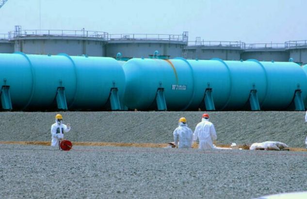
11th July 2022
Japan plans to dump radioactive water from Fukushima into the Pacific Ocean, but its effects on Pacific nations are not clear.
When the earthquake and tsunami hit Fukushima, Japan in 2011, it resulted in the tragic death of many people, and severe damage to a nuclear power plant, which required a constant flow of cooling water to prevent further catastrophe. More than 1.3 million tonnes of radionuclide-contaminated water have now been retained on-site. The Fukushima plant operator, Tokyo Electric Power Company (TEPCO), with the approval of the Japanese Government, plans to begin releasing this water into the Pacific Ocean starting next year. But compelling, data-backed reasons to examine alternative approaches to ocean dumping have not been adequately explored.
Claims of safety are not scientifically supported by the available information. The world’s oceans are shared among all people, providing over 50 percent of the oxygen we breathe, and a diversity of resources of economic, ecological and cultural value for present and future generations. Within the Pacific Islands in particular, the ocean is viewed as connecting, rather than separating, widely distributed populations.
Releasing radioactive contaminated water into the Pacific is an irreversible action with transboundary and transgenerational implications. As such, it should not be unilaterally undertaken by any country. The Pacific Islands Forum, which meets on July 12, has had the foresight to ask the relevant questions on how this activity could affect the lives and livelihoods of their peoples now and into the future. It has drawn on a panel of five independent experts to provide it with the critical information it needs to perform its due diligence.
No one is questioning the integrity of the Japanese or International Atomic Energy Agency (IAEA) scientists, but the belief that our oceans’ capacity to receive limitless quantities of pollutants without detrimental effects is demonstrably false. For example, tuna and other large ocean-going fish contain enough mercury from land-based sources to require people, especially pregnant women and young children, to limit their consumption. Tuna have also been found to transport radionuclides from Fukushima across the Pacific to California. Phytoplankton, microscopic plant-like life that floats free in the ocean, can capture and accumulate a variety of radioactive elements found in the Fukushima cooling water, including tritium and carbon-14. Phytoplankton is the base for all marine food webs. When they are eaten, the contaminants would not be broken down, but stay in the cells of organisms, accumulating in a variety of invertebrates, fish, marine mammals, and humans. Marine sediments can also be a repository for radionuclides, and provide a means of transfer to bottom-feeding organisms.
The justification for dumping is primarily based on the chemistry of radionuclides and the modelling of concentrations and ocean circulation based on assumptions that may not be correct. It also largely ignores the biological uptake and accumulation in marine organisms and the associated concern of transfer to people eating affected seafood. Many of the 62-plus radionuclides present in the Fukushima water have long periods over which they can cause harmful effects, called half-lives, of decades to millennia. For example, Cesium-137 has a half-life of 30 years, and Carbon-14, more than 5,700 years. Issues like this really do matter, as once radioactive materials enter the human body, including those that release relatively low-energy radiation (beta particles), they can cause damage and increase the risk of cancers, damage to cells, to the central nervous system and other health problems.
The Fukushima nuclear disaster is not the first such event, and undoubtedly won’t be the last. The challenges of cleaning-up, treating and containing the contaminated cooling water is also an opportunity to find and implement safer and more sensible options and setting a better precedent to deal with future catastrophes. The Pacific region and its people have already suffered from the devastation caused by United States, British and French nuclear testing programmes. Documented problems have led to international agreements to curtail such testing. In this case, the members of the Pacific Islands Forum are key stakeholders that are finding a unified voice against the planned dumping of radionuclides and other pollutants into the ocean that surrounds their homes, and holds their children’s futures.
The world’s oceans are in trouble and experiencing mounting stress from human-induced impacts tied to global climate change, overfishing, and pollution, with consequential cumulative effects on living resources and the people who depend on them. Pollution, particularly from land-based sources, is one of the greatest threats and challenges to ocean resource sustainability and associated elements of human health.
Japan and TEPCO plan to begin dumping radioactively contaminated water into the Pacific Ocean in 2023. A more deliberative and prudent approach would adhere to the precautionary principle – that if we are not sure no harm will be caused, then we should not proceed. The rush to dilute and dump is ill-advised and such actions should be postponed until further due diligence can be performed. Sound science, and a much more careful consideration of the alternatives, and respect for the health and well-being of the peoples of the Pacific region, all demand it. Far better and transparent communications are needed to provide accurate and adequate information for leaders, resource managers and stakeholders to use in their deliberations on the way forward. If the Island nations lead, other nations are sure to follow.
Robert H. Richmond, PhD is a Research Professor and Director of the Kewalo Marine Laboratory, University of Hawaii at Manoa. He is also a Pew Fellow in Marine Conservation, Aldo Leopold Fellow in Environmental Leadership and Fellow of the International Coral Reef Society. He is part of the advisory panel to the Pacific Islands Forum on the Fukushima dumping, who funded this research. He gratefully acknowledges the contributions of the other panel members, Dr Arjun Makhijani, Dr Ken Buesseler, Dr Ferenc Dalnoki Veress, and Dr Tony Hooker.
https://www.bignewsnetwork.com/news/272615799/the-pacific-faces-a-radioactive-future
1 This Month

of the week – Shut Down Drone Warfare!


Tell the Ukrainian Government to Drop Prosecution of Peace Activist Yurii Sheliazhenko

Petition to revoke the licensing of the Near Surface Nuclear Disposal Facility (NSDF) at Chalk River. https://www.ourcommons.ca/petitions/en/Petition/Details?Petition=e-7247
To see nuclear-related stories in greater depth and intensity – go to https://nuclearinformation.wordpress.com
-
Archives
- March 2026 (251)
- February 2026 (268)
- January 2026 (308)
- December 2025 (358)
- November 2025 (359)
- October 2025 (376)
- September 2025 (257)
- August 2025 (319)
- July 2025 (230)
- June 2025 (348)
- May 2025 (261)
- April 2025 (305)
-
Categories
- 1
- 1 NUCLEAR ISSUES
- business and costs
- climate change
- culture and arts
- ENERGY
- environment
- health
- history
- indigenous issues
- Legal
- marketing of nuclear
- media
- opposition to nuclear
- PERSONAL STORIES
- politics
- politics international
- Religion and ethics
- safety
- secrets,lies and civil liberties
- spinbuster
- technology
- Uranium
- wastes
- weapons and war
- Women
- 2 WORLD
- ACTION
- AFRICA
- Atrocities
- AUSTRALIA
- Christina's notes
- Christina's themes
- culture and arts
- Events
- Fuk 2022
- Fuk 2023
- Fukushima 2017
- Fukushima 2018
- fukushima 2019
- Fukushima 2020
- Fukushima 2021
- general
- global warming
- Humour (God we need it)
- Nuclear
- RARE EARTHS
- Reference
- resources – print
- Resources -audiovicual
- Weekly Newsletter
- World
- World Nuclear
- YouTube
-
RSS
Entries RSS
Comments RSS
