Renewable energy – the low cost, high-value option for the Philippines, Manila BulletinBy Eddie O’Connor, Chairman, Global Wind Energy Council and Mainstream Renewable Power “…..One of the perceptions about renewable energy and the transition to a low-carbon economy is that this technology will impose costs on the Philippines that it cannot afford, particularly in the generation of electricity where coal will have to be replaced by wind and solar power.In fact, renewable energy will save the Philippines money, make its economy more competitive, and boost living standards and consumer purchasing power. At the conference the chairman of the National Renewable Energy Board presented a study by the Philippine Electricity Market Corporation that showed that far from being a burden on the country, the existing renewable energy programme has reduced the overall cost of electricity.
This is because unlike coal or gas power, the variable cost of production for wind or solar energy is zero. This happens because the fuel – the wind and the sun – is free. This electricity is used first to satisfy customer demand, before the system operator brings on more expensive coal power. The overall effect is to depress the wholesale cost of electricity on the spot market.
By using this wind and solar power, the grid operator avoids the cost of operating the more expensive coal and oil plant. Over the three years of the PEMC study from 2014-2017 this avoided cost was 18.7billion pesos; a very significant sum………
n the Philippines all the customer sees on their bill is the cost of the tariff supporting new wind and solar power. What they don’t see is the overall savings accrued through this reduction in the price of electricity.
Knowing that, despite the cost of the tariff, the introduction of wind and solar power onto the system actually saves the customer money, the government in Ireland continues to support renewable energy, and we now have 22% of our electricity capacity from these two sources of generation.
The Philippines can follow this trajectory and aim to have 25% of its electricity capacity supplied by wind and solar energy in the coming decade. The savings that will accrue to the customer will be considerable. Funds that would otherwise be spent on coal or oil can be invested in other infrastructure. Consumers will have additional spending power. The economy will get an extra boost.
Electricity made from wind and solar does not require any fuel to be bought from abroad. The wind and sun belongs to the country. It will be there forever. It doesn’t matter what external price shocks impact on oil or coal, the wind will blow and the sun will shine and their unit cost will remain at zero.
By moving ahead of its regional ASEAN partners and setting ambitious targets for wind and solar power, the Philippines can also attract investment in the supply chain. Early movers into renewable energy like Brazil, Germany, China and Morocco have created new industries and thousands of new jobs. Why should the Philippines subsidise mining jobs in Australia and Indonesia when it could be building the plant that will supply its own clean energy sectors and those across the region?…..https://news.mb.com.ph/2017/12/21/renewable-energy-the-low-cost-high-value-option-for-the-philippines/
“I am very glad for ICAN, that they received the recognition. I think a nuclear ban treaty is a realistic long-term goal,” President Hilda Heine told Kyodo News in the Pacific island-nation’s capital Majuro, in an interview ahead of last Sunday’s award ceremony that took place in Oslo, Norway, some 12,400 kilometers away.
“It gives countries like the Marshall Islands hope that perhaps, in the future, we would be able to eliminate nuclear (weapons) in the world,” she said.
ICAN, a coalition of nongovernmental organizations from around 100 countries that was founded in 2007 in Australia, was recognized by the Nobel Committee for its efforts that led to the adoption at the United Nations earlier this year of the Treaty on the Prohibition of Nuclear Weapons.
The treaty, however, still runs short of the required ratification by 50 countries for entry into force, nor does it have the backing of major powers and nuclear weapon states.
Citing data from the Federation of American Scientists, ICAN said close to 15,000 nuclear weapons are possessed by the United States, Russia, Britain, France, China, India, Pakistan, Israel and North Korea.
“It’s disappointing that those nuclear-armed countries are not supportive of the treaty,” lamented Heine whose country, located near the equator in the Micronesia region of the Pacific Ocean, was chosen by the United States as a nuclear test site after World War II, at which time it was under U.S. administrative control.
Among the 67 tests carried out here, the most powerful and most destructive was the Castle Bravo Test on March 1, 1954 on Bikini Atoll, which exposed some islands and their residents, as well as the crew of a Japanese fishing boat, to nuclear radiation.
“Nuclear should be a concern for every country. We had our experience with the nuclear testing, and we know what it can cause, and the effects on the lives of people and property,” Foreign Minister John Silk said in a separate interview.
Silk said that in the current situation where nuclear powers remain outside the treaty, the awarding of the Nobel Peace Prize to ICAN goes “a long way towards promoting public opinion” that may eventually force them “to voluntarily reduce their nuclear weapons, and even come to the table to sign up on the agreement at some point in time.”
“That’s a very hopeful thinking, but I think that’s what everybody wants to see at the end — a world without nuclear weapons,” he said.
Having been exposed to radioactive fallout on her home island of Rongelap, northwest of Majuro, 69-year-old Nerje Joseph could not agree more.
“They took us away (from there) and destroyed our place, our home,” Joseph said of the Americans, in an interview with Kyodo News at a home provided for her close to the western tip of Majuro Atoll.
Amid the ballistic missile and nuclear threats from North Korean leader Kim Jong Un these days, Joseph, who survived thyroid cancer and had two miscarriages caused by radiation exposure, said in jest, “If I were a man, and I had a weapon, I’d shoot him in the forehead!”
On achieving a nuclear-free world, the mother of 10 children and grandmother of a dozen said, “I don’t really know when it’s going to happen, but I have faith that it will happen soon…I don’t want this kind of devastation to continue.”
Fellow fallout victim Lemeyo Abon, 77, also from Rongelap, said more than the compensation she receives from the United States, “what’s important is a place to call home, a place to live freely.”
“The identity of being a Marshallese is gone when you’re moved to another place,” Abon said. “In a way, it took away our identity, and that’s what bothers me most.”
Heine said the Marshall Islands, which created this year a National Nuclear Commission to develop a strategy and plan of action for pursuing justice, will continue to assert to the U.S. government the concerns of the Marshallese people, and also work with the United Nations.
“We think that the settlement is not enough. We think that the U.S. government still owes the Marshallese compensation for their lost land — the fact that people are not back to their land, they are still nomads in their own country, and also the fact that we have high rate of cancer,” Heine said.
“I think they need to compensate the people and the government for these impacts on the people and the country.”
According to the U.S. Embassy in Majuro, the United States has “expressed regret about the Bravo accident when 253 Marshallese were exposed to high doses of radiation.”
It has extended more than $604 million in compensation to affected communities, while a $6.3 million worth of services is annually provided under the Department of Energy Special Medical Care Program and the Environmental Monitoring Program.
Radiation victim Abon, who worries about the future of her seven children and more than 10 grandchildren, remains pessimistic about the prospects for a nuclear-free world “as long as there are selfish people in the world — those that know they have the power, they are smart, and they want to strive to be No. 1.”
But the leader of the tiny nation of around 40,000 people spread across 29 low-lying coral atolls and five islands, with another 20,000 in the United States, sees a glimmer of hope with ICAN’s influential efforts.
“The advocacy and the work that ICAN is doing should continue because I think in the long run, people may change their opinions. If they push the countries to change their opinions, perhaps, there is a future, there is a hope that nuclear-armed countries can actually agree to stop,” Heine said.
It was supposed to be a trip to paradise, instead it sealed their fatehttp://www.abc.net.au/news/2017-11-28/the-toxic-legacy-of-a-deadly-paradise/9168422 These soldiers were ordered to clean up the toxic legacy of America’s nuclear program, now they’re dying, and their Government has abandoned them.Foreign Correspondent, By Mark Willacy When Jim Androl landed on a remote central Pacific atoll to take part in the biggest nuclear clean-up in United States history, the only extra items his military superiors gave him were some flea powder and a pamphlet on how to avoid heat stroke.
The army did have special radiation suits and respirators for handling the left-over atomic waste on the atoll, but the young soldiers were only allowed to wear them on special occasions.
“The [protective suits] were for photo ops,” the former communications specialist with the US Army’s 84th Engineer Battalion recalls.
“I know once when I believe 60 Minutes was there, they did [let us wear them]. We were just issued our normal warm weather gear … shorts, tee-shirts, hats and jungle boots and that’s it.”
Androl was one of about 4,000 US troops sent to Enewetak Atoll in the Marshall Islands between 1977 and 1979 to scrape up the contaminated remnants of the United States’ atomic testing program.
The US government decided to use soldiers for the clean-up, because employing specialist nuclear workers would have doubled the cost.
“I’d never even heard of Enewetak. I never knew that there were 43 nuclear tests out there,” Androl, who was 22-years old when he was deployed to the atoll, says.
Some of those bombs were the among the most powerful ever detonated, and they left behind a toxic legacy that will live on for thousands of years.
“One of the attempted nuclear weapons explosions didn’t work,” Michael Gerrard, the director of the Earth Institute at New York’s Columbia University, says. “So the plutonium was just broken apart by the conventional explosion, leading to about 400 little chunks of plutonium that were spread around the atoll.”
The plutonium on Enewetak has a radioactive half-life of more than 24,000 years, and the US clean-up troops were ordered to place the shattered pieces into plastic bags and dump them into a crater left behind by an old atomic bomb test.
One-millionth of a gram of plutonium is potentially harmful, and can cause cancer decades after first exposure.
“They’d have us walk around and pick up loose pieces, and just gather up whatever we could, throw it in a pile,” Androl says.
It’s estimated that 85,000 cubic metres of radioactive material was collected and dumped, including contaminated soil, concrete, and military equipment.
“It was a very dirty operation,” Ken Kasik, another of the men sent to Enewetak as part of the clean-up, says. “[The veterans are] all sick, they’re all dying, and it’s because of the radiation.”
Kasik can barely rise from his chair to greet me when I arrive to see him.
We were supposed to meet at his home in Hawaii.
But by the time I land, he is seriously ill in the intensive care unit in Honolulu’s Straub Medical Centre, and is tethered to drips and monitoring machines.
“About three-and-a-half years ago I had so many cancers on me, I couldn’t work anymore. They ripped me apart,” he says.
This time it’s not cancer that has forced Ken Kasik to be rushed to the ICU, but a brain aneurism he says is directly linked to his time on Enewetak and the atomic fall-out there.
“When those bombs go off, in Enewetak, that’s coral sand,” Kasik says. “That just gets pulverised and comes back down as baby powder, and it was on everything, everywhere. The guys would come home, take off their sunglasses, [and their faces] would be white.”
“I never had any clue that dust could literally get into your lungs,” Jim Androl says from his home in the suburbs of Las Vegas. “You breathe it, you drink it, you eat it, you swim in it. Every day for six months, 24/7.”
The problem for Enewetak clean-up veterans like Androl and Kasik, is that successive United States governments have refused to recognise them and their comrades as atomic veterans. This means they cannot access health benefits or radiation exposure compensation.
Other atomic veterans, like those involved in the original atomic testing program in the Pacific in the 1940s and 1950s that left behind the waste on Enewetak and Bikini atolls, were covered for more than 20 specific types of cancers.
“Our boys worked six-month tours on a dirty island, and the government says, ‘You were never there’,” Kasik says. “We were never acknowledged…we don’t exist.”
Like Kasik, Androl has suffered serious health problems over the years that he blames on his six-month tour at Enewetak.
“He had his gall bladder out … two weeks [later] they found a seven-and-a-half-pound tumour, cancerous tumour in his abdomen,” Androl’s wife Bev says.
“I suffer from roughly 40 to 45 residuals from the cancer,” Androl says. “I’ve got pancreatitis, I’ve got a spot on my liver that they’re watching.”
As well as cancers, veterans complain of brittle bones and even of birth defects in their children.
The US military insists there is no connection between veterans’ illnesses and the clean-up on Enewetak, saying their radiation exposure was well within safe limits.
A two-year campaign by Enewetak veterans to get Congress to give them medical benefits has been unsuccessful.
“I think mostly they’re trying to get health coverage, medical care because they’ve got terrible bills. Really high bills from hospitals, because of their treatment,” Giff Johnson, the publisher of the Marshall Islands Journal, the country’s only newspaper, says.
There has never been a formal study of the health of these men, many of whom are now in their late 50s and early 60s.
But an unofficial social media survey of more than 400 Enewetak clean-up veterans found that 20 percent had reported cancers of some type.
The life they live is a far cry from the photos Ken Kasik took at the time, of young men in their prime.
“It just breaks our heart, You know, they’re dying before they’re 60. It’s ridiculous,” Bev Androl says.
The Marshall Islands is once again grappling with its nuclear legacy, as the threat of climate change threatens to break open the dome.
“God, there’s been so many [who have died],” Androl says of his former comrades. “We just lost one two weeks ago. We lost one about six months before that. They told me I’d be dead by now. We’re nobody, we don’t matter, our family’s lives don’t matter.”
The people of the Marshall Islands also suffered terrible heath impacts from 12 years of atomic testing in their homeland, including increased rates of thyroid and other cancers, as well as birth defects.
Whole islands were evacuated, and many people are still not allowed to return to live in their home villages decades on.
Like the US clean-up veterans, the Marshallese who suffered were never properly compensated.
A nuclear claims tribunal set up by the Marshall Islands and the United States awarded more than $2 billion dollars to victims of the atomic testing program — less than $4 million was ever paid.
“America dumped all of their worst rubbish to the Marshallese, and abandoned them with it. And we don’t want to hear about it,” Kasik says.
We call it the tomb,” says Christina Aningi, the head teacher of Enewetak’s only school.
“The children understand that we have a poison in our island.” It’s “Manit Day” on Enewetak Atoll, a celebration of Marshall Islands culture when the Pacific nation’s troubled past seems a distant memory. Schoolchildren sit cross-legged on the coral sands as they sing of the islands and atolls, the sunshine and the breeze; “flowers and moonlight, swaying palm trees”.
They were born decades after the last nuclear explosion ripped through the warm Pacific air with a thunderous roar. But it’s hard to escape the long echo of the bombs.
“Gone are the days when we live in fear, fear of the bombs, guns and nuclear,” they sing.
“This is the time … this is my country, this is my land.”
But those old fears, thought to be long buried, are threatening to reawaken in their island paradise.
In the late 1970s, Runit Island, on the remote Enewetak Atoll, was the scene of the largest nuclear clean-up in United States history. Highly contaminated debris left over from dozens of atomic weapons tests was dumped into a 100-metre wide bomb crater on the tip of the uninhabited island. US Army engineers sealed it up with a half-metre thick concrete cap almost the size of an Australian football ground, then left the island.
Now with sea levels rising, water has begun to penetrate the dome.
A report commissioned by the US Department of Energy in 2013 found that radioactive materials were leeching out, threatening the already tenuous existence of Enewetak locals.
“That dome is the connection between the nuclear age and the climate change age,” says Marshall Islands climate change activist Alson Kelen.
“It’ll be a very devastating event if it really leaks. We’re not just talking the Marshall Islands, we’re talking the whole Pacific.”
The United States detonated 43 atomic bombs around the island chain in the 1940s and 50s.
Four of Enewetak’s 40 islands were completely vaporised by the tests, with one thermonuclear blast leaving a two-kilometre-wide crater where an island had been just moments before.
Enewetak’s population had been re-located to another island in the Marshalls ahead of the tests. Residents would only be allowed to return home more than three decades later — some on the island today can still recall returning to Enewetak as children.
As part of the clean-up process, Washington set aside funds to build the dome as a temporary storage facility, and initial plans included lining the porous bottom of its crater with concrete.
But in the end, that was deemed too expensive.
“The bottom of the dome is just what was left behind by the nuclear weapons explosion,” says Michael Gerrard, the chair of Columbia University’s Earth Institute in New York.
“It’s permeable soil. There was no effort to line it. And therefore, the seawater is inside the dome.” ocals rarely set foot on Runit Island. They’re fearful of the lingering radiation from the dome and because it’s been ruled off-limits.
To this day, only three islands along Enewetak Atoll’s slender rim are considered safe enough for human habitation. “[The other islands were] too hot, too radioactive to worry about,” says Giff Johnson, publisher of the Marshall Islands Journal, the country’s only newspaper.
“There was no point [cleaning them up].”
After the fall-out from the atomic testing, life for the people of Enewetak went from a traditional existence of fishing and subsistence living to one where the waters that once supported their livelihoods were now polluted.
On the main island, where most of the atoll’s few hundred people now live, concerns about the radioactive contamination of the food chain has seen a shift away from a traditional diet of fish and coconut.
The US Department of Energy has even banned exports of fish and copra from Enewetak because of the ongoing contamination.
The vast bulk of foodstuffs are now brought into the island by barge, and that means islanders are reliant on imported canned and processed goods like Spam that have triggered health problems such as diabetes. The shelves of Enewetak’s only store are largely filled with American brand chocolate bars, lollies and potato chips.
Locals sometimes visit Runit to scavenge from scrap copper left behind by the Americans, selling it for a few dollars to a Chinese merchant.
For 30 years, Jack Niedenthal has helped the people of neighbouring Bikini Atoll fight for compensation for the 23 atomic tests conducted there. “To me, it’s like this big monument to America’s giant f–k up,” says Niedenthal. “This could cause some really big problems for the rest of mankind if all that goes underwater, because it’s plutonium and cement.”
Some of the debris buried beneath the dome includes plutonium-239, a fissile isotope used in nuclear warheads which is one of the most toxic substances on earth.
It has a radioactive half-life of 24,100 years.
Cracks are visible in the dome’s surface and brackish liquid pools around its rim.“Already the sea sometimes washes over [the dome] in a large storm,” says Columbia University’s Michael Gerrard. “The United States Government has acknowledged that a major typhoon could break it apart and cause all of the radiation in it to disperse.”
While Professor Gerrard would like the US to reinforce the dome, a 2014 US Government report says a catastrophic failure of the structure would not necessarily lead to a change in the contamination levels in the waters surrounding it.
“I’m persuaded that the radiation outside the dome is as bad as the radiation inside the dome,” says Professor Gerrard.“And therefore, it is a tragic irony that the US Government may be right, that if this material were to be released that the already bad state of the environment around there wouldn’t get that much worse.”
But that is cold comfort to the people of Enewetak, who fear they may have to be relocated once again if the dome collapses or crumbles.
“If it does [crack] open most of the people here will be no more,” says Ms Aningi.
“This is like a graveyard for us, waiting for it to happen.”
Pacific Island nations urge world leaders to act as islands expected to sink
AUSTRALIA’S tropical island neighbours may exist today, but their leaders have urged us to help them from sinking.news.com.au, Matt Young@MattYoung 14 Nov 17A LARGE swath of Pacific Island nations are slowly being eaten away until residents will be forced to evacuate and the islands eventually sink into the sea — and it’s coming sooner than we think.
This modern-day Atlantis is thanks to sea levels across small island nations that have seen a dramatic rise over the past few decades, a rate of up to 3-4 times larger than the global average. Tuvalu, in the western Pacific Ocean, will reportedly be uninhabitable by 2050, while its island neighbour Kiribati, is expected to be fully submerged by 2100.
The Maldives, which has the lowest elevation in the world and a population of 427,000, may also have sunk by the end of the century.
It has led experts — including Professor Tim Flannery, climate change expert and Professor at La Trobe University — to believe we are “on a trajectory that will see those nations compromised”.
The WHOI research team also compared the radioactive contamination at the Marshall Islands to the contamination found today near Fukushima in Japan in the aftermath of the Dai-ichi Nuclear Power Plant disaster. “In contrast to Fukushima, where cesium is the most abundant radionuclide of concern, in these atolls, the focus should be on plutonium, given its significantly high levels,” said WHOI radiochemist Ken Buesseler.
Scientists have found lingering radioactivity in the lagoons of remote Marshall Island atolls in the Pacific Ocean where the United States conducted 66 nuclear weapons tests in the 1940s and 1950s.
Radioactivity levels at Bikini and Enewetak Atolls were extensively studied in the decades after the testing ended, but there has been relatively little work conducted there recently. A team of scientists from Woods Hole Oceanographic Institution (WHOI) reported that levels of radioactive cesium and plutonium have decreased since the 1970s, but these elements continue to be released into the Pacific Ocean from seafloor sediments and lagoon waters.
The levels of plutonium are 100 or more times higher in lagoon waters compared to the surrounding Pacific Ocean and about two times higher for a radioactive form of cesium. Despite these enrichments, they do not exceed U.S. and international water quality standards set to protect human health, the scientists reported Oct. 30, 2017, in the journal Science of the Total Environment.
To determine the source of these radionuclides in lagoon waters, the WHOI scientists measured the amounts and flow of radioactive material entering the ocean from groundwater seeping from the islands. They found that groundwater was a relatively low source of radioactivity.
In particular, they found that radioactive groundwater was not leaking much from beneath one suspected potential source: the Runit Dome on the island of Runit—a massive 350-foot-wide concrete lid that covers 111,000 cubic yards of radioactive soil and debris that were bulldozed into a bomb crater and sealed over. It was constructed in the late 1970s by the U.S. government to contain contaminated waste from the nuclear tests. The bottom of the Runit Dome is not lined and below sea level, so scientists and others have been concerned that tidal action could move water through the buried radioactive material and bring it out to sea.
“The foundations of these island atolls are ancient coral reefs that have the porosity of Swiss cheese, so groundwater and any mobilized radioactive elements can percolate through them quite easily,” said WHOI geochemist Matt Charette. Though that does not seem to be happening now, the scientists advise that the Runit Dome area should be continuously monitored as sea level rises and the dome deteriorates.
Using isotopes of plutonium that act like a fingerprint to pinpoint sources, the WHOI scientists found that the seafloor sediments around Runit Island seem to be contributing about half of the plutonium to the lagoon. “Additional studies examining how radioactive plutonium moves through the environment would help elucidate why this small area is such a large source of radioactivity,” Buesseler said.
The WHOI scientists who conducted the study and wrote the report included Ken Buesseler, Matthew Charette, Steven Pike, Paul Henderson, and Lauren Kipp. They sailed to the islands aboard the research vessel Alucia on an expedition funded by the Dalio Explore Fund.
The team collected sediments from the lagoon with poster tube-sized collectors that were inserted by divers into the seafloor’s sediments, filled with mud, capped. Back in WHOI laboratories, the cores were sliced into layers and analyzed to reveal a buried record of local fallout from the nuclear tests. The scientists also collected and analyzed samples of lagoon waters .
On the islands, they collected groundwater samples from cisterns, wells, beaches, and other sites. They analyzed these samples for the levels of radioactive cesium and plutonium from weapons tests. For the first time on these islands, the scientists also measured isotopes of radium, a naturally occurring radioactive “tracer” that give scientists key information to determine how much and how fast groundwater flows from land into the ocean.
The WHOI research team also compared the radioactive contamination at the Marshall Islands to the contamination found today near Fukushima in Japan in the aftermath of the Dai-ichi Nuclear Power Plant disaster. “In contrast to Fukushima, where cesium is the most abundant radionuclide of concern, in these atolls, the focus should be on plutonium, given its significantly high levels,” said WHOI radiochemist Ken Buesseler.
The U.S. conducted 66 nuclear weapons tests between 1946 and 1958 at Bikini and Enewetak Atolls, each a ring of low-lying reef islands that surrounds a larger lagoon. Bikini has 26 islands; Enewetak had 42 islands, but three were bombed out of existence. They became known as the western part of the “U.S. Pacific Proving Grounds.”
Bikini and Enewetak are among 29 atolls that make up the Republic of the Marshall Islands, located in the equatorial Pacific, about 2,500 miles west of Hawaii. The collective land area of the thousands of small islands is equivalent to the area of Washington, D.C. but they are spread across an ocean area that exceeds the size of Alaska.
The work holds particular significance to the atolls’ indigenous populations which were evacuated before the tests and thus far have only been allowed to return to one small island in the Enewtak Atoll.
This research was funded by the Dalio Foundation and the Dalio Explore Fund.
The Woods Hole Oceanographic Institution is a private, non-profit organization on Cape Cod, Mass., dedicated to marine research, engineering, and higher education. Established in 1930 on a recommendation from the National Academy of Sciences, its primary mission is to understand the ocean and its interaction with the Earth as a whole, and to communicate a basic understanding of the ocean’s role in the changing global environment. For more information, please visit www.whoi.edu.
The new category would make official the Green party’s pre-election policy which promised 100 visas for those affected by climate change.
As part of the new Labour-led coalition government, the Green party leader James Shaw was given the role of climate change minister.
He told Radio New Zealand on Tuesday that “an experimental humanitarian visa category” could be implemented for people from the Pacific who are displaced by rising seas resulting from climate change.
“It is a piece of work that we intend to do in partnership with the Pacific islands,” Shaw said.
Before the election, the Greens also proposed increasing New Zealand’s overall refugee quota from 750 each year to 4,000 places over six years.
Shaw’s announcement comes after the New Zealand immigration and protection tribunal rejected two families from Tuvalu who applied to become refugees in New Zealand due to the impact of climate change.
The families argued rising sea levels, lack of access to clean and sanitary drinking water and Tuvalu’s high unemployment rate as reasons for seeking asylum.
The tribunal ruled they did not risk being persecuted by race, religion, nationality or by membership of a political or religious group under the 1951 refugee convention.
International environmental law expert Associate Professor Alberto Costi, of Victoria University, told the Guardian that the current convention could not accommodate environmental refugees. “The conditions are pretty strict and really apply to persecution. These people who arrive here hoping to seek asylum on environmental grounds are bound to be sent back to their home countries.”
In 2014 Ioane Teitiota, from Kiribati, made headlines after he applied in New Zealand to become the world’s first climate change refugee “on the basis of changes to his environment in Kiribati caused by sea level rise associated with climate change”.
Costi acknowledged Shaw’s proposal would allow that gap in the refugee convention to be filled but said the problem would be legally determining whether an environmental migrant was still able to live in their home country.
“I have sympathy but legally it creates a big debate. There needs to be clear guidelines.”
Costi said there would be a difference in an application from someone from Tarawa in Kiribati, where conditions are obviously worsening every year, to those whose countries are only affected seasonally.
“It’s an idea to be explored. I would welcome more clarity.”
OVER a month ago 122 nations took the decisive step to bring the world closer to the shared aspiration of a nuclear weapons-free world. The Philippines, along with the other Asean members, was proud to be part of the historic moment that saw the adoption of the Treaty for the Prohibition of Nuclear-Weapons—a landmark agreement that strengthens the nuclear disarmament architecture, fulfills the goal set out in the Treaty on the Non-Proliferation of Nuclear Weapons, and delegitimizes once and for all the use of nuclear weapons.
The treaty represents the universalization of the Philippines’s fervent hope to put nuclear weapons firmly on the path of extinction, as set forth in its constitution and in the Treaty on the Southeast Asian Nuclear Weapons-Free Zone.
During the negotiations on the nuclear-weapons ban, the Philippines championed the inclusion of nuclear testing in the list of prohibited acts. It proposed language that would have committed States Parties to undertake not, and I quote, “to carry out any nuclear-weapon test explosion or any other form of nuclear-weapons testing.” However, as treaty negotiations go, the language proposal was watered down.
Be that as it may, what is important is that, under the nuclear- weapons-ban treaty, States Parties undertake not to conduct nuclear- weapons tests. With this, the act of nuclear-weapons testing is effectively declared illegal under international law.
The Philippines looks forward to signing the Treaty on the Prohibition of Nuclear Weapons on September 20 and usher in this new phase in our collective goal for the complete, irreversible and verifiable elimination of nuclear weapons.
The Philippines’s long-standing position against nuclear testing was first articul ated on the international stage when it signed the Comprehensive Nuclear Test Ban Treaty in 1996. It lent its voice to the growing clamor that recognized the detrimental effect of nuclear testing to the environment and its horrific consequences to humankind, where the suffering of victims can span generations.
Today, as in the years past, we call upon the remaining eight fellow UN member-states to finally heed the humanitarian imperative against nuclear tests and exercise their role as responsible citizens of the global community by finally signing onto the Comprehensive
Nuclear-Test-Ban Treaty (CTBT), thereby ushering it into force. The forthcoming Conference on the CTBT is the most opportune time to do this. It happens to be on the same day when the Treaty on the Prohibition of Nuclear Weapons will be opened for signature.
The actions of the Democratic People’s Republic of Korea constitute a flagrant violation of Security Council resolutions and pose a clear and present danger to international peace and security. Its actions demonstrate the urgent need for the CTBT to enter into force. While the Philippines, along with its fellow Asean members, condemn DPRK’s missile tests, it underlines the need to establish the international legal landscape that expressly delegitimizes its actions—if only to clearly and unequivocally articulate the collective desire of the community of nations to put a stop to them once and for all.
New Zealand’s Jacinda Ardern signs coalition deal, names Winston Peters Deputy PM, ABC News 24 Oct 17, New Zealand’s incoming Government is hoping to make the nation greener by planting 100 million trees each year, ensuring the electricity grid runs entirely from renewable energy, and spending more money on cycle ways and rail transport.
Key points:
Incoming prime minister Jacinda Ardern signs coalition deal with NZ First and the Greens Party
Ms Ardern says the country aims to generate 100 per cent of its electricity from renewable sources by 2035
She also plans to raise the minimum wage by 27 per cent
Prime minister-elect Jacinda Ardern and NZ First Leader Winston Peters — who will serve as deputy prime minster and foreign affairs minister in the new Government — signed the coalition agreement on Tuesday and outlined their priorities……
Ardern aiming for 100 per cent renewable energy
Ms Ardern’s plan is for New Zealand to reduce its net greenhouse gas emissions to zero by the year 2050.
Some of the targets will require only incremental changes.
New Zealand already generates about 85 per cent of its electricity from renewable sources including hydroelectric, geothermal and wind.
Ms Ardern plans to increase that to 100 per cent by 2035, in part by investigating whether solar panels can be used atop schools.
She said the country would need to double the amount of trees it plants each year, a goal she said was “absolutely achievable” by using land that was marginal for farming animals.
These are a few of the ways vulnerable constituencies are confronting the risks global warming throws at them.
And on Friday, the Philippines Commission on Human Rights set a date to interrogate 47 carbon majors on their climate impact. Companies including ExxonMobil, Shell and BP have been called to a preliminary meeting on 11 December, as part of an ongoing investigation.
Former president Anote Tong compares Kiribati’s future to the sinking of the Titanic, ABC News By Sarah Hancock , 13 Oct 17 Anote Tong is the former president of the Republic of Kiribati and his island home, in the central Pacific Ocean, is already suffering from the effects of climate change.
Rising sea levels are causing land to be engulfed by tidal waters, driving people away from their homes and leaving them displaced.
Anote Tong is the former president of the Republic of Kiribati and his island home, in the central Pacific Ocean, is already suffering from the effects of climate change.
Rising sea levels are causing land to be engulfed by tidal waters, driving people away from their homes and leaving them displaced.
“What I have seen in my lifetime over the years has been villages, communities, who have had to leave … because it is no longer viable,” he said. “The sea is there and there is nothing. Everything has been taken away so they have had to relocate.”……..
“As a grandfather I have got to think beyond that, as a leader I have to think beyond what will happen today, and knowing what we know today, what will happen to the next generation,” he said.
Mr Tong compared Kiribati’s future to the sinking of the Titanic.
“We are the people who will be swimming,” he said.
New Zealand Educates Youth on Nuclear Disarmament, https://www3.nhk.or.jp/nhkworld/en/news/editors/5/nzeducatesyouthonnucleardisarmament/index.html– Hiromi Kurosaka, New Zealand is a staunch advocate of abolishing nuclear arms. Its policy coalesced in the 80s after strong opposition. And as a new generation grows up, the country is still committed to educating them about the horrors of nuclear weapons.
A commemoration of the victims of the atomic bombing of Hiroshima takes place annually in staunchly anti-nuclear New Zealand. The country adopted an anti-nuclear policy decades ago. Opposition had grown over the years as France repeatedly tested its nuclear weapons in the region’s waters. New Zealand’s policy bans the country from possessing nuclear arms or bringing them into its territory. Nuclear power isn’t used in the country either.
This year marks the 30th anniversary of the policy. A school focusing on teaching students the importance of disarmament invited survivors of the atomic bombing of Hiroshima to recount their painful experiences.
15-year-old Yasmin Clements-Levi, who heard the accounts of survivors for the first time, said “I’m really glad that I learned now, really exactly what they’ve gone through and how it affects them to this day.”
The school held a debate to help students think more deeply about the issue. Some of the students were against nuclear weapons. “It’s just horrible — the fact that so many people can die. It’s generally not worth it to have them in the world at all.” “If a terrorist group like ISIS were to get nukes, they could cause infinite destruction.”
Others maintained that they’re necessary. “If you talk about
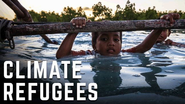
Are Hurricanes Creating Climate Refugees In The Caribbean? Forbes, Marshall Shepherd , 21 Sept 17“………Prime Minister Roosevelt Skerrit declared that 95% of the country of Dominica was destroyed by Hurricane Maria. I suspect that many of the 73,000 residents left the country and with that level of destruction, when can (or will) they go back? Other countries like Cuba, Puerto Rico and the British/U.S. Virgin Islands took massive hits from Irma and Maria as well.Some reports estimate that Puerto Rico may be without power for 4 to 6 months. Places like St. Bart, Anguilla, St. Maarten, Barbuda and Dominica are much smaller, and I am already noticing that they do not get mentioned very much in the social and broader media discussions.
It is for these reasons that I wonder if some of the residents will ever return. Maria Cristina Garcia is the author of the book, Climate Refugees: The Environmental Origins of Refugee Migrations. In a Cornell University media release, Garcia stated
People have been displaced by climate for millennia…but we are now at a particular historical moment, facing a new type of environmentally driven migration that will be more fast and furious. It will require incredible adaptability and political will to keep up with the changes that are forecasted to happen…..
Garcia is also concerned because climate refugees (displaced due to sea level rise, loss of agricultural productivity, storm-related destruction) would not fall under the current legal designations for refugees. U.S. law bases refugee status on persecution related to religion, race, political viewpoint, or nationality. Other international laws are similar and provide no protection.
Why US bases make Okinawa, Guam nuclear ‘targets’ Amid North Korea-US tensions, Asia-Pacific communities hosting US bases see military presence as making them a target. AlJazeera, by Jon Letman , 8 Sept 17, Jon Letman is an independent journalist in Hawaii, covering wildlife conservation, and the politics of the Pacific Rim.
Lihue, Hawaii – The frequency of activity has increased but the pattern remains predictable: a defiant North Korean missile test followed by provocative war games, then another missile launch, more angry threats and warnings, followed by counter-threats and new sanctions, and now a sixth nuclear test and more severe warnings and accusations.
In this geopolitical tit-for-tat, Asia-Pacific communities that host US military bases watch cautiously as fiery rhetoric pushes the two nuclear-armed adversaries ever-closer to what would be a catastrophic war.
The island of Guam came into sharp focus in August when North Korea announced plans to fire four Hwasong-12 ballistic missiles near the US territory following President Donald Trump‘s threat to unleash “fire and fury like the world has never seen” against North Korea.
Guam’s Pacific Daily News reported that a missile launched from North Korea could reach Guam and its more than 160,000 US citizens in just 14 minutes.
As Guam residents were being advised how to prepare for a possible nuclear strike, President Trump cheerfullyassured Guam’s governor that the extra media attention would boost the island’s tourism industry.
“You’ve become extremely famous all over the world,” Trump said, promising the US territory’s governor that tourism would increase “tenfold with the expenditure of no money.”
“Like a spear into battle”
But on an island labelled with the tagline “Where America’s Day Begins,” many of its residents long for the day when American militarism ends.
“The US military likes to couch their activities in solely defensive metaphors,” says Michael Lujan Bevacqua, a Chamorro studies professor at the University of Guam. “The reference to Guam as ‘the tip of the spear’,” he says, “offers a sliver of truth.”
Bevacqua argues that like other empires, the US describes its foreign presence as a source of order and safety, “never the destabilising force … even if it takes land and resources, even if it poisons the earth, even if it depresses or constricts the local economy.”
The US military presence can be characterised as a shield with a giant target on it, Bevacqua suggests. In Guam, it is “really the source of the danger just as much as a source of defence”.
As a US possession (non-self governing territory) without voting rights, Guam will be “dragged along like a spear into battle,” Bevacqua notes. “Whether the spear loves battle or would prefer peace is irrelevant, as our purpose is to be something used in a fight and little more.”…….
A short drive from the University of Guam, Andersen Air Force Base is the staging grounds for a continuous bomber presence that includes B1-B bombers and B2 Spirit bomberswhich are capable of carrying B61 tactical nuclear weapons and the B83, a thermonuclear weapon 60 times more destructive than the bomb dropped on Nagasaki.
Increasingly, bombers based at Andersen conduct precision strike exercises and in July the 37th Expeditionary Bomb Squadron deployedto Guamfrom South Dakota, arming the island with a pre-emptive attack force capable of an offensive attack.
Guam also has a Terminal High Altitude Area Defense (THAAD) antimissile battery, Naval Computer and Telecommunications Station and an 18,000 acre Naval Ordnance Annex. Naval Base Guam is the home port for fast attack nuclearand non-nuclear submarines.
Guam is not the only place
From the US military’s perspective, Guam is essential to maintaining a “ready to fight tonight” capability, but to North Korea, this much firepower from a hostile adversary represents a lethal threat.
In August, as tensions threatened to boil over, Secretary of State Rex Tillerson visited Guam where he said: “The North Korean missile capability can point in many directions. So, Guam is not the only place that would be under threat.”
This stark reality is all too well known across the Asia-Pacific region where many communities host US bases. Between Guam and North Korea, the US has over 180 military bases, installations and more than 90,000 troops who train alongside their allies Japan and South Korea which represent the eighth and 10th largest global military expenditures.
In South Korea, the US is consolidating its bases but will also soon claim the largest overseas US military base in Pyeongtaek, 64km south of Seoul. Although South Koreaarguably faces the most imminent threat from North Korea, many South Koreans await the day when the US will finally leave. More than six decades after an armistice halted the 1950-53 Korean War, longtime peace activist retired Catholic priest Father Mun Jeong-hyeon asks: “Why Korea was divided? Why is the USA stationed in this country for a long time?”
Satoko Norimatsu, an editor at Asia-Pacific Journal: Japan Focus and co-author of Resistant Islands: Okinawa Confronts Japan and the United States, says: “Of course, US bases in Japan pose a threat to people and the environment around them.”
She’s referring to a nationwide network of more than 100 US bases that run the length of the country, with the greatest concentration in Okinawa. “North Korea understandably declared US bases in Japan would be their target,” she says.
Norimatsu stresses the importance of viewing local demilitarisation movements like those in Okinawa, Guam and elsewhere in a larger context and says there’s a need for multinational, multilingual efforts against US militarism across the region.
Okinawa – ‘Keystone of the Pacific’……..
Besides the threat of living among dozens of military bases, Okinawans face the danger of external attack in the event of war. Hideki Yoshikawa, director of Okinawa Environmental Justice Project, insists US bases don’t protect his home island.
“With the large concentration of US military bases, Okinawa is a perfect target for foreign military aggression,” he says. Yoshikawa points out that because US installations built surrounded by densely populated Okinawan cities, “any aggression directed at US military bases in Okinawa would have spillover effects on our civilian population.”
Living in a state of ‘strategic denial’
The danger of being used by the US military is tragically familiar to the people of the Marshall Islands where the US tested 67 nuclear bombs between 1946-1958, leaving behind a legacy of sickness, death and forced displacement. Today, the US continues to test offensive weapons in the Marshall Islands, using Kwajalein Atoll as a target for unarmed Minuteman III ICBMs……..
Pearl Harbor is still armed………University of Hawaii, says Hawaii’s large military presence makes the islands more vulnerable and, because of their proximity toAsia, a more plausible target than the continental US.
Compoc rejects the argument that Hawaii must rely on the military. “The notion that small island nations have no choice but to stay dependent on the US military for economic survival is the same logic of an abuser telling a woman she has no choice but to say in a violent relationship,” she says.
In June, Compoc was part of a delegation from Hawaii which travelled to Okinawa for the ninth gathering of the International Women’s Network Against Militarismto counter preparations for war and build solidarity. “It was very moving to speak about Hawaiian sovereignty there and have Okinawans hold their fists up in solidarity,” Compoc says.
Building this kind of solidarity across cultures, languages and national identities is at the heart of Kyle Kajihiro’s work as a board member of Hawaii Peace and Justice. “The protection of our islands, whether Hawaii, Guam, or Okinawa, is not the primary purpose of US bases. The US uses our islands as military platforms and command centres to launch attacks and wage wars in other parts of the world,” Kajihiro says.
Kajihiro points out that prior to the 1893 US overthrow of what had been the independent Kingdom of Hawaii, its leaders had anticipated the danger of being drawn into a war if Hawaii was allied with a large military power. The creation of an alliance of Pacific Island states that those leaders sought lives on today in the desire for a pan-Pacific alliance as the threat of war looms large across the region.
Both islands were blasted by Hurricane Irma, one of the strongest ever to charge across the Atlantic Ocean, packing winds of 180 miles per hour (290 kilometers per hour).
Irma damaged 95 percent of Barbuda’s properties and left the island covered in rubble and “barely habitable,” said Prime Minister Gaston Browne.
“These storms are more ferocious, they are coming in greater frequency — evidence that climate change is real,” Browne said in an interview with CNN.
“We’re living the consequences of climate change.”
Irma has packed sustained winds of over 180 mph (295 kph) for more than 33 hours, making it the longest-lasting top-intensity cyclone ever recorded, France’s national weather service said.
It comes on the heels of Hurricane Harvey, which drenched Texas with deadly floods.
The next big storm, Hurricane Jose, is already churning in the Atlantic behind Irma.
“Those who do not believe in climate change, we’re hoping that when they would have looked at these natural disasters that they’ll change (their) position,” Browne said.
“All of us need to believe in it and take collective action.”